When Mountains Move
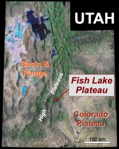
My first post as a W&M blogger came after our Utah field season during the summer of 2008. Indeed, we lived the high life that July, conducting geologic research on the Fish Lake Plateau, a broad and broken highland situated nearly 2 miles above sea level. My undergraduate research students: Trevor Buckley, JoBeth Carbaugh, and Graham Lederer have graduated and moved on to success in graduate school and careers beyond the academy.
One of the areas in which we worked was Mount Hilgard, an iconic mountain that tops out at just over 3,500 meters (11,500 feet). What makes Mount Hilgard iconic is its curious shape. From the north the peak rises to a craggy summit while from the east or west it is asymmetric with a gentle southern flank and a steep northern rampart.
Mt. Hilgard owes its shape to the underlying geology, the peak is capped by a 250 meter thick sequence of volcanic rock erupted from gassy volcanoes 24 million years ago. The volcanic rocks unconformably overlie an older sequence of thinly-bedded mudstone and limestone. During the last 5 million years these rocks were uplifted, faulted, and tilted such that they are inclined about 10˚ towards the south. Gravity, water, and ice conspired to erode the bedrock: the volcanic rock stands as a hulking edifice that, over time, sheds copious debris onto the weak foundation of sedimentary rock below.
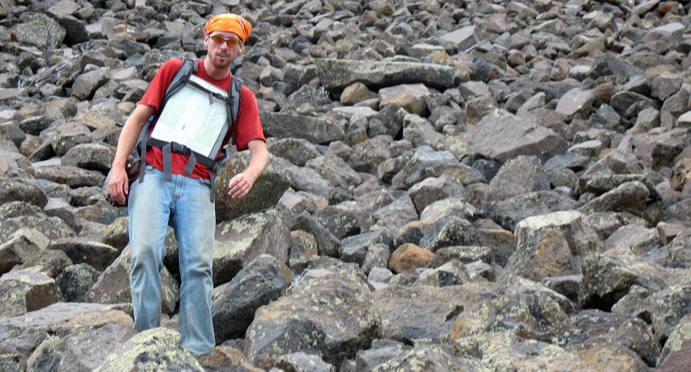
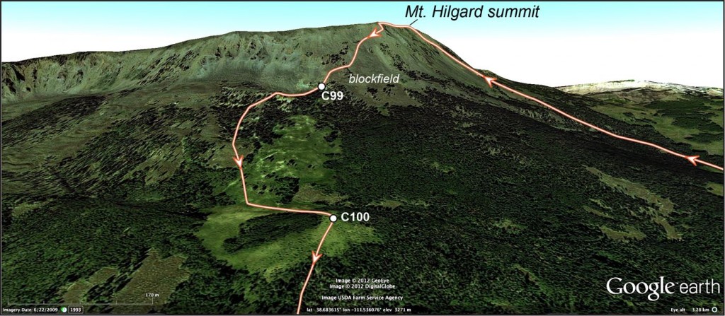
On July 23rd, 2008 Graham Lederer and I set off on our last traverse for the summer and climbed Mt. Hilgard to collect samples. On our descent we transited a block field composed of rubble accumulated at the base of the cliffs above, hiking down a block field is precarious work. A small bedrock outcrop (C99) provided a respite from the tortured descent. Further downslope (C100) my field notes tersely read, “bloody block field with mosquitoes- no bedrock here”. Much to our chagrin, surficial deposits effectively masked the underlying bedrock.
Take a look at the latest imagery (from July, 2011) of Mt. Hilgard available on Google Earth. A big chunk of the mountain’s east side moved downslope in the spring of 2011. In common parlance it’s a landslide, to a geologist it’s a debris flow. In 2008 we’d crossed the same patch of ground that later became entrained in this flow. Geology is a science in which time and place are important. Our traverse was in the wrong place, but at the right time!
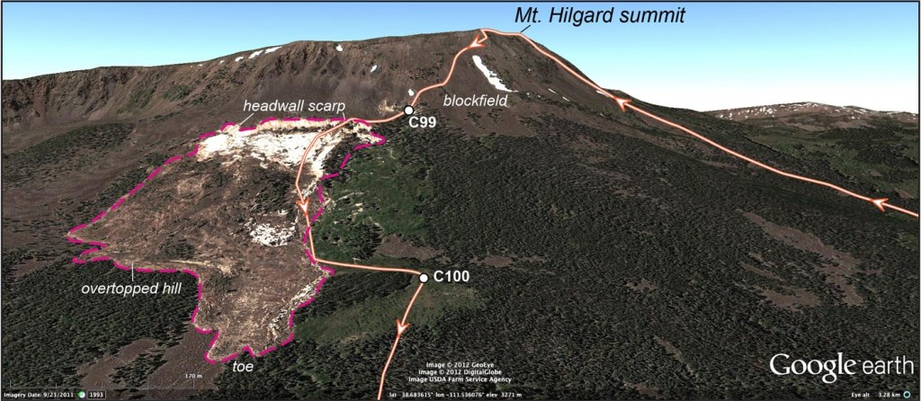
Oblique view (to the west) of Mount Hilgard from 2011 Google Earth imagery. Note large mass movement.
This mass movement came downslope with enough velocity to flow up and over a small hill and continue a bit further down the other side. The flow terminates in a series of lobes about 800 meters (1/2 mile) below its origin. To put the scale of this mass movement into context, I plotted the outline of the flow onto an image of William & Mary’s campus. In this scene, the flow originated between Sadler Center and the Integrated Science Center. It would have flowed east, taking with it most of Old Campus, including the Geology Department, and grinding to a halt just before reaching North Boundary Street. The Mt. Hilgard event likely moved half-a-million cubic meters of material—that is quite a pile. These mass movement events play a large role in shaping this alpine landscape.
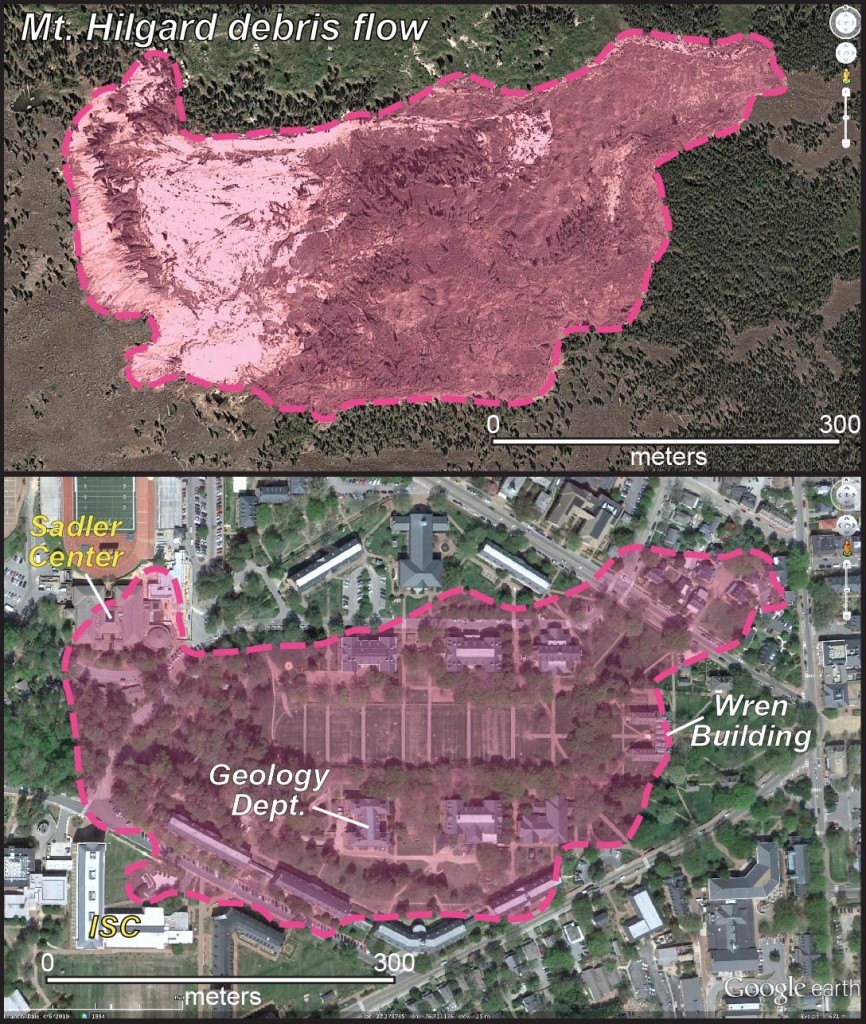
Top- 2011 Mount Hilgard debris flow outlined. Bottom- Mount Hilgard debris flow superimposed on image of William & Mary’s old campus.
This summer I’ll be back on the Fish Lake Plateau with William & Mary students and we’ll head for the eastern slope of Mount Hilgard. Here we’ll do geology—examining the newly exposed bedrock and quantifying the 2011 mass movement event. No doubt we’ll stand on the debris flow surface and wonder, that if the time and place had both been wrong, would we have been able to outrun this debris flow as it roiled down Hilgard’s menacing flank? What do you think?
Comments are currently closed. Comments are closed on all posts older than one year, and for those in our archive.





Dr. Bailey:
I’m a geo with Arch Coal and work at Sufco Mine. I noticed the white scar on Hilgard last summer and finally drove up there to take a look yesterday (7-4-12). Its an outstanding debris flow. I was with my wife and 88 yr. old dad so I couldn’t hike up to it from the road (FS015). I’ve had the opportunity to watch a number of similar flows in action on the Wasatch Plateau over the years. I suspect you would have been able to get out of the way. The flows I have seen up close seem to move on the order of inches per minute. I’m sure there are more rapid movements in places. All the flows I have observed have occurred in the North Horn and possible lower Flagstaff. I’m not sure what formation is under the volcanics…light color looks like Flagstaff? I am very interested in the red formation exposed at Red Creek Hole…could that possibly be Claron Fm starting to develop southward…we don’t have it in the Sufco Mine area??
Mark Bunnell