
A Highland Fling (Part 1)
The new semester at William & Mary is well underway and after this weekend, we’re off and running with the Field Methods in the Earth & Environmental Sciences course. In contrast to previous years, this edition of Field Methods is focused on only one location – William & Mary’s Highland, once the home and estate of America’s 5th President, James Monroe (W&M 1774 – 1776). This 500-acre property at the western edge of the Piedmont is both a historic site and a working farm, my 27 students are all in for understanding the geology underfoot.
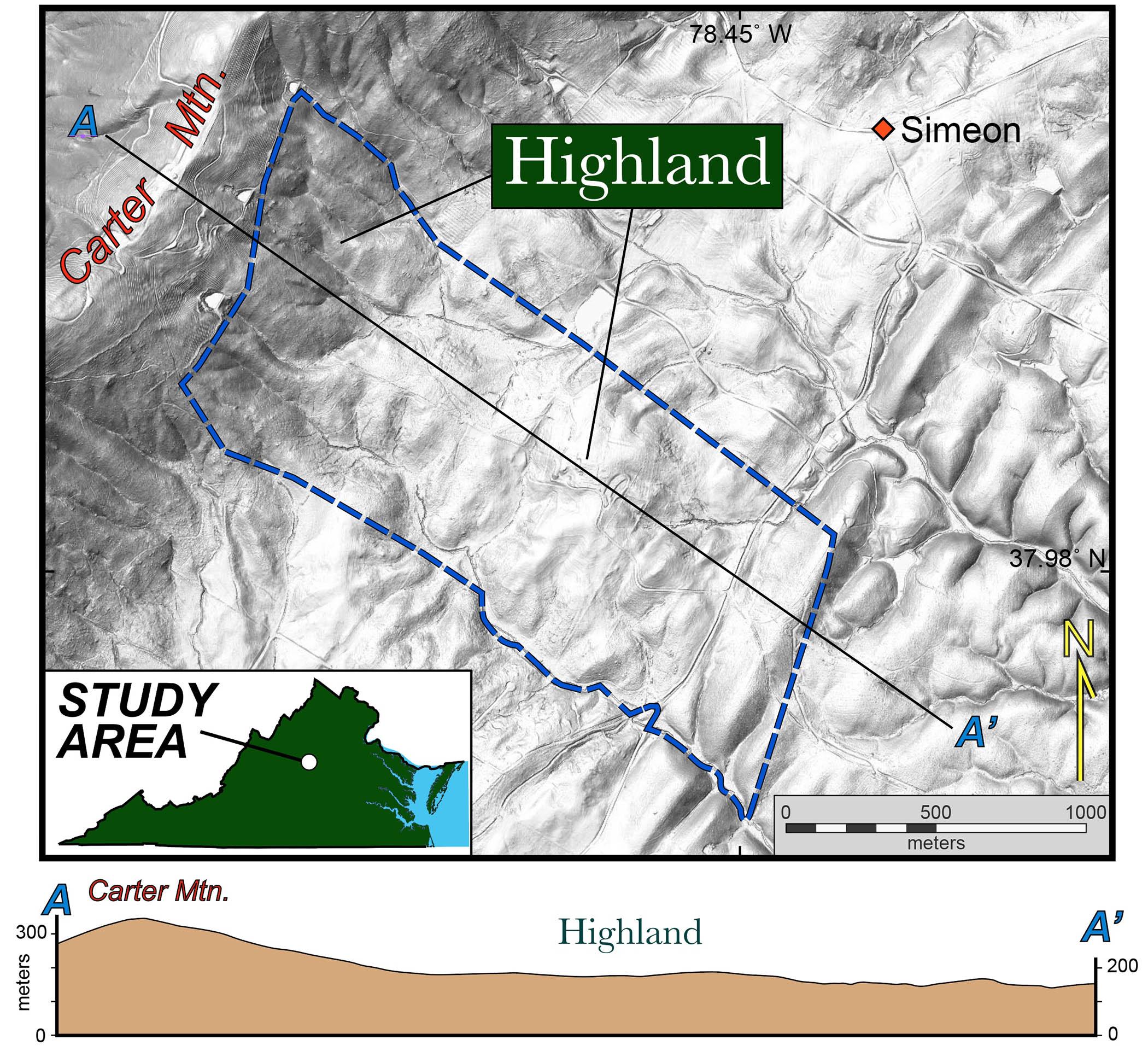
Grayscale shaded relief map of William & Mary’s Highland estate area in central Virginia. Notice the varied terrain.
We’re collaborating with Dr. Sara Bon-Harper, Highland’s Executive Director, as our place-based research fits nicely into the vision of W&M’s Highland campus as a place for significant student research and learning. The Highland landscape is a tapestry of pasture and woodland that has witnessed significant landscape change over the past three centuries while the bedrock geology provides a glimpse of change throughout deep time. Our goal is to link the deep time story to both the historical and ongoing land use at Highland.
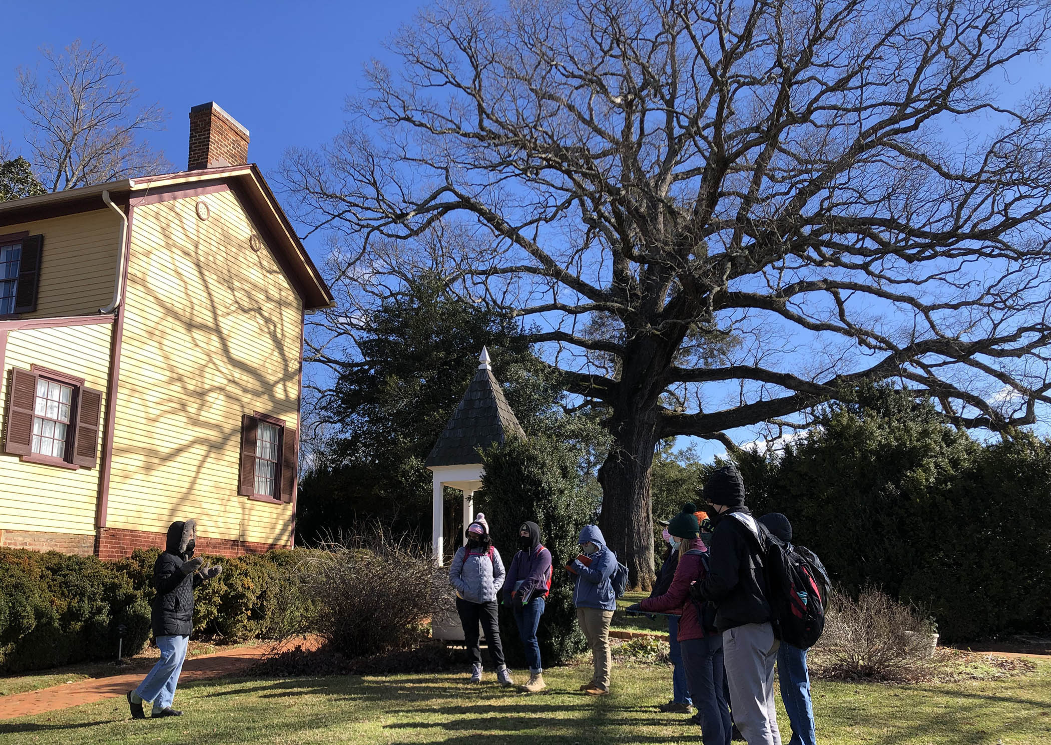
Dr. Sara Bon-Harper (bundled up on the left) introduces one team of Field Methods students to historic Highland.
Saturday was our first outing and we arrived at Highland all bundled up as it was cold. Although there was plentiful sunshine, the temperature struggled to reach 37˚ F and an ill-tempered northwest wind seemed to blow all day. In the morning, we got our bearings at the estate’s historic core with its 19th century buildings and then ventured further afield in the afternoon.
It was a productive day, and we’ll return for three more trips during the semester. Ultimately, we’ll map the geology and landscape using a variety of tools (from hand lens to magnetometers). We’ll sample the rocks, soils, and groundwater to understand the chemistry. We’ll use LiDAR topographic data to identify curious landforms that require explanation as their age and origin will be key for establishing a chronology and narrative of landscape change.
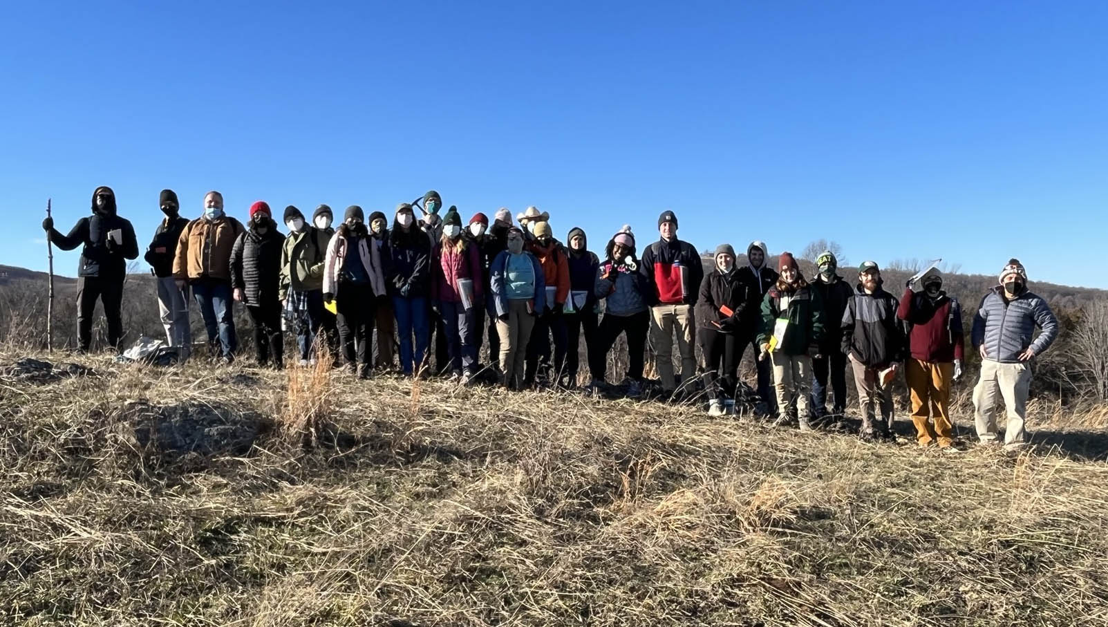
The full Field Methods crew strikes a pose in a pasture at William & Mary’s Highland (Photo by Sara Bon-Harper).
Later this semester, we’ll report our findings and provide content to help Highland further its educational outreach. I’m excited to be a part of this endeavor, and look forward to what new discoveries the Field Methods class of 2022 will unearth.

Comments are currently closed. Comments are closed on all posts older than one year, and for those in our archive.
Hey! That’s us! Great article Chuck! We gonna rock the world with geology!
This is so exciting and what a wonderful testament to the positive that can come to future generations.
So exciting to see W&M students doing field studies up at Highland! GO TRIBE ! Eager to hear more about your work and wish you the best!