
From the Tunnel to the Temple
The W&M Geology Department’s spring field trip dashed out of Williamsburg on Saturday for a one-day jaunt from the Tunnel to the Temple. The tunnel is the Blue Ridge Tunnel that Claudius Crozet engineered beneath Rockfish Gap in the 1850s. The temple is the LOTUS (Light Of Truth Universal Shrine) temple that forms the centerpiece of Yogaville, a distinctive community constructed in the 1980s. It was a day trip full of geology, but we also took in the history and cultural significance of these iconic Virginia destinations.
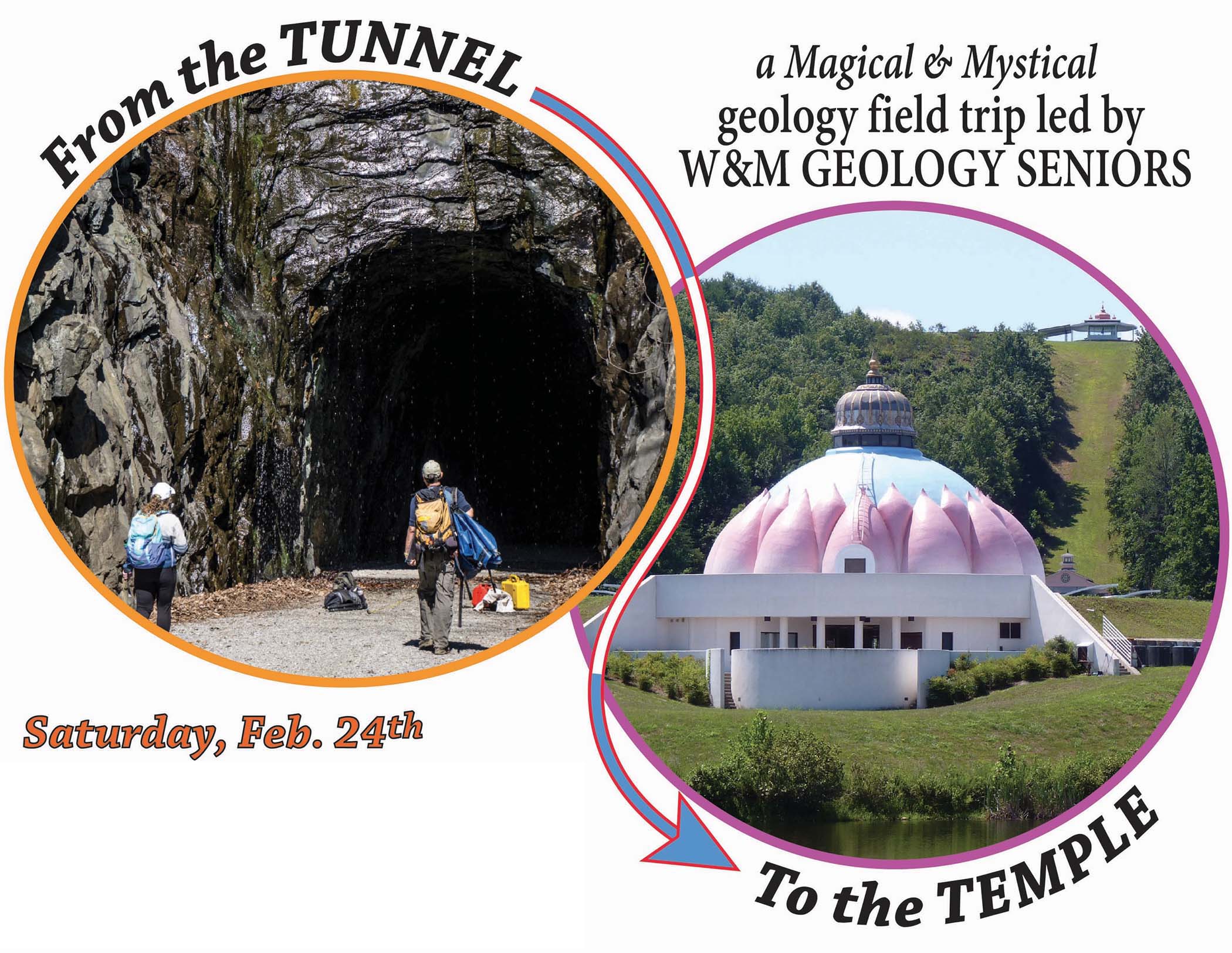
Flashy advertising for the 2018 William & Mary Geology Department’s Spring Field Trip.
Geology seniors Katie Lang and Aubrey Vaughan led the trip, and were joined by a raucous group of nearly 30 students and three faculty members. The weather was overcast and rain threatened, but mild temperatures prevailed making it feel like spring was here.

Map of the Tunnel to Temple field trip area in the Blue Ridge Mountains and Piedmont in central Virginia.
From the village of Afton, below Rockfish Gap, we hiked to the eastern portal of the Blue Ridge Tunnel. When this tunnel opened in 1858, it was the longest in the United States, and served as the rail crossing under the Blue Ridge Mountains for more than 80 years. During the 2nd World War, a larger rail tunnel was constructed adjacent to the older structure. Today, Nelson County and the Claudius Crozet Blue Ridge Tunnel Foundation are working to reopen the tunnel for public access. Katie Lang’s senior research is focused on mapping the geologic structures exposed in the tunnel, she’s already discussed the geology of Rockfish Gap on the 2017 Virginia Geological Field Conference and will be presenting her results later this semester at a Geological Society of America meeting. But on this February Saturday, Katie was showing off the Blue Ridge’s dark interior to her peers.
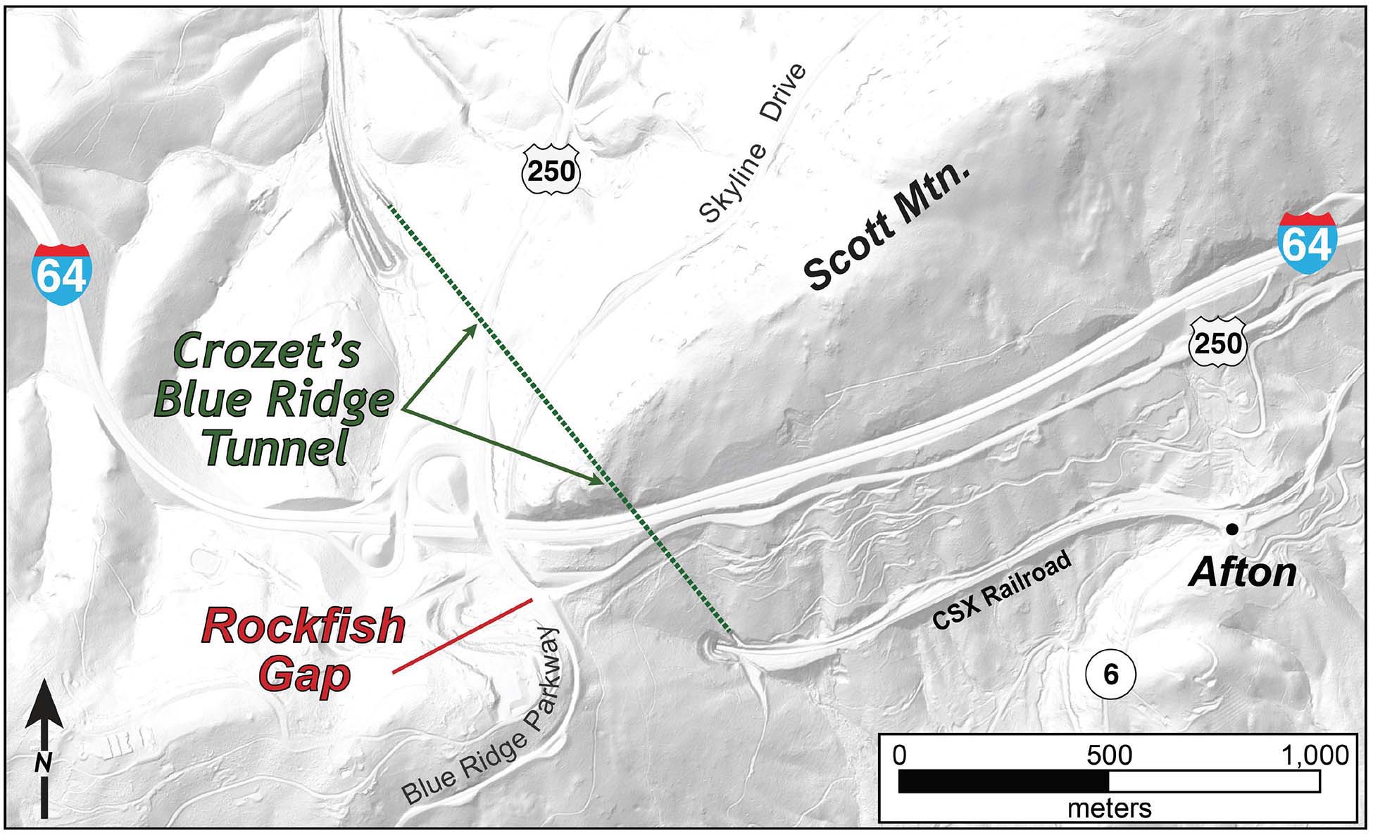
Grayscale shaded relief map of the Rockfish Gap area illustrating the path of the Blue Ridge Tunnel beneath U.S Rt. 250, Interstate 64, and the Skyline Drive (from 1-m resolution LIDAR data).
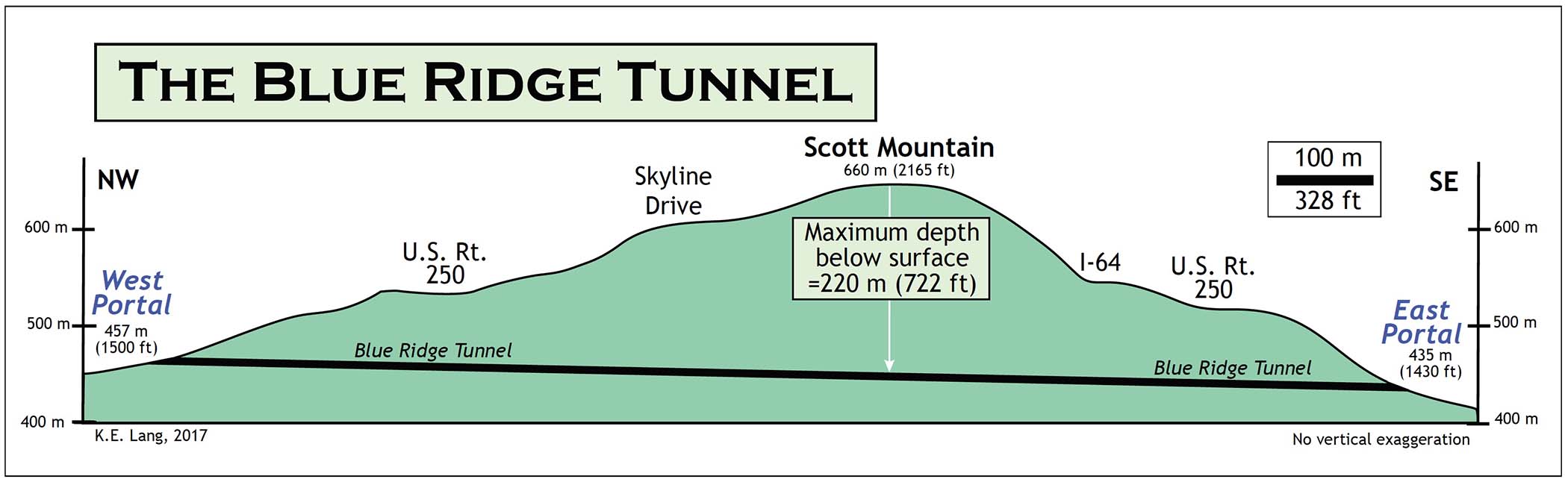
Cross section of the Blue Ridge Tunnel beneath Rockfish Gap and Scott Mountain, Virginia. Click on the image for a bigger view.
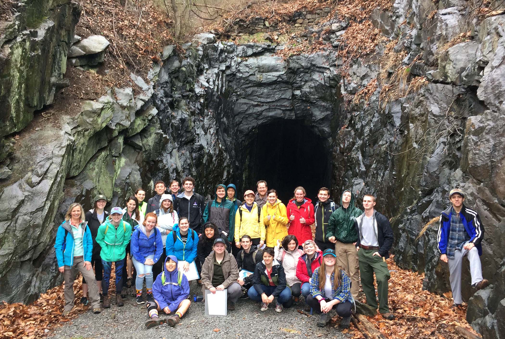
A crew of mostly happy William & Mary geologists at the Blue Ridge Tunnel’s east portal.
The tunnel is cut into greenstone, a tough and durable metamorphic rock that is part of the Catoctin Formation which forms a significant geologic unit in the Blue Ridge mountains of central and northern Virginia. These rocks were once basaltic lava flows, but enjoyed a long and complex history since they formed ~570 million years ago. The most prominent feature in the greenstone is its foliation, a planar alignment of minerals that produces a distinctive ‘grain’ in the rock. Foliation formed when the rock was solid, yet hot enough to flow. The greenstone was deformed and sheared at depths of 15 – 20 km (9 – 12 mi.) some 330 to 350 million years ago during the early phases of tectonic mayhem that created the Appalachian Mountain belt. The foliation is well-expressed in arcuate form within the tunnel, as the trace of foliation intersects with the nearly elliptical form of Crozet’s tunnel walls and roof.
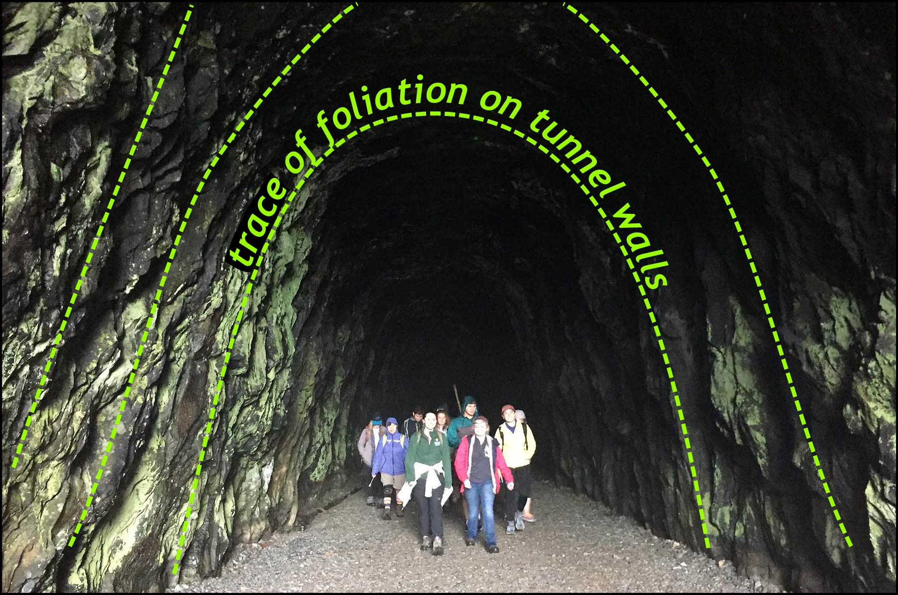
Near the eastern portal of the Blue Ridge Tunnel. Foliation, the prominent structure in the Catoctin greenstone, intersects the walls and roof of the elliptical tunnel. The foliation is not folded, rather it is dipping steeply towards the photographer. William & Mary geologists for scale.
There are other structures exposed in the walls of the tunnel including joints and faults (different types of fractures). These are brittle geological structures that formed after the foliation, and when the rock was cool enough to crack but not flow – likely under high stress in the upper 10 km (6 mi.) of the Earth’s crust.
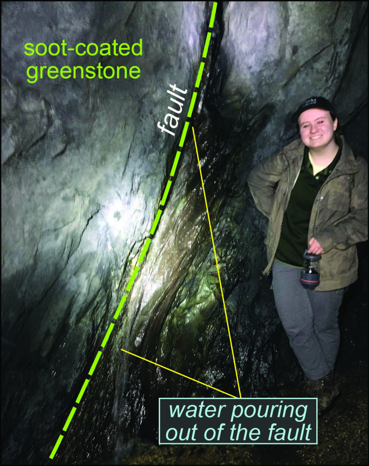
It’s Katie’s Fault! Groundwater pours from a fault exposed in the walls of Crozet’s Blue Ridge Tunnel.
200 meters (~650′) from the eastern entrance a steeply-dipping mineralized fault zone is exposed in the tunnel walls. For a structural geologist the fault is fabulous, but there is also groundwater flowing out from the fault – that’s enough to garner interest from geochemists and hydrologists. Professor Jim Kaste deployed the conductivity and pH meter – the waters were acidic (pH = 5.1) and quite conductive.
Just how long ago had the water, pouring forth from this underground crack, rained down as precipitation onto the surface of the Blue Ridge Mountains? Was it a few days ago or millennia ago? Although the Catoctin greenstone was a difficult rock to bore a tunnel through, it is full of fractures and faults in addition to being well-foliated such that there is a connected micro-fabric to the rock. These discontinuities provide any number of potential pathways for water to percolate from the surface into the bedrock.
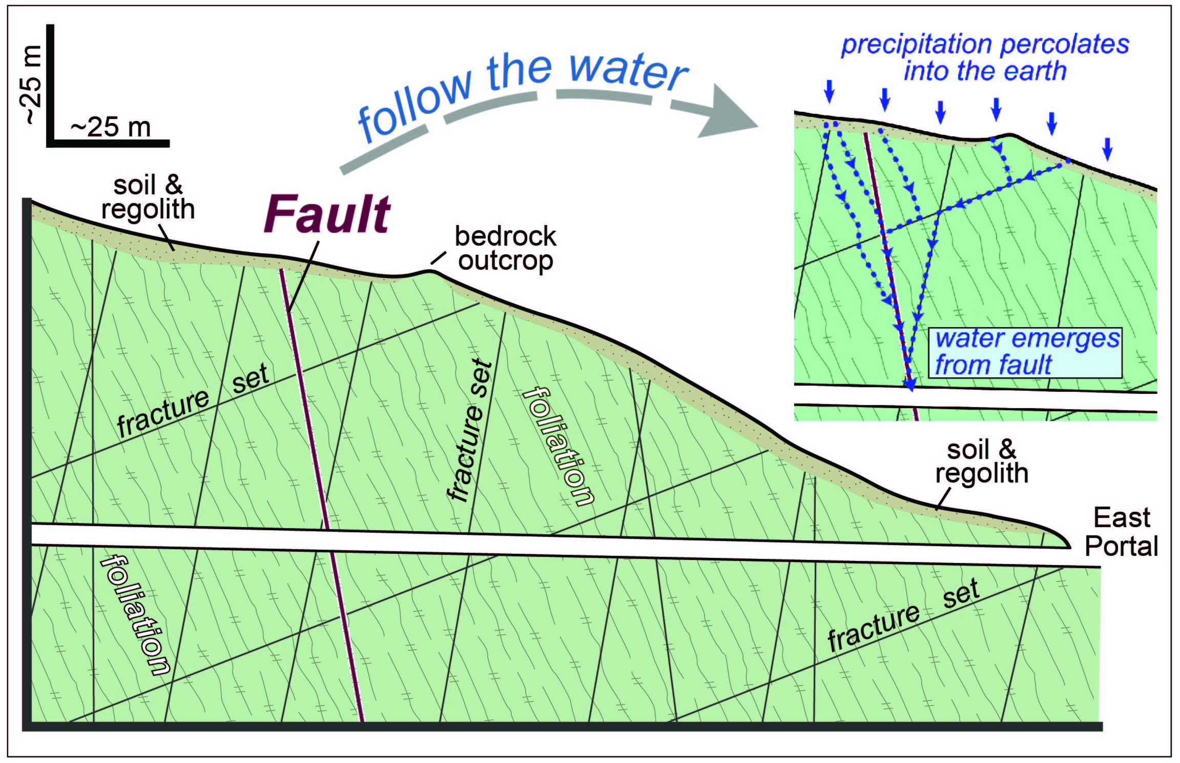
Schematic cross section with fractures, faults and foliation. Note pathways for water to reach the tunnel.
During our visit, water was flowing at rate of ~5 to 8 liters/min. (1 to 2 gallons/min.) from the fault. Our Tunnel Foundation guide, Bob Dombrowe, noted that the discharge of water from this fracture is correlated to a lack of precipitation – during a dry summer, water only trickles out of the fracture, but after a righteous rainfall water pours forth with alacrity. We suspect that the residence time of the ground water (the time that water spends between first percolating into the earth and discharging into the tunnel) is quite short – on the order of days to weeks.
Our journey further into the tunnel was blocked by a massive concrete wall (some call it a wafer – a 5-meter thick wafer!). The interior of the Blue Ridge Tunnel is sealed by two concrete barriers, erected in the 1950s as part of an ill-begotten project to store natural gas in the tunnel. Today, the only way to reach the deep interior of Crozet’s tunnel is to crawl through a 50 cm (20”) diameter steel pipe that traverses the concrete wafer. Wriggling through the pipe is a claustrophobic experience, and at the far end, the pipe opens into darkness (no surprise) while water ponds behind the other side of the barrier. As part of the tunnel restoration, the concrete barriers will be removed. On research trips to the tunnel over the past year, Katie and I have gone through that steel pipe four times – we’ll be happy to see the wafer removed.
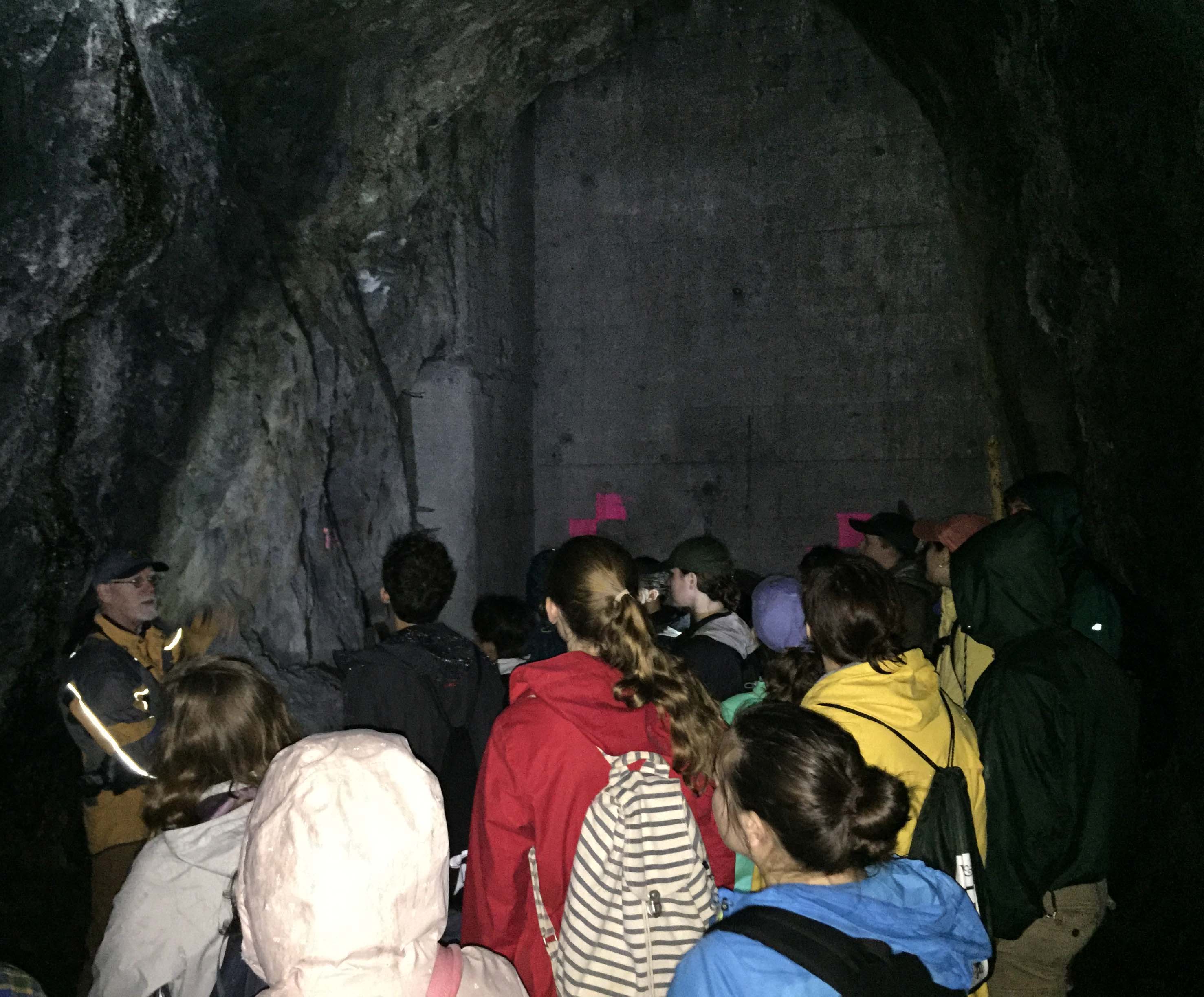
Bob Dombrowe (left, with the glowing jacket) discusses the great concrete wafer blocking the tunnel.
Before we entered the tunnel, I measured the outside air temperature to be 16˚ C (61˚ F) with a dewpoint temperature of 14˚ C (58˚ F). The air was humid and there was an occasional raindrop or two, but the air was not saturated. The Blue Ridge Tunnel is much like a natural cave in that the temperature is moderated relative to the outside air as it’s typically warmer than the outside air during the winter months and refreshingly cooler during the summer months.
However, on Saturday the air temperature outside the tunnel was high for February, such than the air inside the tunnel was cool enough that ~100 meters into the tunnel the air temperature was equal to the dewpoint temperature such that the air was saturated. Here, tiny water droplets filled the air, but they were not so dense to be fog or mist. However, there were enough suspended droplets to be easily seen in the beam of a flashlight. These tiny droplets of water, too small to rain down on us, also swallowed (via reflection, refraction, and dispersion) our lights in short order. Somebody noted that Gollum (of Lord of the Rings fame) would really like it inside the Blue Ridge Tunnel.
We emerged safe and more-or-less dry from Claudius Crozet’s Blue Ridge Tunnel, and then lunched at Rockfish Gap before heading south to Yogaville.
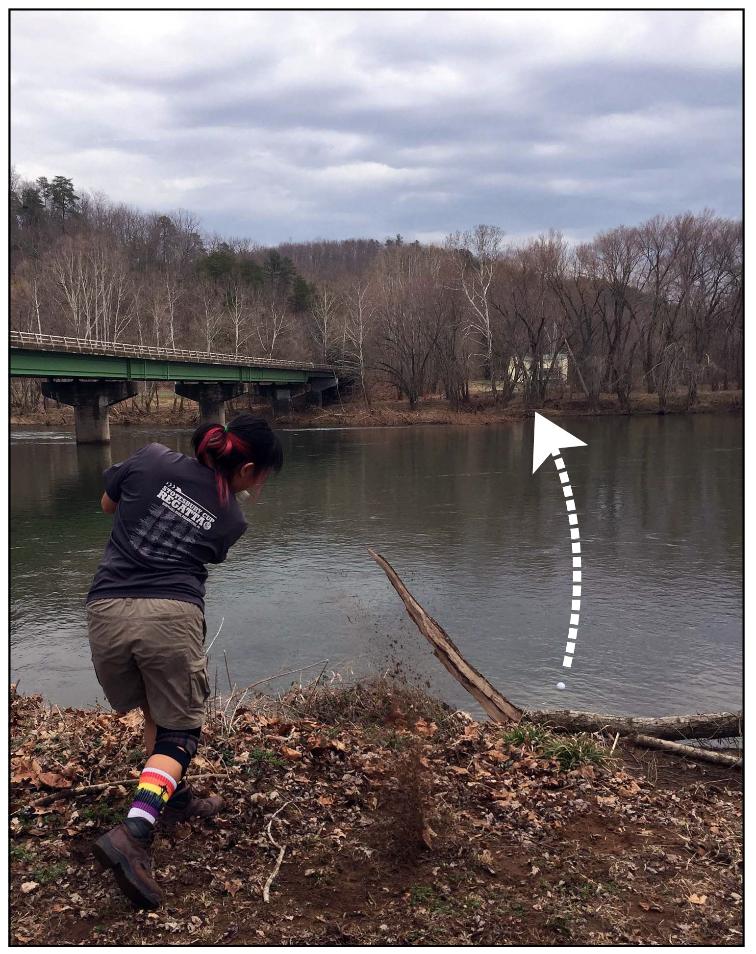
Anna Ledwin makes a valiant swing with a 5-iron in an effort to determine the width of the James River. The golf ball is the white dot below the arrow.
En-route to Yogaville we made a bonus stop along the banks of the James River, and estimated the discharge of Virginia’s big river. For geologists this exercise never gets old: a stream’s discharge is given by its average velocity multiplied by its cross sectional area (Q = V x A). Most of our estimates came in at ~100 m3/sec – which were low as the James was coursing along at 160 m3/sec. The biggest uncertainty came in estimating the width of the James River, as most of our estimates (guesses) were ~100 meters. The actual width was 140 meters. Visual estimates of the distance between two points can be challenging, and we ultimately resorted to the time-honored golf club technique to better estimate the width of the James River.
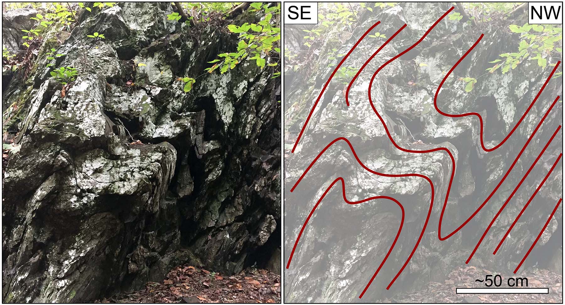
At Yogaville, Aubrey Vaughan took charge and led us on a hike to a series of outcrops along a small stream. The outcrops expose intensely folded phyllite and quartzite.
Folded phyllite at Yogaville.
Some of the phyllite contained 1- to 2-cm ruddy brown cubes of goethite, a hydrated Fe-oxide mineral that forms pseudomorphs after the original mineral (likely pyrite) was replaced.
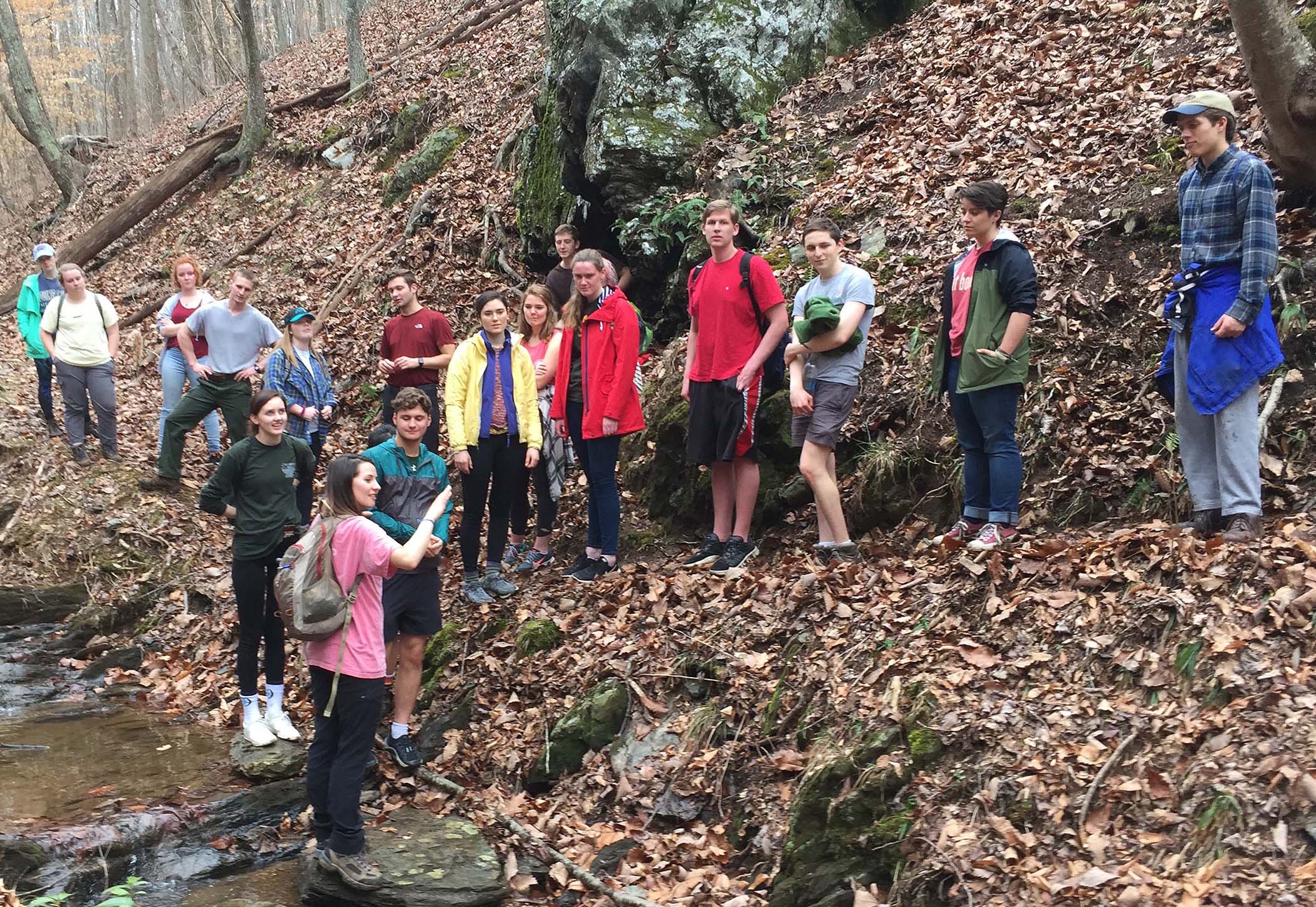
Aubrey Vaughan (in the pink shirt) reveals geologic truth at Yogaville.
At one of the exposures the rocks form a 3-m deep alcove, locally known as Ānanda’s alcove. Ānanda was a cousin and disciple of Buddha, but it is also the term for a state of extreme happiness in Sanskrit. There’s even a little shrine at the back end of the alcove. If one sits quietly, and with with purpose, in the alcove they will notice boudinaged quartz veins in the phyllite and recognize that the alcove is actually the inside of an asymmetric northwest-verging fold.
That’s ananda for a structural geologist!
We’ve taken to calling the outcrop Ānanda’s anticline, but aren’t sure the term will stick.
Aubrey’s research is focused on unraveling the kinematics of how these rocks were folded and stretched. Yogaville sits squarely on the Buckmarlson transition zone, a zone of highly strained rocks that formed at the boundary between the Blue Ridge and Piedmont geological provinces. She’ll also be presenting the results of her research at the Geological Society of America meeting this spring.
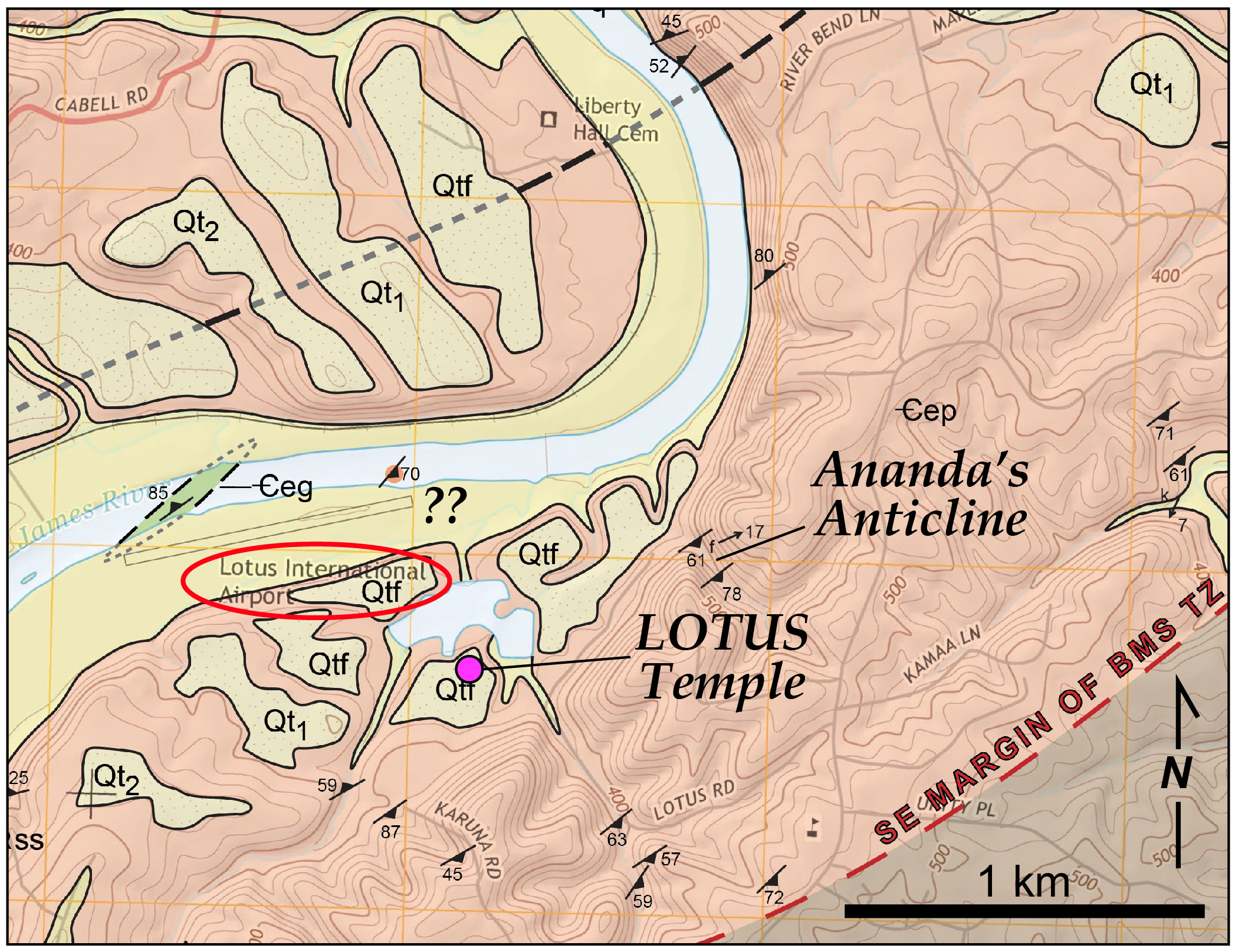
Geologic map of the Yogaville area from Spears et al. (2015). The LOTUS temple is located on an ancient James River terrace. Ananda’s Anticline occurs in deformed phyllite within the Buckmarlson Transition Zone. Note the Lotus International Airport!
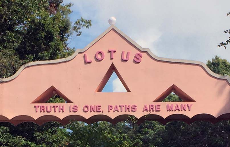
After the outcrops, it was time for a tour of the temple. The LOTUS temple is a beautiful structure that was constructed as a monument to peace, love, and understanding. Virginia’s a historic state with many old buildings, and although Yogaville’s pastel temple is just a few decades old, it’s a significant structure with an important message about tolerance that seems more relevant than ever.
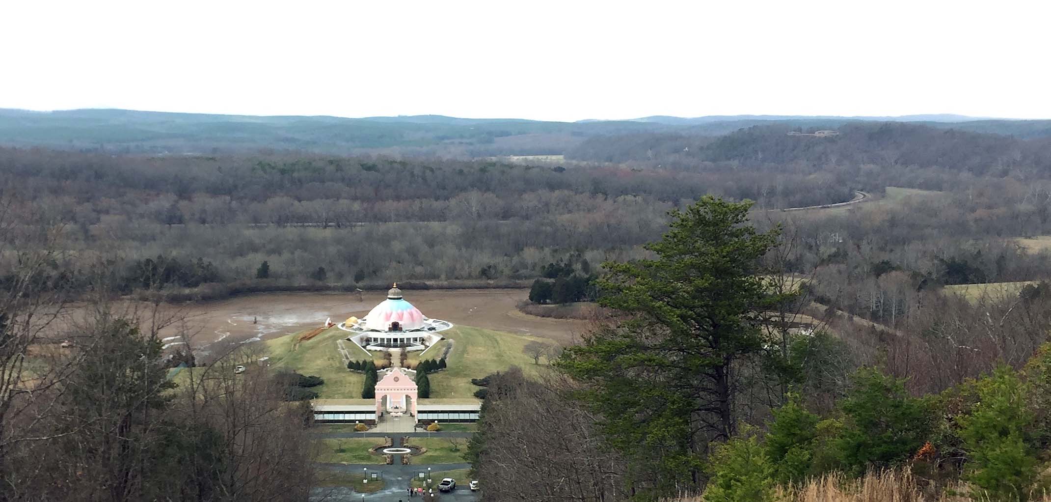
View to the northwest of the LOTUS temple and the James River lowlands.
The LOTUS temple is built on a set of ancient river terraces above the modern floodplain of the James River. In the 1980s, when Yogaville got its start, the James River floodplain was used as pasture and was more-or-less tree free. There was once a grass landing strip there (emblazoned on topographic maps as Lotus International Airport!). Over the past 30 years, secondary succession has reforested the floodplain and what was once grassland is now a burgeoning woodland. In riparian areas throughout Virginia, bottomland once used in agriculture is reverting back to forest.
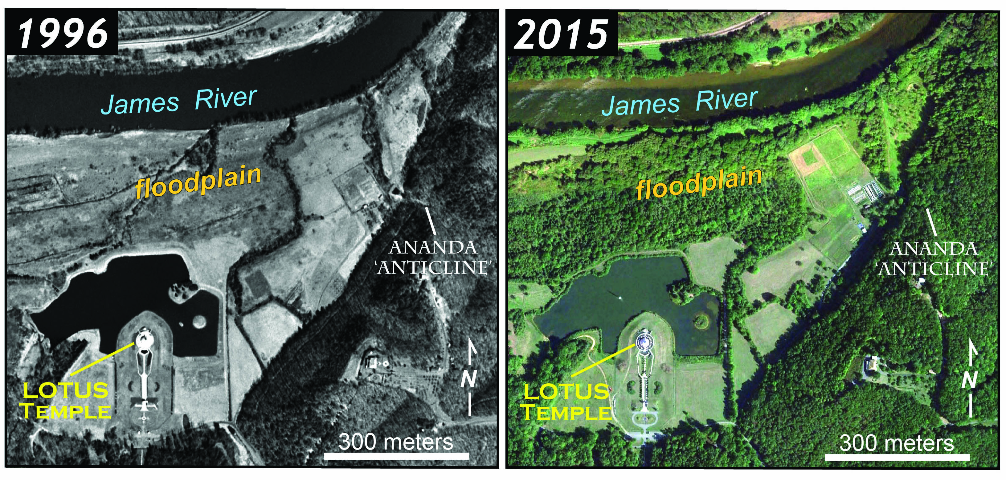
Yogaville, then and now, over the past 20 to 30 years the forest has been restored along the James River’s floodplain.
In the late afternoon, we rolled away from the pastoral tranquility of Yogaville, and headed east for the long drive back to campus. We had packed quite a bit of interdisciplinarity into this trip – just another day in the field for the William & Mary Geology Department.
Parting words from Yogaville.


Comments are currently closed. Comments are closed on all posts older than one year, and for those in our archive.
How many flights of stairs???
Thanks for sharing such informative details about the trip. Neat way to spend the day!
Nicely done with great imagery!