Dispatches from Oman: Fodder for the Tectonic Cannon
I’ve been in Oman for over ten days and seen plenty of deformed rocks—it is what I came for. What follows are a series of images illustrating deformed Omani rocks: there are folds, faults, fractures, and veins. This stuff is eye candy for a structural geologist.
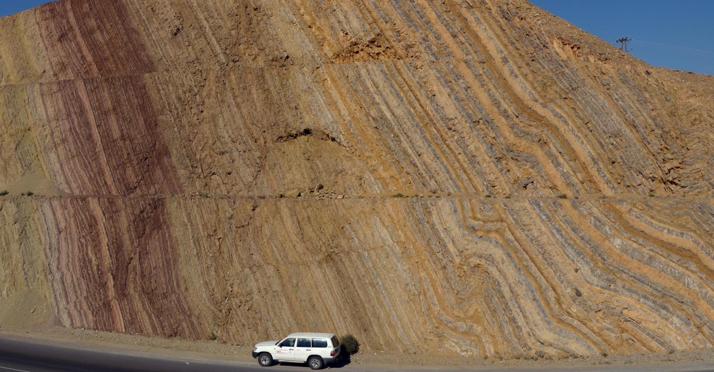
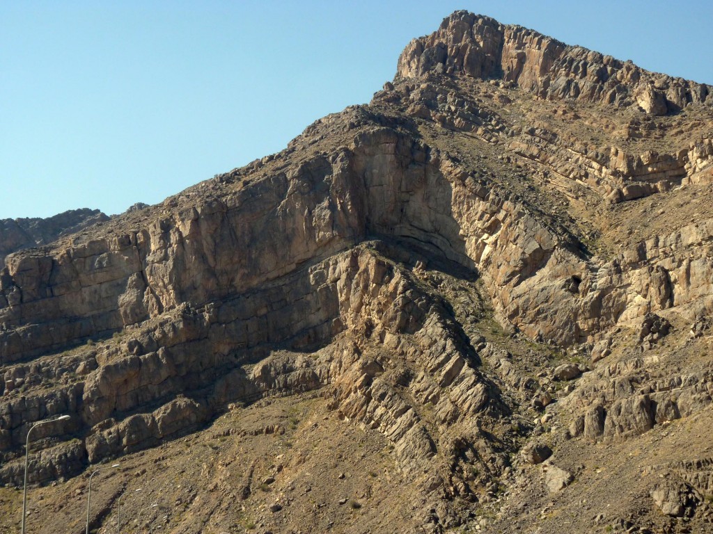
This first photo is a stitched panorama using our GigaPan apparatus of a big road cut on the main highway between Muscat and Nizwa. Notice the tilted and folded strata of the Hawasina sedimentary sequence and the lovely 4WD vehicle (unfortunately not our vehicle, we’re driving a saloon car).
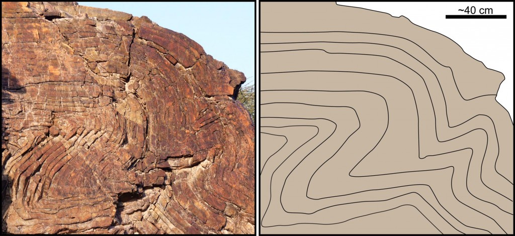
Here is a small outcrop of crumpled sedimentary layers near the village of Al-Taww. It is complex in detail.
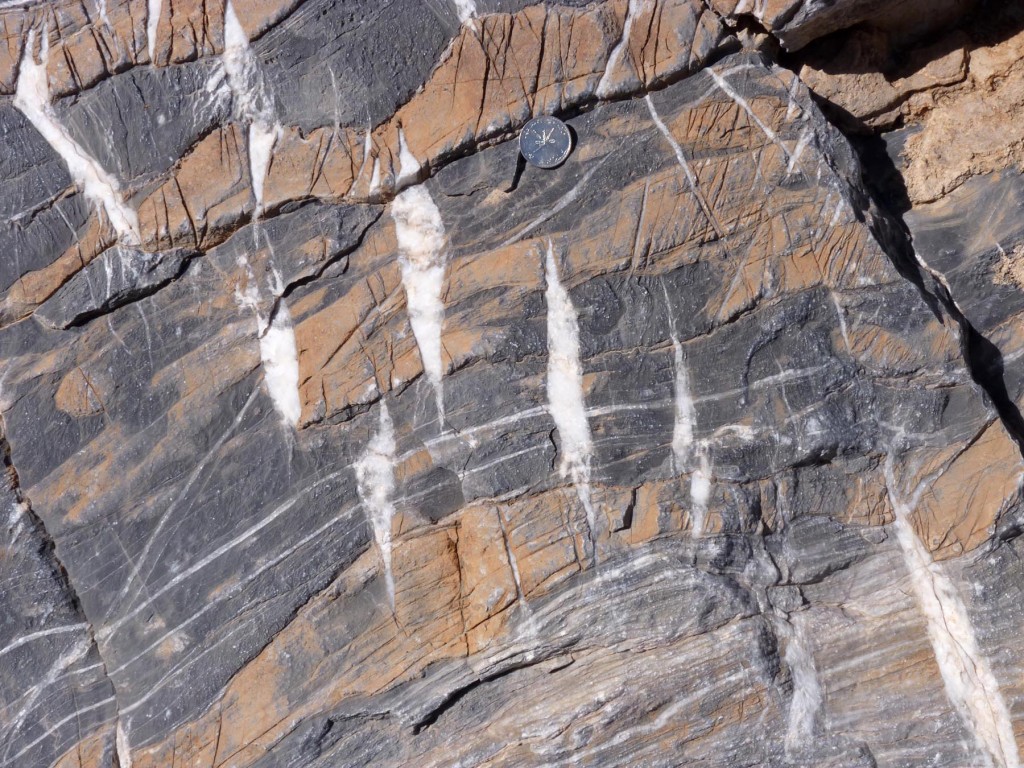
Notice the scale bar in this photo, an Omani 50 baiza piece that is about the size of a U.S. quarter. The rock in this photo is interlayered limestone (gray) and dolomite (beige) and the original sedimentary layering is tilted (lower left to upper right). The distinct white structures are tension gashes/veins, fractures that opened and immediately filled with the mineral calcite (white). Just where did the calcite in the veins originate?
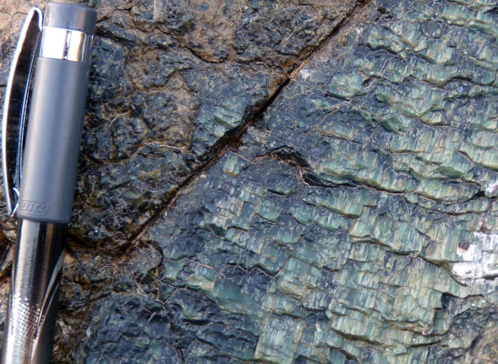
This image illustrates a close-up view of slickensides on a serpentinite-coated fault in the ophiolite sequence. The linear and stepped morphology of the slickensides are useful for determining the kinematics of faulting.
The last image is of a mountain-side north of the village of Birkat al Mouz along Wadi Muaiydin, exposing a dramatic fold sequence in Mesozoic limestones. Nice stuff!
All this eye candy is wonderful to view, but also begs the question(s)
Why were these Omani rocks fodder for the tectonic cannon?
and
When were these rocks crumpled, broken, and faulted?

No comments.
Comments are currently closed. Comments are closed on all posts older than one year, and for those in our archive.