
Student Summer Research Spotlight: Living Shorelines
Erosion and sea level rise have dramatic consequences on shorelines throughout the Chesapeake Bay region. Usually, property owners stabilize their shorelines with bulkheads, revetments or other shoreline armoring methods. But these methods provide little habitat for the Bay’s many estuarine species, and prevent natural marshes from migrating upland as sea levels rise. Scientists from the Center for Coastal Resources Management (CCRM) at William & Mary’s Virginia Institute of Marine Science (VIMS) have spent many years studying and installing “living shorelines,” constructed marshes that stabilize eroding shorelines, provide valuable ecosystem support and move with rising sea levels. This summer, W&M Environment & Sustainability students Nhu-Lan Pho ’25 and Matt Whalen ’22 worked with CCRM scientists to find whether property owners granted living shoreline construction permits had actually built living shorelines, and to measure the area of the marshes that had been installed.
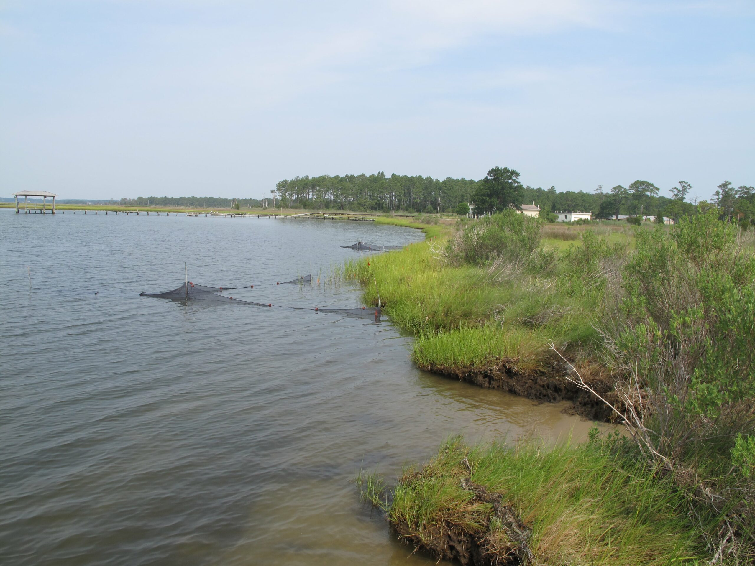
A marsh shoreline in need of restoration. Photo credit: Adriana Gorsky
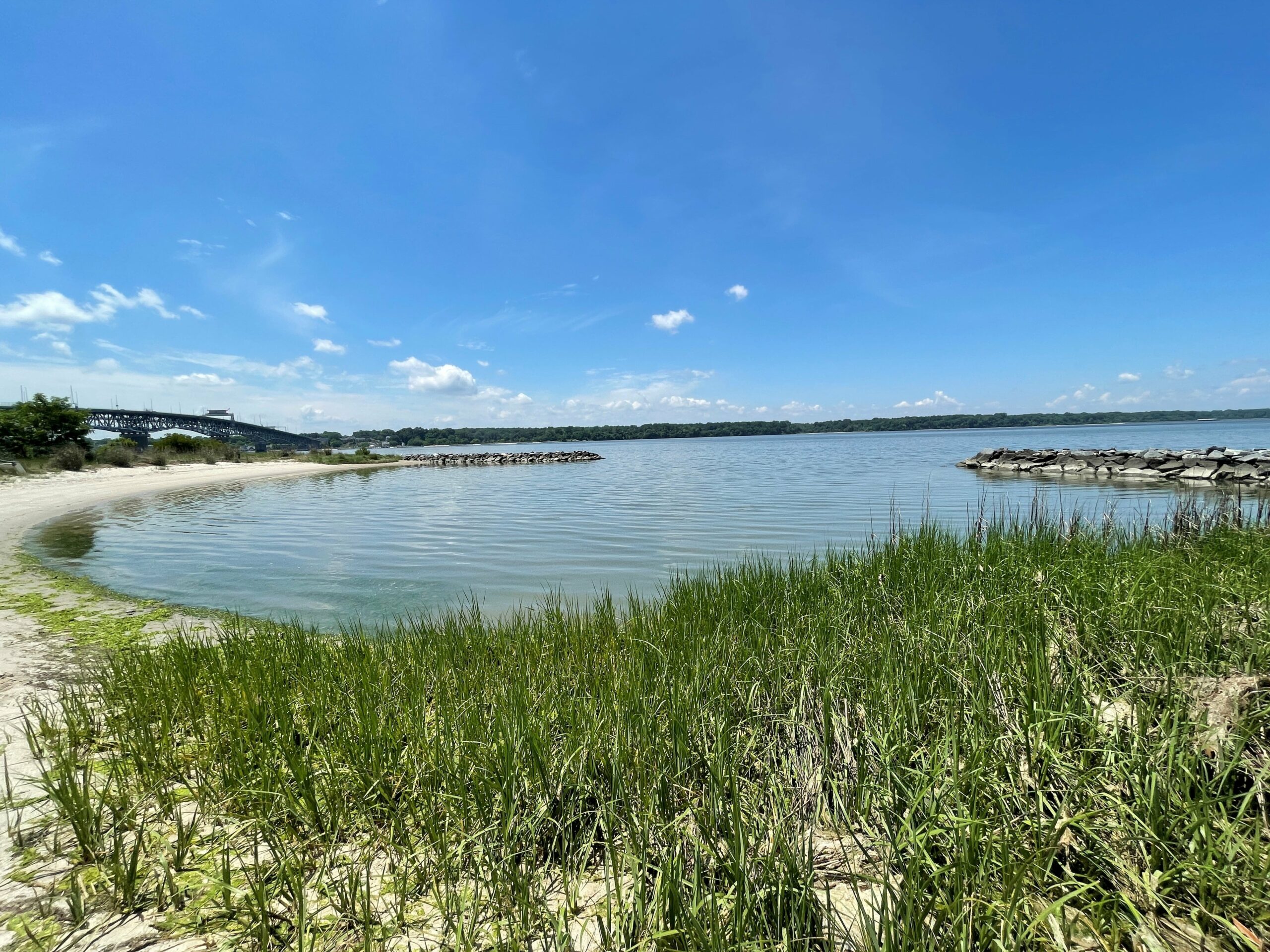
A living shoreline on the VIMS campus
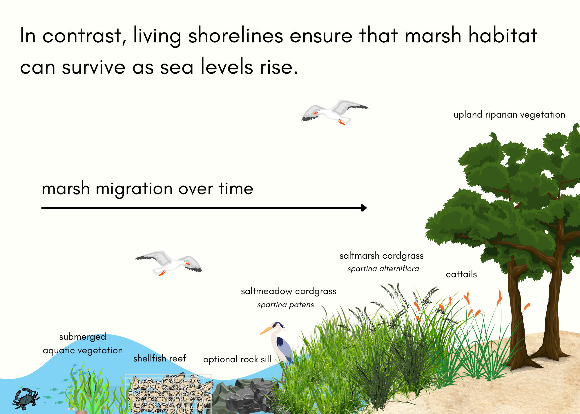
While traditional methods do stabilize shorelines, they have a negative impact on the local marine environment. When bulkheads are built behind existing marshes, they prevent the marsh from naturally migrating upland as water levels rise or as the shoreline is eroded. Eventually, the natural marsh will disappear. In contrast, living shorelines move over time. Additionally, roots from wetland vegetation stabilize sediment and reduce wave energy, which is especially helpful in areas with boat traffic. Natural shorelines in general provide valuable habitat for wetland species and improve local water quality.
Living shorelines are typically constructed of either non-structural materials, such as grasses and other vegetation, or a mix of structural and non-structural materials. Structural materials, such as rock sills, ensure that vegetation has time to grow and establish a marsh. Shellfish reefs are also frequently installed to reduce wave energy against vegetation. In all living shorelines, vegetation provides the majority of the shoreline stabilization, and living shorelines are now the official preferred method for shoreline protection in Virginia.

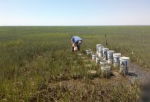
Nhu-Lan and Matt worked with Dr. Donna Bilkovic, Christine Tombleson, David Stanhope, Kory Angstadt and other CCRM staff to assess living shoreline construction in Matthews, Gloucester and Middlesex counties, all in Virginia’s Middle Peninsula. After searching county permit databases, they used a mix of ArcGIS Pro satellite imagery analysis, field work and communication with property owners to determine if living shorelines had been built. If they did find that a marsh had been built, the students would measure the length and area of the constructed marsh, inputting the points in ArcGIS’s Field Maps application.
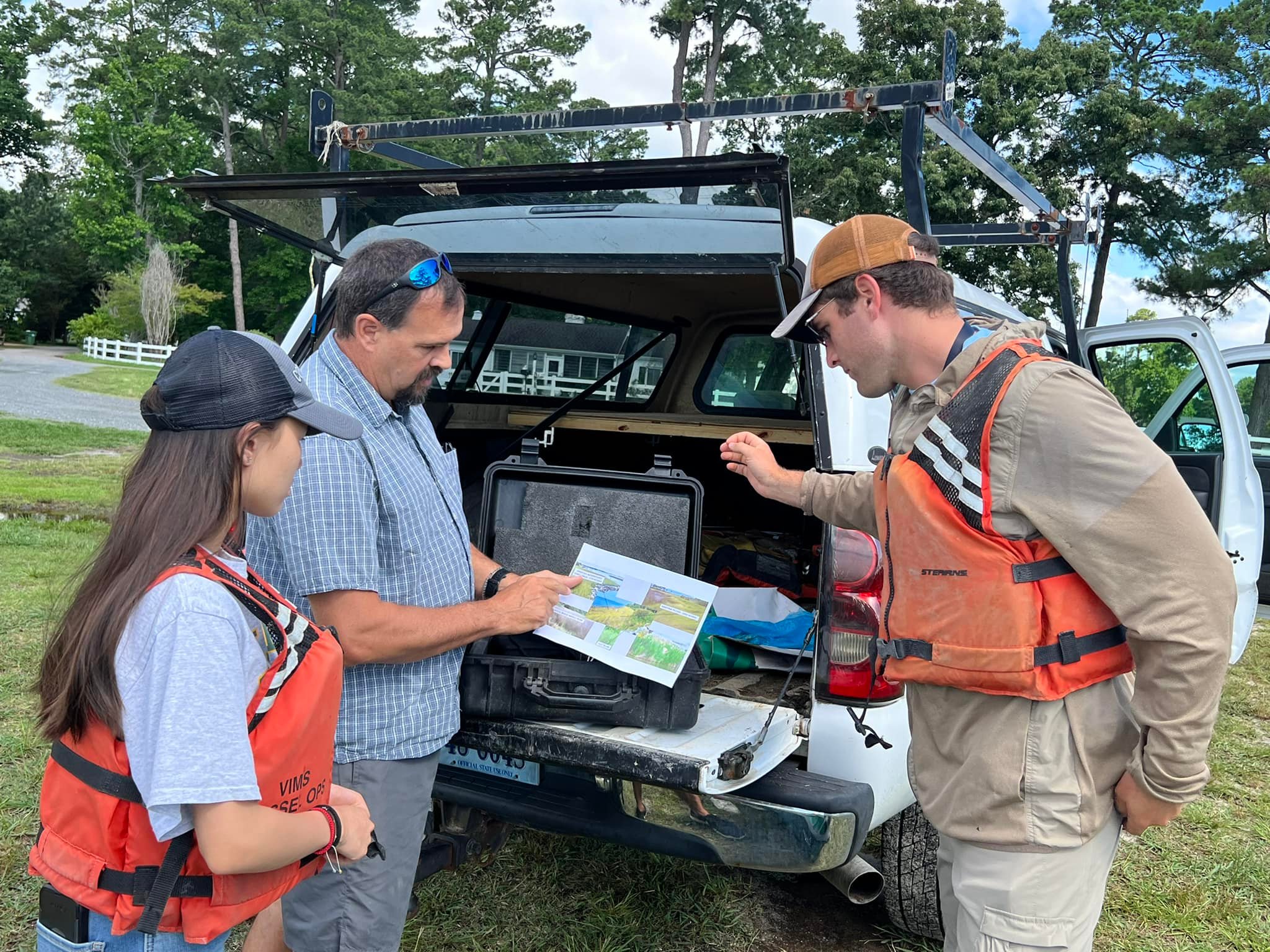
Nhu-Lan, Matt and David Stanhope of VIMS examine a map during field work. Photo courtesy: David Stanhope
“I loved my internship at VIMS…it was tough but rewarding work. Meeting with homeowners and explaining the purpose of living shorelines made me wish that more people understood their importance to marsh ecosystems,” said Nhu-Lan. Though important, cold-calling homeowners could at times be stressful – Nhu-Lan recounted how one homeowner thought she was part of a scam, until he Googled her name and met the VIMS team at his property. Additionally, many homeowners were confused when they were contacted by VIMS, as they didn’t know the history of their property’s marsh. “Some [homeowners] didn’t even know they had a living shoreline,” said Nhu-Lan.
The information collected by the team will be used to compare natural marsh and living shoreline ecosystem services.

No comments.
Comments are currently closed. Comments are closed on all posts older than one year, and for those in our archive.