
Who’s unconformable?
I spent the spare moments over Thanksgiving break working to complete a geologic map of the Big Run watershed in Shenandoah National Park. Fun stuff. My structural geology seminar has Monday, December 6th as a deadline to turn in their geologic map, cross sections, structural contour map, and research report – thus it is my deadline as well.
Geologists enjoy telling stories, stories that come from observing rocks at the outcrop, piecing together the spatial relations between outcrops, and learning secrets from the rocks themselves by cutting them open, measuring their microscopic structures, and analyzing their chemistry. This is a story about old rocks exposed in the Blue Ridge Mountains and my structural geology seminar. I tasked the students with determining whether the contact (boundary) between the underlying greenstones of the Catoctin Formation and sedimentary rocks of the Weverton Formation is conformable or unconformable?
What does it mean to be conformable or unconformable? When layers of rocks are deposited in a continuous succession through time without any significant break in deposition they are conformable. But if deposition is interrupted or there is an episode of erosion between deposition then the boundary between the older and younger rocks is unconformable, in essence part of the geologic record is missing.
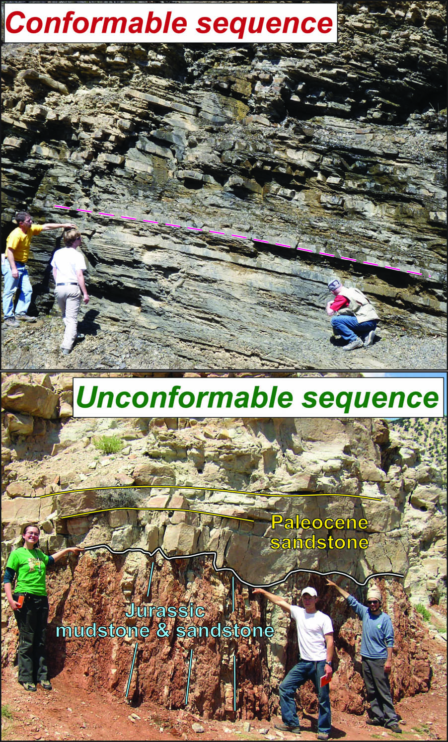
Outcrop views of conformable and unconformable sequences. Top- a conformable sequence of inclined Devonian mudstone and sandstone in West Virginia. Bottom- angular unconformity (wiggly white line) separating tilted Jurassic strata from horizontal Paleocene strata in Utah.
The Catoctin Formation takes its name for exposures at Catoctin Mountain, Maryland and consists of a thick pile of metamorphosed lava flows that extruded out and flooded an ancient landscape some 560 million years ago. Sandstones, conglomerates, and mudstones of the Weverton Formation, named for the Weverton cliffs along the Potomac River near Harpers Ferry, were laid down in rivers and alluvial plains during the early Cambrian period. Collectively, this rock sequence has been interpreted to record an episode of tectonic rifting that tore apart the ancestral North American continent and created the Iapetus Ocean (which long since disappeared due to the tectonic collisions that created the Appalachian mountain range). For nearly a century geologists have debated the nature of the boundary between the Catoctin and Weverton formations. A conformable contact makes for a simpler story with volcanism and rifting preceding the birth of the Iapetus Ocean and its attendant sea level rise across the continent. With an unconformity in the sequence geologists must rethink their tectonic models.
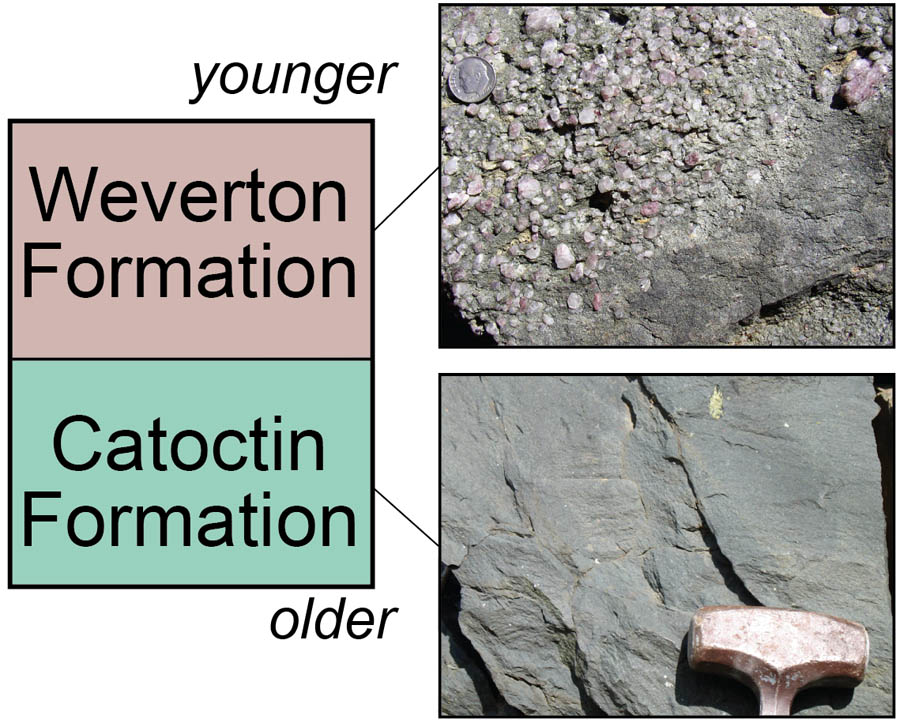
Stratigraphic relationship and outcrop photos of the Catoctin (basaltic greenstone) and Weverton (conglomerate, sandstone, and mudstone) formations.
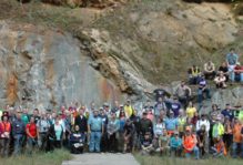
In humid and temperate regions like the Blue Ridge Mountains weathering and soil-forming processes cover up the bedrock and obscure geologic contacts. To answer the conformable or unconformable question we need to map the geology and discern the geometry of the contact over a wide area. In the past five years, working with a crew of W&M undergraduates we’ve mapped this contact across much of Shenandoah National Park. This semester we targeted the Big Run basin; existing geologic maps are nearly 40 years old and their portrayal of the geology is not detailed. As with most seminar courses in the Geology Department, students conduct original research that provides new data on Earth history and process. We’ve made three trips to the Blue Ridge, enjoying crisp and brilliant autumn weather each time. Collectively we’ve traversed and retraversed the Big Run basin, looking for bedrock outcrops and attempting to follow the geologic contact wherever it is located.
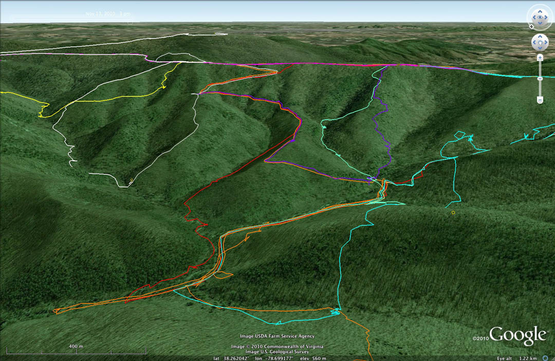
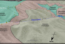
Oblique aerial view (in Google Earth) looking to the southeast illustrating GPS tracklines from the Structural Geology seminar’s traverses in the Big Run basin, Shenandoah National Park, Virginia.
Making a geologic map in the Blue Ridge Mountains is as much a physical endeavor as an intellectual pursuit. Our study area has over 500 meters (1,640 feet) of topographic relief. Although the study area is laced by a network of trails, to map the contact we end up way off the trails. We end up in briar thickets and laurel thickets; we end up on the steepest slopes and in creek bottoms looking for outcrop. We measured hundreds of geologic structures and delineated the position of the contact and a number of locations. Our maps, structural contours, and cross sections are now taking shape in digital form. So is the contact conformable or unconformable? No comment just yet. Check back in a week or so to see our completed maps and conclusions.
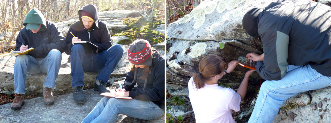
Views from the field. Left- frozen fingers taking notes on a cold morning. Right- measuring rock structures with a clinometer.

Comments are currently closed. Comments are closed on all posts older than one year, and for those in our archive.
Oh, mapping memories! Have you kept count of bears and ticks this time around?
Eagerly awaiting the exciting conclusion…