Inside the Ghubrah Bowl, Oman: dropstones, double-duckbills, and pencil structures, oh my!
In early January, with two of my research students, we escaped winter’s cold by heading to the Sultanate of Oman for a week of field research. Oman is a delightful place, and even more so in January with its warm temperatures and cheery sunshine. What follows is the first of three posts that will highlight our 2018 Oman research trip.
After two long flights we arrived in Oman, a tad jet-lagged but excited for fieldwork. The next morning we set off to the Ghubrah Bowl in the western Hajar Mountains.
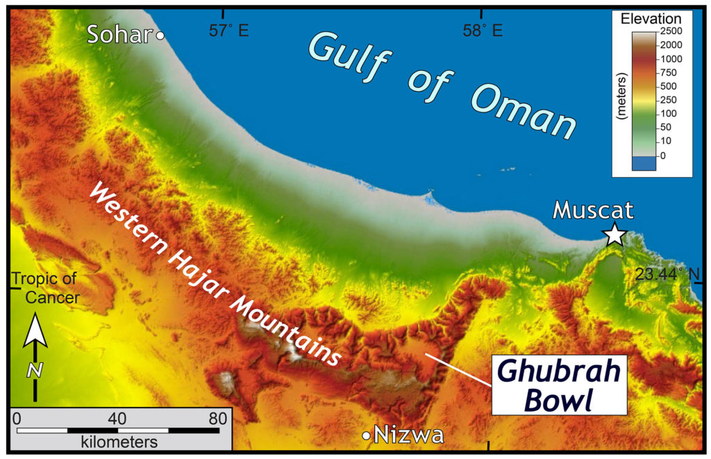
Shaded relief map of northern Oman with the Ghubrah Bowl highlighted. Based on 30-m data from the Shuttle Radar Topography Mission.
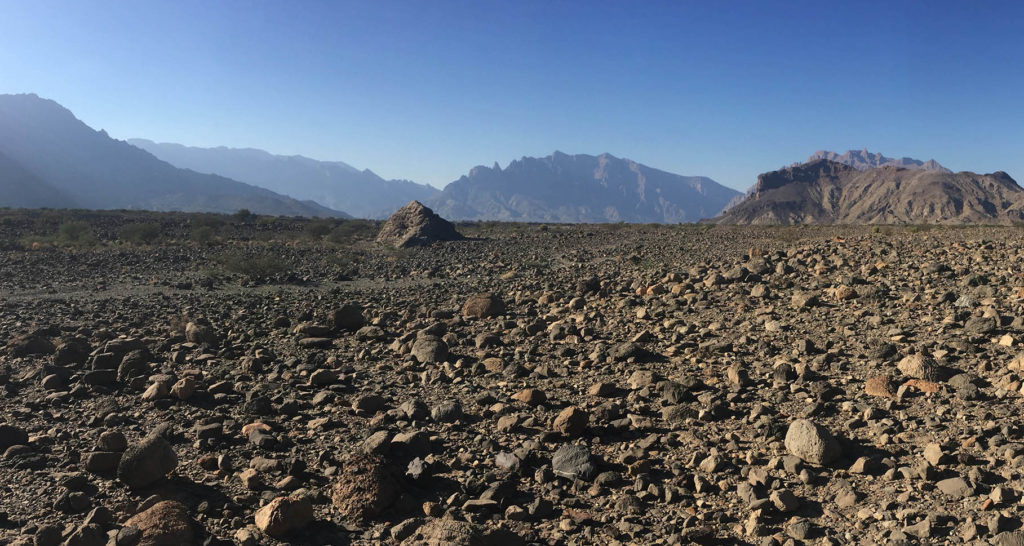
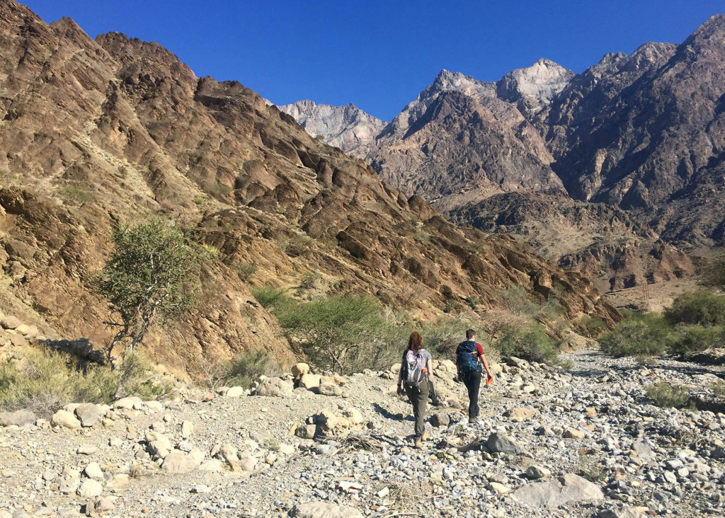
Ghubrah is a village located at the northern end of a broad topographic basin ringed by towering peaks. As you might expect, the ‘Bowl’ is a distinctive bowl-shaped topographic feature with a wide flat bottom that is bound on all sides by steep mountains. To reach the Ghubrah Bowl we traversed a narrow gorge carved by Wadi Mistal. The paved road twists between the canyon’s high cliffs, and then dramatically emerges into the open expanse of the ‘Bowl’ – it is an eye-popping scenery change over a short distance.
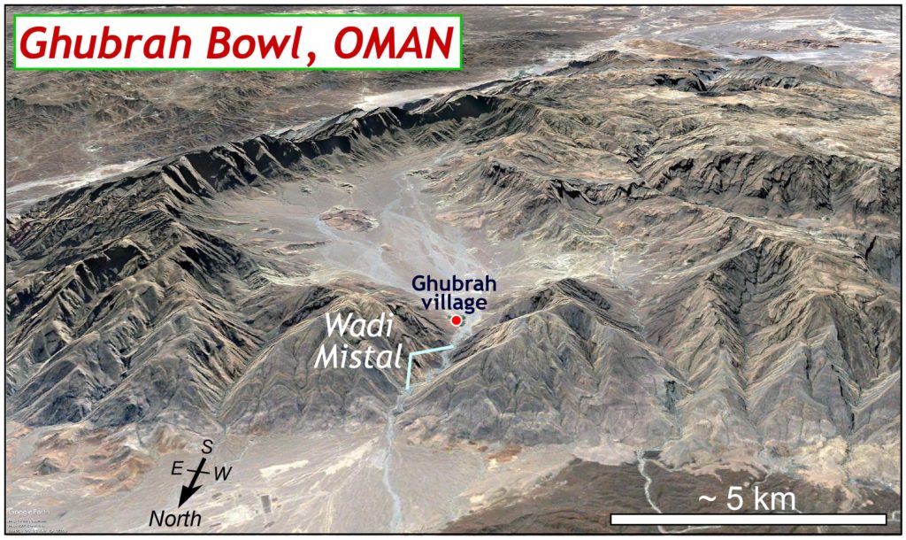
Oblique view of the Ghubrah Bowl, Oman (as viewed from the North). Imagery from Google Earth. Note the scale bar is ‘scaled’ for the foreground of the image, the field of view increases towards the background.
The geological structure and character of the bedrock strongly influences the erosion that produced the Ghubrah Bowl’s landscape. At the bottom of the bowl (and along its lower slopes) some of Oman’s oldest rocks are exposed. These gnarled Precambrian rocks underlie, with profound unconformity, a sequence of younger layered carbonate rocks that were deposited between the Permian and Cretaceous (250 to 100 million years ago). In Oman’s arid climate, the carbonate rocks (limestones and dolomites) stand tall producing rugged alpine terrain. As erosional processes carved into the Hajar Mountains, wadis such as Wadi Mistal cut canyons through the carbonate rocks and, in some locations, exposed the older siltstones, sandstones, and conglomerates below. The Precambrian rocks are mechanically weak and easily erodible, thus wadis that were once narrow canyons in the carbonate strata, widened into broad valleys with gently sloping gravel plains after they’ve eroded down to the older rocks. The Ghubrah Bowl forms an erosional window through the limestone carapace of the Hajar Mountains.
We were here to study the oldest strata in the Ghubrah Bowl which formed during an intriguing time in Earth’s history. Between 730 and 700 million years, the Earth was in the midst of a monstrous ice age, some researchers posit it was a global ice age that locked continents beneath all-encompassing glaciers and covered the oceans with sea ice from the tropics to the poles. It is known as the Snowball Earth hypothesis. Glacial deposits of this age occur on many continents. Over the years I’ve studied glaciogenic rocks of similar age in Virginia’s Blue Ridge Mountains. To be half-a-world away from the Blue Ridge examining rocks of similar age and origin is part of the sublime beauty of geology.
In the Ghubrah Bowl much of the bedrock is a distinctive conglomerate, that is more aptly described as a diamictite. What makes a diamictite a diamictite? How does a diamictite differ from a conglomerate?
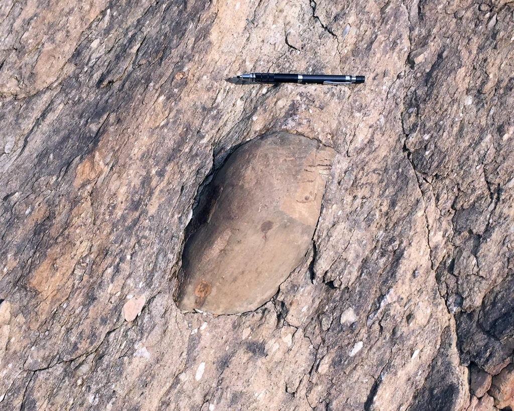
Diamictite from the Ghubrah Formation with a large outsized clast (center), likely a dropstone, encased in a muddy matrix. Pencil is ~15 cm (~6”) in length.
Diamictites are distinctive because 1) they are poorly sorted or completely unsorted deposits that contain a wide-range of clast sizes – everything from mud upwards to boulders and 2) the clasts occur in a matrix of fine-grained sediment, such that these rocks are typically matrix supported. Diamictites can form by a variety of means, but the active processes must be able to both transport and deposit grains of vastly different size. Flowing water and wind effectively sort sediment based on its grain size, yielding sediment that has a more-or-less homogeneous grain size. Glacial ice is different; it’s an equal opportunity transport agent that carries with it everything from mud to house-sized boulders with equal efficiency. When glaciers melt they typically leave behind an unsorted mess of sediment, that once lithified becomes diamictite.
Colorwise, Ghubrah diamictites are not flashy, but their structures more than make up for the drab color. There are outsized clasts galore, the largest clasts are boulders (up to ~1 m in diameter) that are bound up in a fine-grained foliated matrix. These large clasts are interpreted to be dropstones, literally stones that dropped from above into the muddy sediment at the bottom of the ocean. When rock-laden ice rafts off from glaciers it eventually melts at sea, thereby “dropping” the sediment that was entrained in the ice to the seafloor.
The Ghubrah diamictites provide another data point about a freakishly frozen time during Earth history, and many researchers have worked to discover the frigid secrets in Ghubrah’s past.
We were here to determine how and when these rocks were deformed. On earlier trips to the Bowl, I’d noticed that some clasts are elongate and well-aligned such that the rock has a pronounced linearity to it. At some point after deposition, the diamictites were deformed such that the rock developed both a foliation and lineation. Tyler Skelton, W&M Geology class of 2019, is always game for an adventure and last Fall we crafted a research plan to:
- map the structures preserved in the Ghubrah diamictites
- quantify the deformation these rocks experienced
- determine the age of deformation by dating minerals formed during deformation
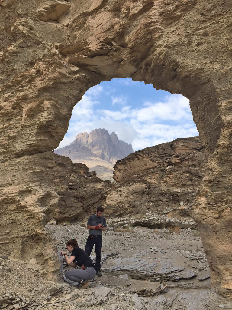
William & Mary geologists Cece Hurtado and Tyler Skelton collecting field data beneath an arch of foliated diamictite in the Ghubrah Bowl, Oman.
Clasts in the Ghubrah diamictites are a diverse group and include ‘granite’, metavolcanic rock, sandstone, and siltstone. Clasts of harder rock (granites, and their ilk) are subangular to subrounded, have a low aspect ratio (<1.5:1), and are typically poorly-aligned. Other clasts are cut by sets of internal cracks, these fractures broke the clasts apart and elongated them parallel to the overall maximum stretching direction during deformation.
In contrast, clasts of fine-grained rock, such as the siltstone, are quite different as they are commonly well-aligned and elongate with aspect ratios upwards of 3:1 to >5:1. The fine-grained clasts were mechanically weaker than the hard clasts, and as such experienced more shape change during deformation. By measuring the orientation and aspect ratio of clast populations, Tyler will estimate both the finite strain and the rheological differences between clast types.
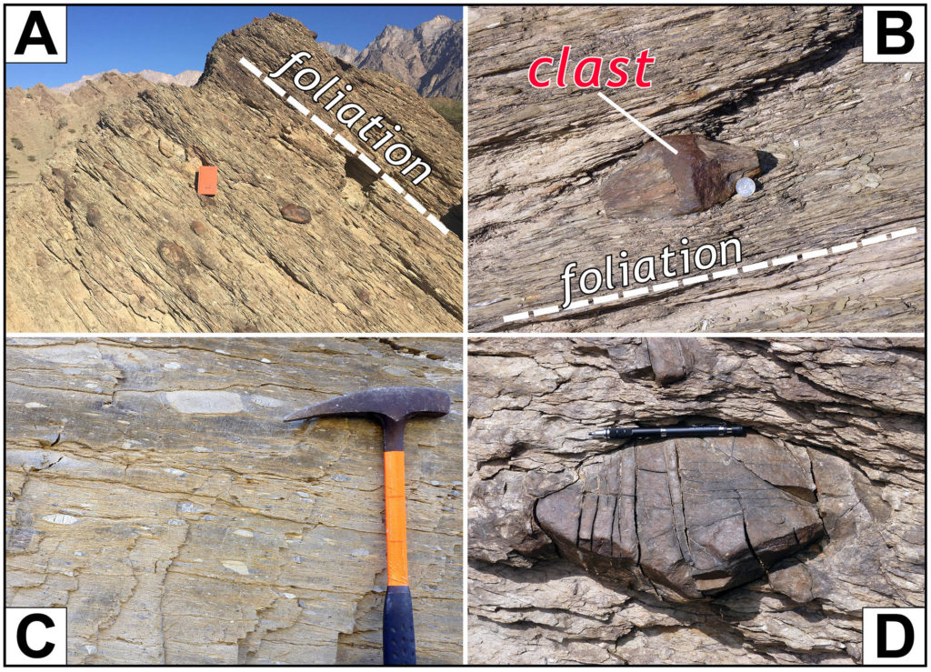
Ghubrah diamictite gallery. A) foliated Ghubrah diamictite, with ‘potato-like’ clasts in the foliated matrix (orange field book is 19 cm (7.5”) tall). B) large clast in Ghubrah diamictite (coin is 50 baisa, about the size of a U.S. quarter) with a double-duckbill structure. C) elongate siltstone clasts in the Ghubrah diamictite, long axes of the clasts are approximately parallel to the foliation. D) outsized clast cut by extension fractures which elongated the clast.
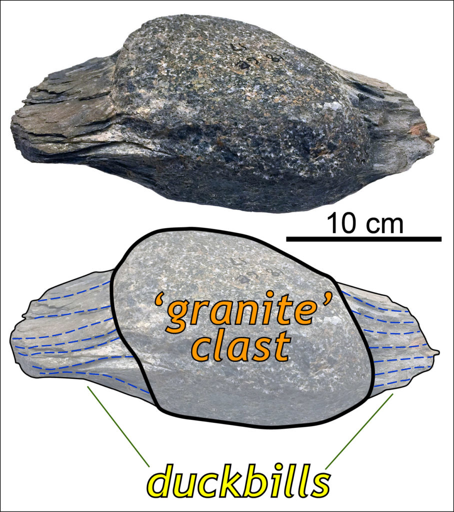
Many of the larger hard rock clasts are mantled by wing-like structures that are parallel to the macroscopic foliation and lineation. A rock with wings seems an odd thing. To me, these structures resemble a duck’s bill and each clast has two duckbills extending off opposite sides and parallel to the lineation. Why not call these features double-duckbill structures?
I double-duckbill dare you to come up with a better name for these structures.
Double-duckbills developed in the ‘pressure shadow’ created around the large clast as finer-grained matrix flowed around the clast during deformation (much like an eddy in a stream). We predict that the material in these double-duckbill structures will include more recrystallized minerals than elsewhere in the rock.
That’s quite a haul of awesome structural geology – but wait, there’s more!
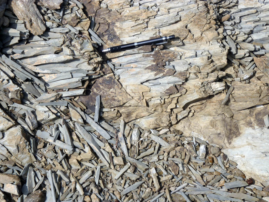
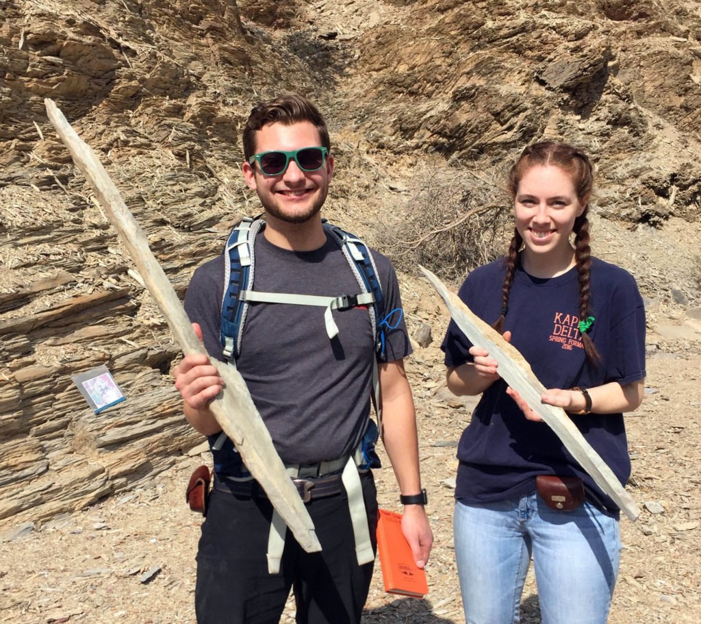
At some locations, the Ghubrah Formation has a well-developed pencil structure (cleavage). Pencil structure is just what the name implies, the rock cleaves in such a way that it breaks into elongate prism-like pieces, whose rough shape is somewhat similar to a pencil. The standard model for the formation of pencil structure involves a fine-grained sediment that develops a planar fabric with aligned clay minerals during compaction after deposition. Later, the rock is deformed and a second cleavage develops at a high angle to the compaction fabric – with just the right amount of strain, the rock’s two planar weaknesses produce pencil-like features. In William & Mary’s new undergraduate curriculum, scientists reach out to the arts and humanities – in keeping with that spirit, Tyler’s developed an interpretive dance to illustrate the formation of pencil structure!
As an undergraduate, I first learned about pencil structure from George Davis’ classic structural geology textbook (Structural Geology of Rocks and Regions, 1984). George does a great job introducing pencil structure, then he highlights some exceptionally large examples of pencil structure. Ever since then I’ve taken delight in finding oversized pencils. The Ghubrah pencils are world-class, if there was an Olympic event for pencil structures these Omani pencils would have a great chance of earning a medal.
Since returning to Williamsburg, Tyler’s been working up his field data and slabbing his samples for strain analysis. We’ll return to the Ghubrah Bowl next January, during our Rock Music Oman field course, and will discuss its crazy geological structures and marvel at the glorious landscape.
Comments are currently closed. Comments are closed on all posts older than one year, and for those in our archive.




Love this article. I like the fact that there is a geological structure one can reasonably call double-duck bill. If it looks like a duck…
Excellent! One of the best of your, always good, posts.
I don’t know, they’re pretty wide for duckbills. What about platypodes?
Good points all around – the naming committee (a few of my W&M research students) and I debated going the platypus route on the name. Indeed, these structure do look like the structures at the front end of that southern hemisphere monotreme. But the consensus was that duckbills have a global appeal!
I’ve also seen lovely (and large) pencil structures in the Appalachian foreland basin. In Oman, just east of the Ghubrah Bowl I’ve encountered bigger pencils that check in between 1 and 1.5 meters in length, although they tend to flare out/widen at one end and look more like a paddle than a pencil (since they are rock, they’d be no fun to use as paddles!).