Clear as Mud: W&M geologists use Lake Matoaka sediment to refine charcoal classification system
A group of William & Mary researchers from the Department of Geology and the Environment & Sustainability program have found that microscopic charcoal pieces from Lake Matoaka sediments correspond closely with events in American history. This research builds on other published studies investigating the sediment record in Lake Matoaka, the 40-acre, 300-year-old mill pond on campus.
The authors of this paper include Professor of Geology Jim Kaste, Associate Professor of Geology Nick Balascio, former W&M Geology undergraduate Lee Frank-DePue (now a graduate student at the University of Syracuse), former W&M Geology undergraduate Kayla Cahoon (now a graduate student at the Virginia Institute of Marine Science), and former W&M Mellon Postdoctoral Scholar of Environmental Science & Policy Dr. Richard Vachula (now an Assistant Professor at Auburn University).
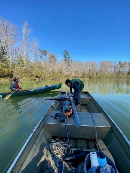
The project began in 2016, when the geologists took several cores of the lake’s sediments. To the untrained eye, a sediment core looks like a five-foot-long tube of mud. To the geologists, however, it is a window into Williamsburg’s past, and a chance to further develop a charcoal particle classification system for the Southeastern United States.

Professor Nick Balascio prepares to take a sediment core of Lake Matoaka. Photo courtesy of Jim Kaste
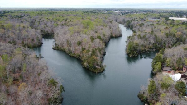
Lake Matoaka was created in the early 1700’s by damming what was then known as Archer’s Hope Swamp. Now, the lake is fed by several small streams that run through campus. Outflow from Lake Matoaka becomes College Creek, which becomes a large tidal creek as it nears the James River. Because Williamsburg’s history is so well-studied, researchers can use the historical record to better understand geological evidence found in Lake Matoaka.
Studying charcoal particles from the sediment record is one of the few ways that geologists can examine a region’s fire history, including what types of fires burned there. Fire types may include natural forest fires, human-caused agricultural fires or fires from burning fossil fuels. Charcoal is the natural byproduct of fires, and different fire types can create charcoal particles with distinct shapes, textures and porosities.
In 2016, the researchers used radioactive lead and cesium isotopes found naturally in the lake core to create a timeline of sedimentation in the lake. They determined that the lake accumulates new sediment at the approximate rate of 0.5 cm per year, which is relatively quick. Now, they can use that timeline to study other particulates such as charcoal found in the core.
Because of the slow sedimentation rate, it is possible to analyze the core on a fine scale: a centimeter of sediment from the lake core may contain data from just a few years. “We can sample with a resolution of a couple of years,” says Professor Kaste. “With most other lakes, if you grab a centimeter, you might have 50 or 60 years in that centimeter…We can get a really good time resolution on environmental indicators like lead, grain size, charcoal, mercury or other environmental proxies.”
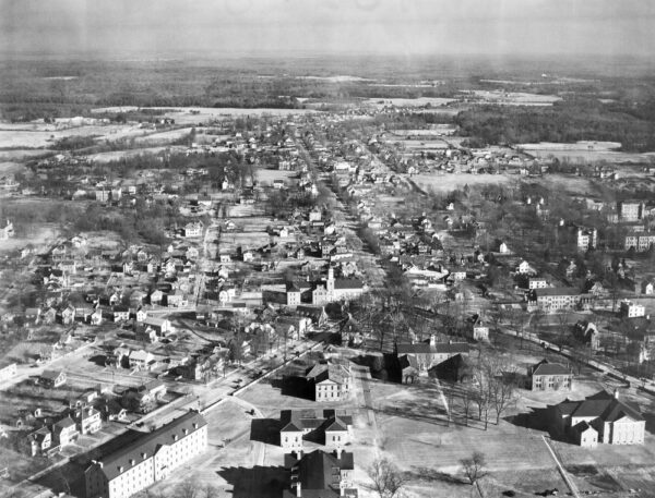
Though it was originally Virginia’s historical capital, the population of Williamsburg declined after the capital was moved to Richmond in 1780. The population began to increase after the Civil War, and has continued its upward climb ever since. The researchers found that the shape and size of charcoal particles corresponded to historic land and fuel use in the area.
Before the Revolutionary War, the sediment record reveals charcoal types associated with agricultural burning, and possibly with the intense burning from an armory during the Revolutionary period. The post-Revolutionary sediment record corresponds with the decreasing local population, and sediments from the post-Civil War era show decreased agricultural burning, with the potential addition of coal as a fuel source.
Charcoal sediment research presents some challenges. It can be difficult to determine whether particles are from natural or man-made fire sources, and particles may fracture during analysis. The historical record of Williamsburg may aid researchers in determining the origins of charcoal particles, since all major fire sources from the past 300 years are generally known.
Professor Kaste described how Williamsburg’s historical record helped to interpret the core. “We know that Jamestown Road was paved around 1906, so we see the lake change because all of a sudden the dam was stabilized and the lake level was stabilized. [The historical record] is a way to validate our approach of using the core to reconstruct change…we’re lucky that this area has a good historical record, so it kind of supports the [charcoal identification] technique elsewhere.”
The researchers hope that this study will help redefine the charcoal classification system used in the Southeast. Currently, the charcoal classification system is mostly based on Northern boreal forest data. One major finding from this study was that 54% of the charcoal particles from Lake Matoaka belong to the same type. This could possibly indicate that more categories are needed to distinguish the sources of charcoal particles in the Southeast. The researchers proposed three additional classification categories, which should help Southeastern paleogeologists better define the origins of both human-caused and natural charcoal particles in the region.


No comments.
Comments are currently closed. Comments are closed on all posts older than one year, and for those in our archive.