Ivy Creek, the Old Stomping Ground
This post begins what I plan to be a recurring series on drainage basins and watersheds. For earth scientists interested in landscapes and surface hydrology: drainage basins are a fundamental component of these natural systems.
A drainage basin consists of all the terrain that contributes water to a particular stream or river. For instance, rain that falls on the Geology building at William & Mary runs off into College Creek, College Creek flows south into the James River, and the James River debouches into the Chesapeake Bay at Hampton Roads. Drainage basins are diverse, ranging in size from near continental portions (i.e. Mississippi/Missouri and Amazon) to modest creeks that drain a few square kilometers, and small drainage basins are nested inside progressively larger basins. In what drainage basin are you reading this post?
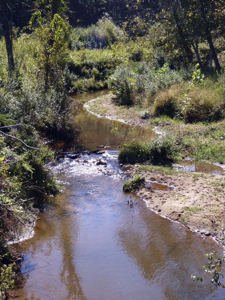
I grew up on a patch of rolling upland terrain near Ivy, Virginia about 10 km west of Charlottesville in Albemarle County. I spent much of my youth in the local creek that meandered across the rural landscape. This was Ivy Creek. It is a small stream, typically a meter or two or three wide, with a sandy to gravelly bottom and steep muddy banks (1 to 2 meters high).
My friends and I had many adventures in Ivy Creek and its tributaries. We traipsed through the creek on hot summer days searching for cool water and deep shade. After snowfalls we’d build a snow ramp on the edge of Ivy Creek Branch, take to our sleds, glide down the nearby hill, hit the ramp, and often land askew in the partly frozen creek – good times!
Fond memories aside, Ivy Creek and its drainage basin are quite ordinary. Because the Ivy Creek drainage basin is so typical (or perhaps classic) it makes a nice embarkation point for an ongoing discussion about drainage basins.
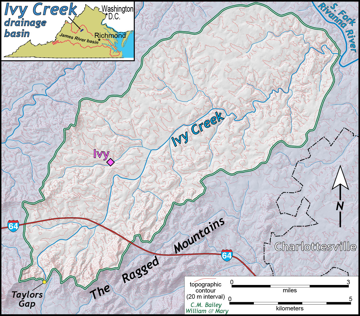
The Ivy Creek watershed encompasses nearly 60 square kilometers (23 sq. miles). The stream begins along the northwestern slope of the Ragged Mountains and flows in a northeasterly direction for over 20 kilometers (~13 miles) where it joins the South Fork of the Rivanna River (a tributary to the James River).
The Ragged Mountains are a group of subdued and rounded hills underlain by granitic bedrock that solidified about a billion years ago. For a not so subdued and phantasmagoric story of this range read Edgar Allan Poe’s “A Tale of the Ragged Mountains” which ostensibly takes place here. All things considered, the old granitic bedrock in the Ivy Creek watershed is relatively uniform and homogeneous. As such, Ivy Creek flows across bedrock with a similar strength and erodibility throughout its drainage basin.

A late afternoon winter view of the Ragged Mountains, headwaters of Ivy Creek, Albemarle County Virginia.
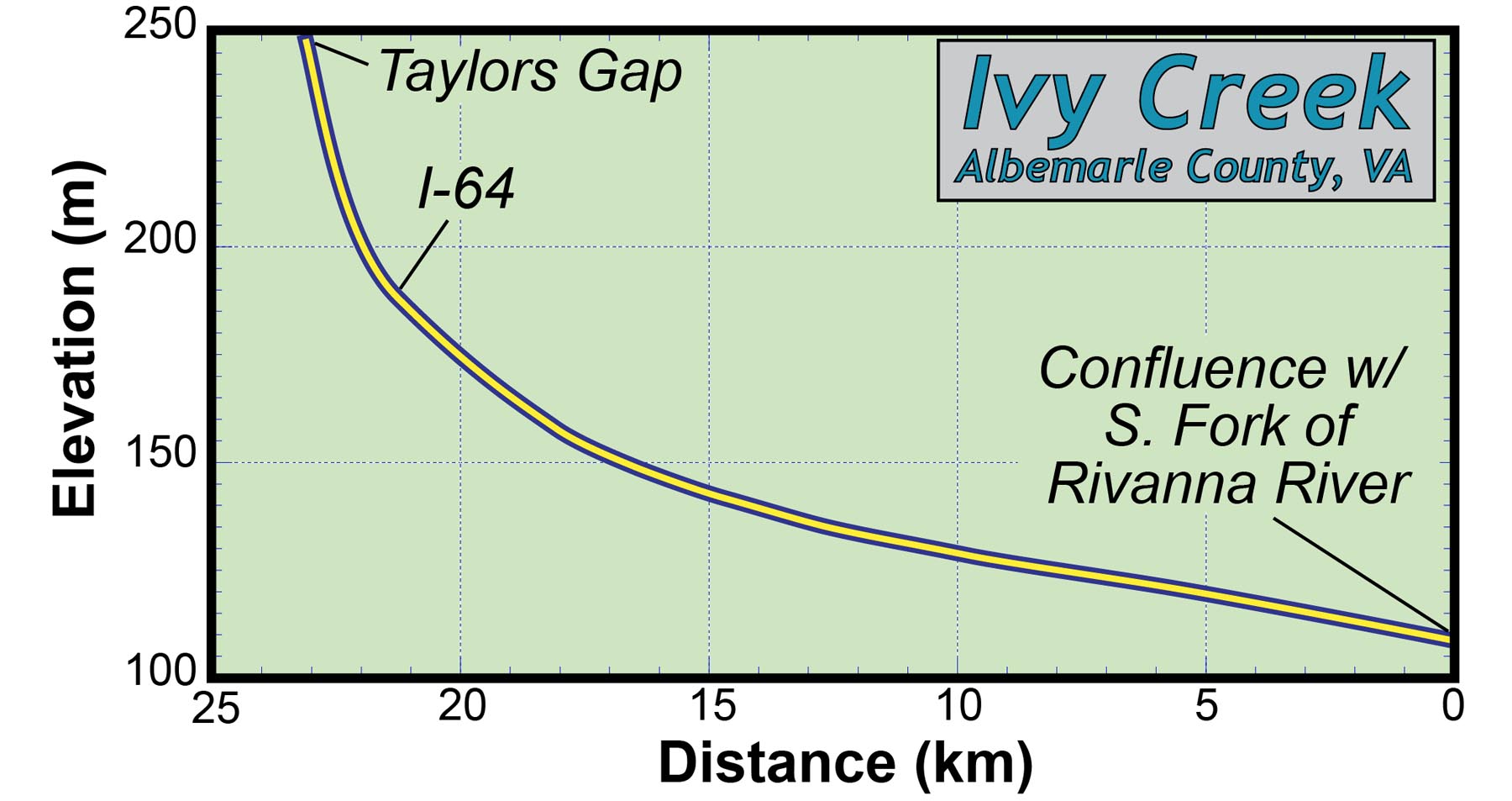
Consider Ivy Creek’s gradient: at its headwaters near Taylors Gap the stream has a steep gradient (~40 meters per km) that gradually lessens (~2-3 meters per km) near its confluence with the Rivanna. The longitudinal profile of Ivy Creek is steep near its headwaters and becomes progressively less steep further downstream. This concave up profile is very typical of many stream systems. Why do streams typically have such a profile?
Since the bedrock in the Ivy Creek basin is similar throughout the basin it is unlikely that the bedrock is exerting much of a control on the stream gradient. In a future post we’ll examine a stream that crosses bedrock of varying hardness and erodibility, but let’s get back to Ivy Creek.
Near Taylor’s Gap, Ivy Creek is perhaps 1 meter wide (~3’) and quite shallow; near its confluence with the Rivanna, Ivy Creek is upward of 5 meters wide (~16’) and plenty deep. As Ivy Creek flows downstream, traversing its basin, tributary streams join the main stem adding their flow to Ivy Creek, enlarging the channel and increasing the stream discharge.
These relations hold true for many stream systems:
- Stream channel slope (S) decreases downstream
- Mean stream discharge (Qm) increases downstream
Essentially, the gradient of a stream channel is proportional to an inverse function of its mean annual discharge. Perhaps a stream’s discharge plays a major role in controlling a stream’s gradient. I’ll leave it at that for the moment, but I am curious as to your thoughts.
Comments are currently closed. Comments are closed on all posts older than one year, and for those in our archive.


I grew up right next to Ivy Creek too, though down at its confluence with the South Fork. I used to play in the stream at Ivy Creek Natural Area (right across from my neighborhood), and my friends and I would also kayak in the reservoir. I remember we used to like to see how far up ivy creek we could kayak without bottoming out at various times of the year. Any idea approx how far up into Ivy Creek the south fork reservoir extends on average, and where the stream is actually it’s “natural” slope?
Emily G.,
I rarely got to the downstream end of Ivy Creek. The old topo maps show the approximate profile of Ivy Creek prior to having its lower kilometer or so flooded by the Rivanna Reservoir.