Mystery at Midway Mills (Part 2)
In the last post I described how an old stone mill in the central Virginia Piedmont had disappeared. I discovered Midway Mills’ disappearance on a discouraging and wet field day in July 2012. Despite our first day setbacks, my research student Jacob Rosenthal (W&M ’13) carried on with his project. Ultimately, he discovered the quarries from which the Midway Mills stone was likely extracted, produced a fine map, and is co-author of a recently published field guide about the geology of the Scottsville Mesozoic basin and the surrounding region.

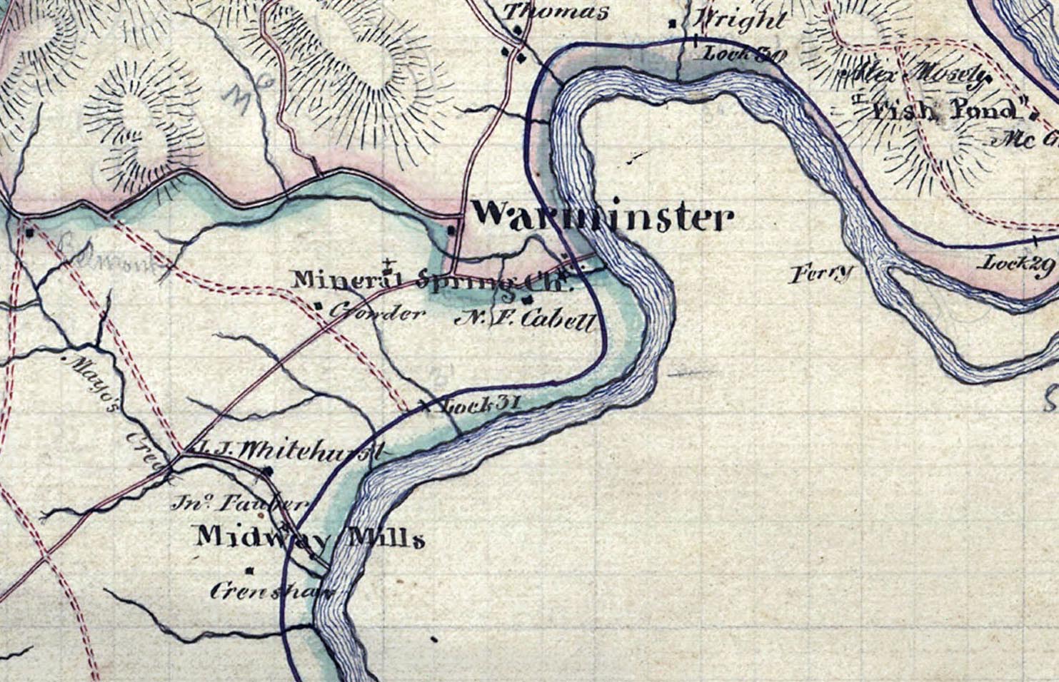
Detail from an 1866 map of Nelson County, Virginia by Hotchkiss and Robinson illustrating Midway Mills and the James River. Note also the locks along the Kanawha and James River canal.
With every trip to Midway Mills I asked locals what had become of the old mill- I never got the same story twice. “The mill had been torn down to rebuild an English Castle…”, “the blocks were scattered in a field near Scottsville…”, “the stones were used to build a mansion in the next county…”, etc.
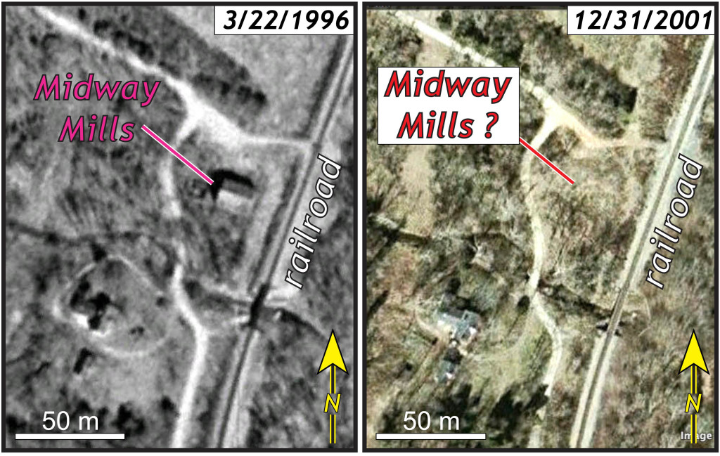
I consulted with the Nelson County Historical Society and learned that Midway Mills had indeed been demolished in 1998. The decrepit mill was privately owned, and although there had been talk of refurbishing the mill for nearly two decades, that never happened.

Aerial photos of Midway Mills, Virginia. The 1996 image shows the mill, whereas in the 2001 image the mill is gone.
From the geological literature, I learned that stone quarried near Midway Mills had also gone into various buildings throughout the region, but these buildings were proving difficult to locate. For instance the gothic-style old federal courthouse in Abindgon, Virginia built in the 1880s incorporated Midway Mills sandstone as trim work, but unfortunately that courthouse had been torn down in the 1960s. Not only was Midway Mills gone, but also my quest to find other structures made from Midway Mills stone was not going well.
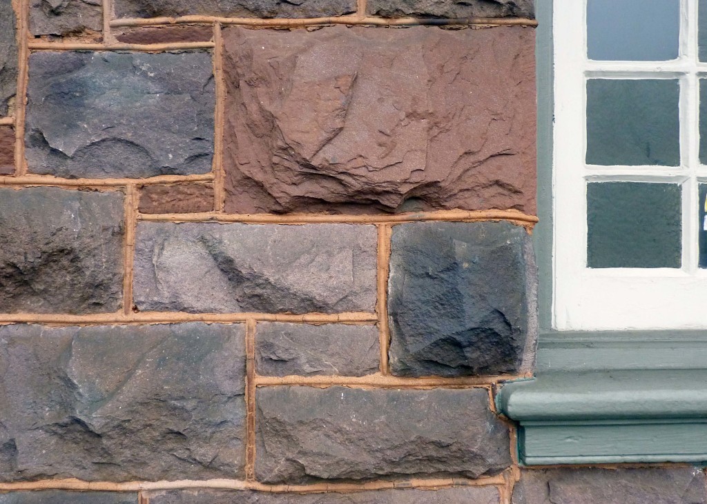
I did have one success. The old Norfolk & Western Railway’s passenger station in Bedford, Virginia (originally known as Liberty Station) remains standing. The building no longer serves as a rail station, rather it currently houses a vibrant restaurant. I visited the structure on a misty and gray morning, but was delighted to find the building composed of sturdy rectangular blocks of reddish silty-sandstone and grayish-maroon arkosic sandstone- just the stone that crops out in the old Midway Mills quarries.

Hewn blocks of Triassic Midway Mills sandstone in the exterior wall of the old Norfolk & Western Railway’s Bedford (Liberty) station. The building was constructed in the 1880s and currently houses the Liberty Station Restaurant.
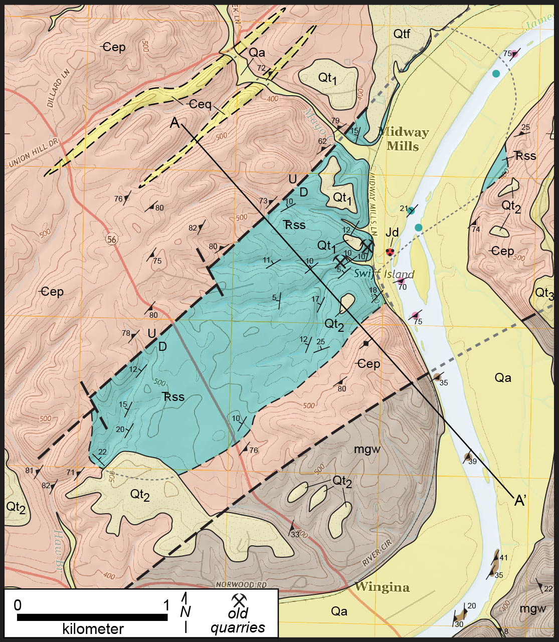
Returning to the geologic story, the Midway Mills sub-basin in eastern Nelson County, Virginia is underlain by a stratified sequence of arkosic sandstone, silty-sandstone, and arkosic conglomerate. These sedimentary rocks are underlain and surrounded by (on the geologic map) older Paleozoic metamorphic rocks (phyllite, metagraywacke, and minor quartzite), and overlain by unconsolidated surficial deposits (alluvium and alluvial terraces) along the James River.

Geologic map of the Midway Mills sub-basin, central Virginia Piedmont. The basin is the blue-green region. Mapping by Jacob Rosenthal, Chuck Bailey, and the Buckmarlson Banshees (2012-2014).
We interpret the northwestern boundary of the Midway Mills sub-basin to be a fault. This contact is nowhere exposed for direct observation; in Virginia’s humid and temperate climate, soil and vegetation cover 99% of the bedrock, but the Midway Mills strata dip towards this contact- a geometric pattern consistent with a fault contact. It’s a normal fault in which the hanging wall strata (the Midway Mills sedimentary rocks) were down-dropped to the southeast, relative to the metamorphic rocks in the footwall. The bounding fault to the Midway Mills basin is segmented by a series of NNW-striking transverse faults.
The southeastern boundary of the Midway Mills sub-basin is likely an unconformity, where the strata dip away from the contact, and the younger sedimentary rocks overlie the older metamorphic rocks. Coarse-grained sandstone and pebble conglomerate is common near this boundary as well. The asymmetric geometry of the Midway Mills sub-basin suggests the overall structure is that of a half-graben.
I’ll close this installment with more questions than answers:
- What can be inferred about the paleoenvironment from the Midway Mills strata?
- When were the Midway Mills strata deposited?
- When did faulting and the development of the half-graben occur?
and last, but not least…
- What has become of the stone from the old Midway Mills?


No comments.
Comments are currently closed. Comments are closed on all posts older than one year, and for those in our archive.