
Summer Research: Introducing the Wayne WonderMonkeys
 As I noted in my last post our summer geologic field research took us to the Beehive State. Our work is primarily focused on Wayne County in the south-central part of Utah. Created in 1892, Wayne County forms an expansive rectangular block of nearly 2,500 square miles. The county is sparsely populated with about 2,700 human inhabitants: that’s an average population density of just over one person per square mile (plenty of elbowroom). The Fremont River neatly traverses the county from the high plateaus in the west, through spectacular red rock terrain, and into the low desert in the east.
By any measure Wayne County is a scenic place, and in an effort to publicize the rugged beauty of the county a local civic group coined the term Wayne Wonderland in the 1920s. Eventually, that wonderland became Capitol Reef National Monument (now a National Park). Today, nearly ¾ of a million people visit the park per year.
Typically, my research students working in a particular region create a research team name. Some past groups include the Grenvillian UberJocks (1999), the Browns Cove BearBait (2006), and the Alberene Dream Team (2011). This year’s research team has embraced the sobriquet – the Wayne WonderMonkeys.
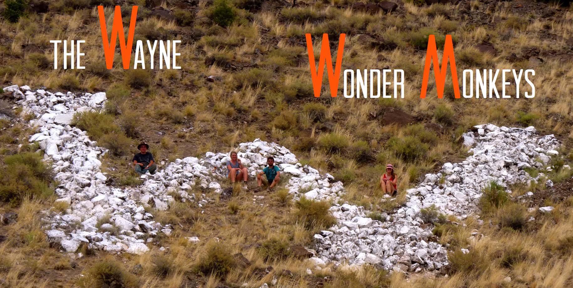
The Wayne WonderMonkeys at the Wayne County W (whitewashed volcanic boulders on a hilltop above Bicknell, Utah).
Indeed, we are studying the geology of Wayne County and the county’s landscape is surely a wonderland. But, why the monkey moniker? In the modern era, monkeys are not part of the Wayne County fauna. But as my 11-year old stepdaughter adroitly points out, monkeys are both smart and energetic creatures—an apt description for a group of W&M undergraduates wandering about Wayne County, Utah.
Once again our research is supported by the U.S. Geological Survey’s EDMAP program and we are producing a geologic map of the Lyman 7.5’ quadrangle in cooperation with the Utah Geological Survey. The Lyman 7.5’ quadrangle lies in the southeastern part of the Fish Lake Plateau at the boundary with the Colorado Plateau and Thousand Lake Mountain (elev. 3400 m) dominates the landscape to the east. We focused on the Lyman quadrangle because it’s the place to go to:
- Understand the kinematics and timing of the Thousand Lake Fault System, a major fault that forms the boundary of the Colorado Plateau. Geomorphic evidence suggests that this fault system experienced Quaternary slip, but the magnitude and timing of that movement is poorly understood. Hanna Bartram is evaluating the history and potential seismic hazard associated with this fault.
- Understand the origin of the Rabbit Valley salient, a distinctive topographic feature that extends westward from the flank of Thousand Lake Mountain. The topography is distinctly hummocky and salient could be an old and very large mass movement deposit. Zachariah Fleming’s research is focused on the origin of this enigmatic terrain.
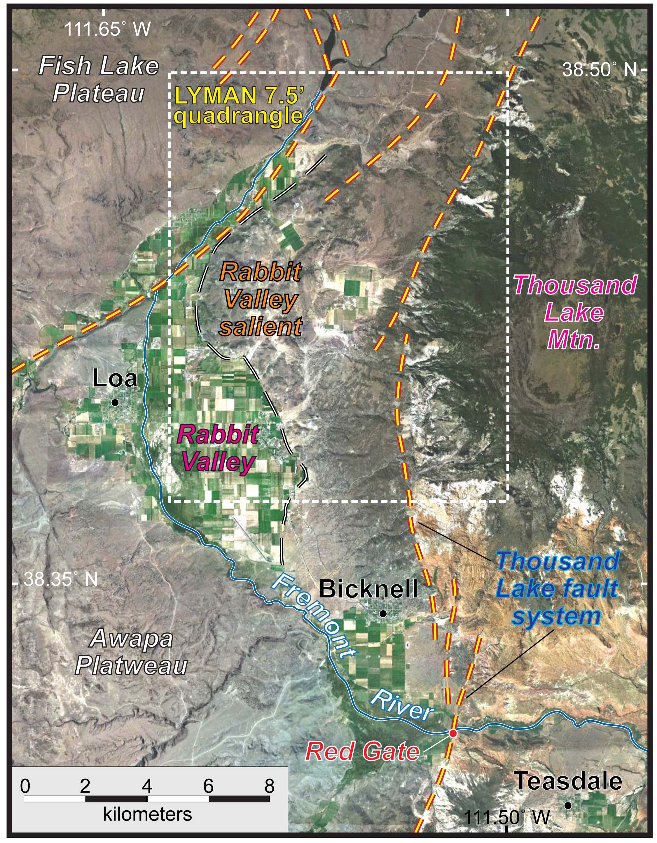
Annotated image of the Lyman 7.5′ quadrangle, in Wayne County, Utah.
For a more animated view of the Wayne WonderMonkeys’ research and field experiences witness this video they posted.


Comments are currently closed. Comments are closed on all posts older than one year, and for those in our archive.
Oh hey there… you guys rock