
Mid-Summer Dream Team Report
The Alberene Dream Team has left the building and is now safely ensconced back in the eastern Blue Ridge Mountains. The Dream Team took a well-earned respite from fieldwork last week to compile field data in the Geology Department.
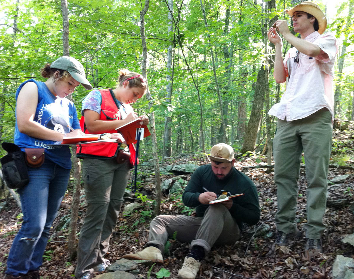
Alberene Dream Team in action somewhere among the green hills of central Virginia. From left to right- Andrea Jensen, Molly Hahn, Alex Johnson, and Kevin Quinlan.
In my original post I noted that the Alberene Dream Team is conducting research in the eastern foothills of the Blue Ridge Mountains and producing a geologic map of the Alberene 7.5’ quadrangle. Since that post I have been asked- just what is a quadrangle?
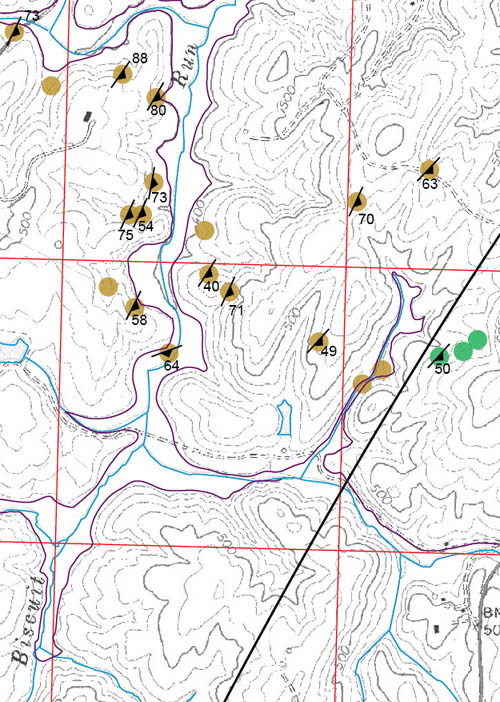
Part of the Dream Team’s digital field map. Red boxes are 1 km by 1 km. Colored dots are different rock types, black numbered symbols are geologic structures, and solid lines are contacts.
A quadrangle, in geographic parlance, is a rectangular area of land illustrated on maps produced by the U.S. Geological Survey. A 7.5’ quadrangle encompasses 7.5’ (minutes) of latitude by 7.5’ of longitude. In Virginia a 7.5’ quadrangle is ~11 km by 14 km. The Alberene 7.5’ quadrangle takes its name for the small village of Alberene (37.886˚ N, 78.617˚ W) that was once a company town where soapstone was quarried.
The Dream Team spent most of the last month conducting fieldwork in the Alberene quadrangle. During the summer, the riot of vegetation that cloaks the landscape and obscures bedrock outcrops makes fieldwork in Virginia challenging. Nevertheless, the Dream Team has canvassed the Alberene quadrangle, examined over 250 outcrops, collected many kilograms of samples, and measured a multitude of fractures and faults.
In addition to producing a detailed geologic map and collecting the primary data for their senior theses, the Alberene Dream Team is filming clips to make a short documentary on the process of doing geologic field research.
Video Snippet- Mapmakers Discussion
Professor Brent Owens and I are off to join the research team tomorrow. Over the next few weeks we’ll be canoeing the James River to investigate Triassic fault zones, we’ll be searching for exposures of a curious igneous rock rumored to crop out at Thomas Jefferson’s Monticello, and we’ll be hiking up and over the green hills to pinpoint the location and geometry of geologic contacts. And as my research students say, this promises to be a smashing good time.

No comments.
Comments are currently closed. Comments are closed on all posts older than one year, and for those in our archive.