
Knickpoint on the Nottoway
Deep in the heart of Southside Virginia lies a bedrock outcrop of tremendous size. Quality outcrops are rare in the Piedmont, but between the communities of Victoria and Crewe the Nottoway River tumbles over sloping bedrock ledges making a dramatic knickpoint that exposes acres of granitic gneiss in the channel.
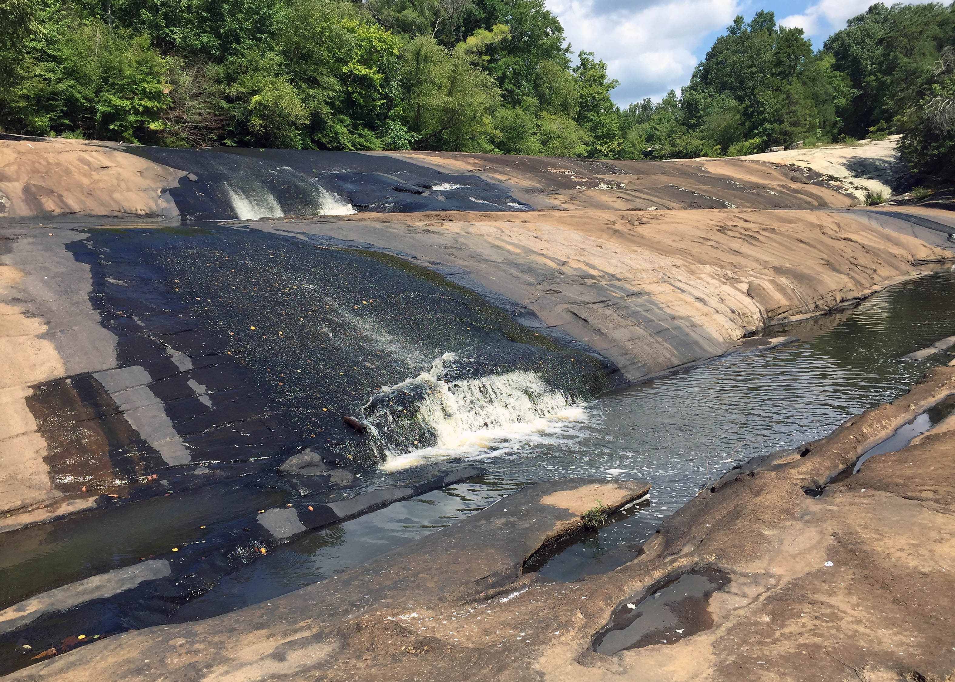
The Falls of the Nottoway River at low water (~25 cfs). Note the vast amount of granitic bedrock exposed in the channel.
The Nottoway River is a Piedmont stream, and its headwaters are anything but dramatic, merely a series of small drainages that flow away from a low divide in the midst of the modest terrain that is the Piedmont. The Nottoway River flows to the southeast crossing the Fall Zone just west of Interstate 95 before flowing out onto the Coastal Plain eventually merging with the Blackwater River at the Virginia/North Carolina border to become the Chowan River, a tidal river that 80 km downstream opens into Albemarle Sound.
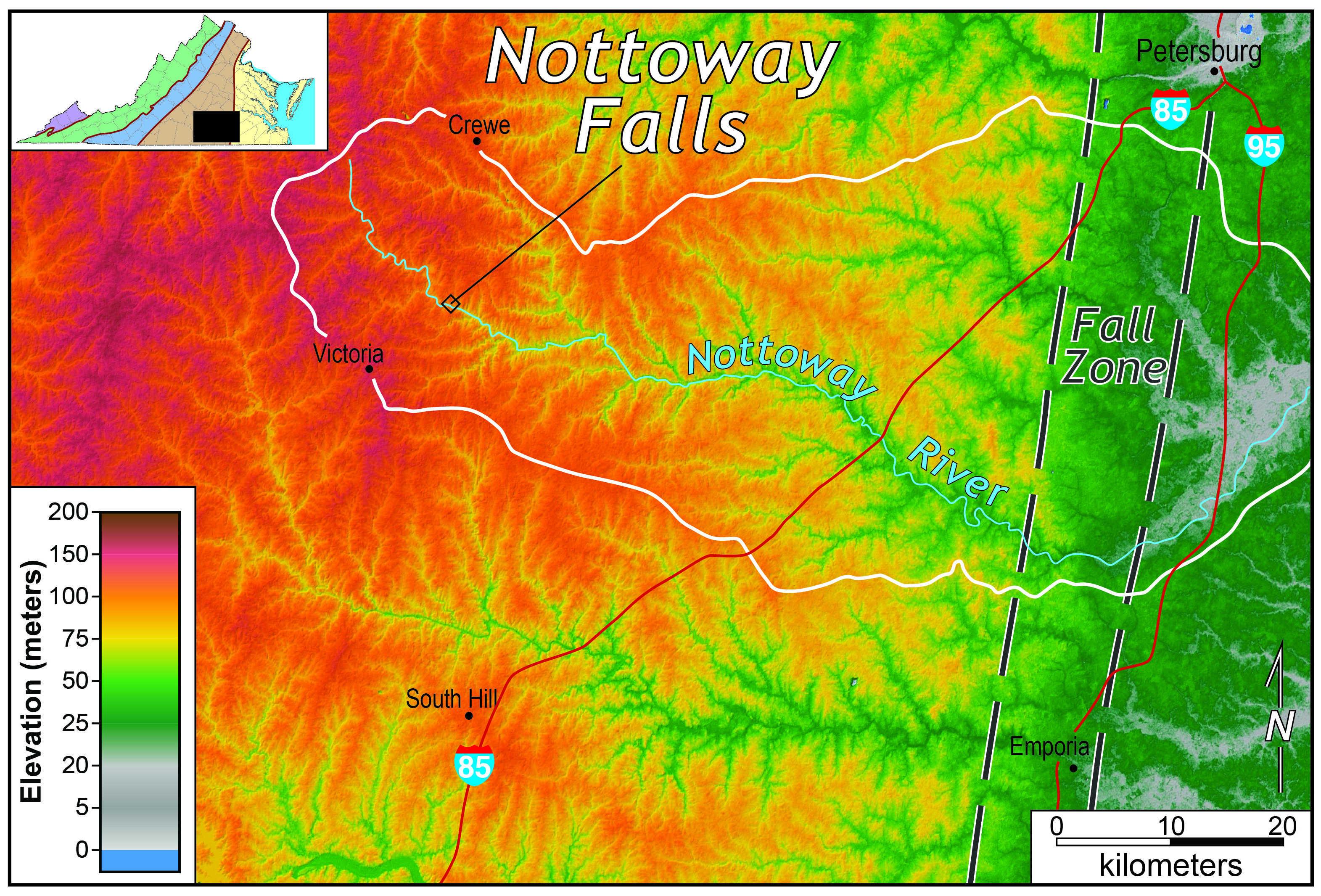
Shaded relief map of the upper Nottoway River watershed, south-central Virginia.
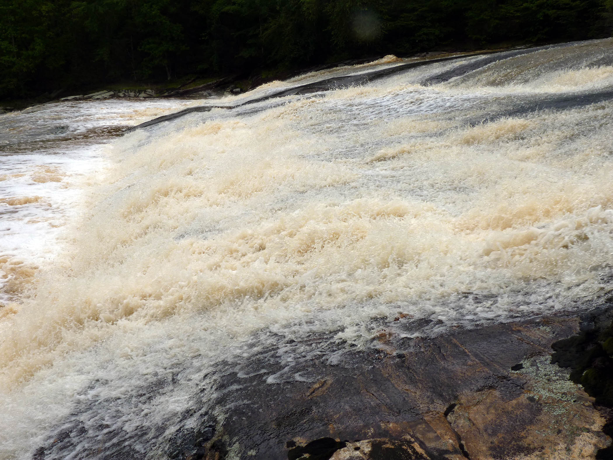
The Nottoway River at high flow (~1,500 cfs) pouring over the sloping granitic ledges at the Falls.
The upper Nottoway River forms a typical concave-up profile as its gradient decreases away from the drainage divide, however 29 km (18 mi.) downstream something curious happens. Here, just below the State Rt. 49 bridge, the Nottoway River gets busy and drops with gusto, falling ~30 m (~100’) in a 3 km (2 mi.) stretch. When the flow is up it’s a whitewater stream that looks more like a distant cousin of the raucous Chattooga River (think the movie Deliverance) in the southern Appalachian Blue Ridge than a mopey Piedmont stream creeping towards the Atlantic Ocean.
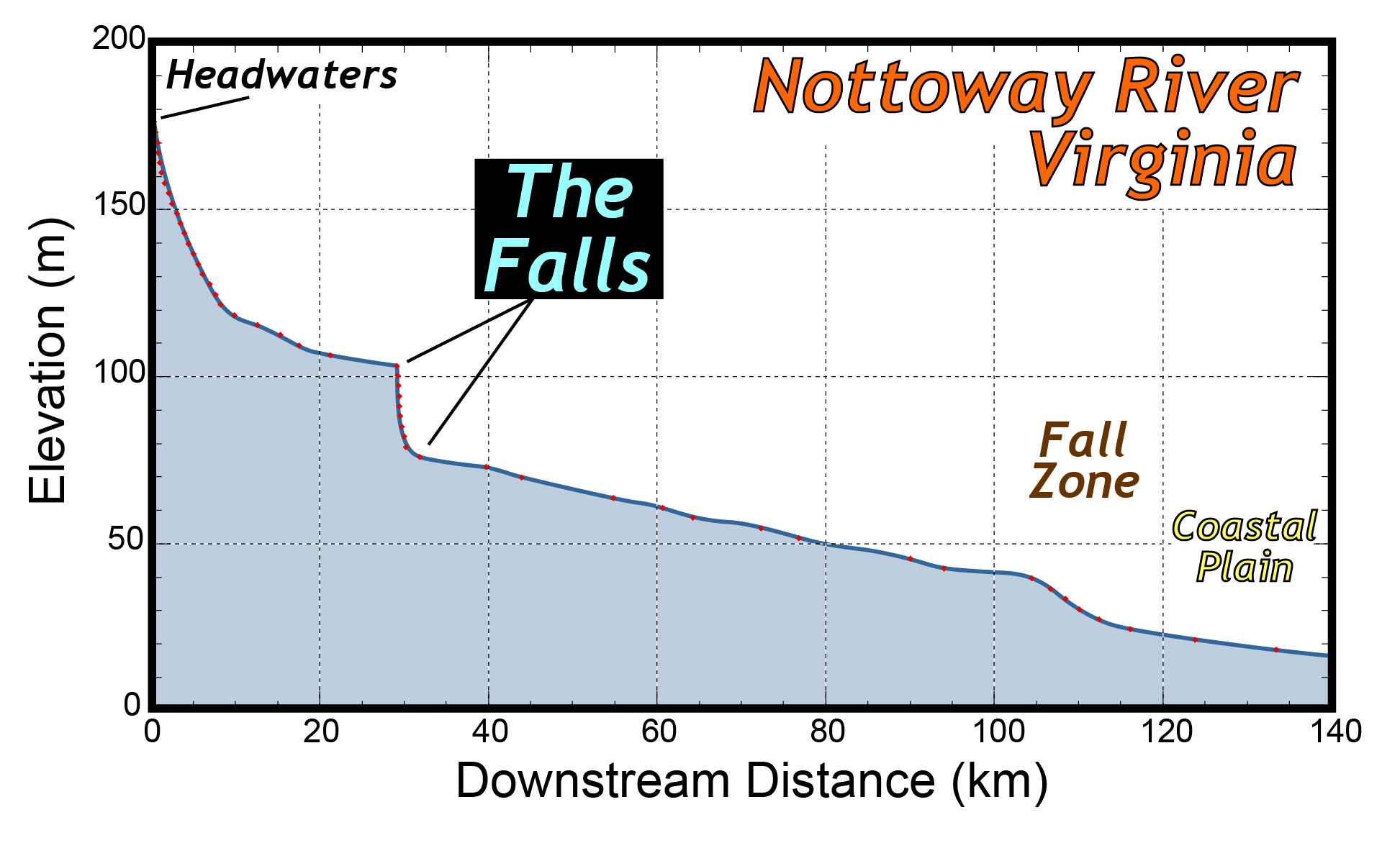
Longitudinal profile of the Nottoway River, south-central Virginia. The Falls forms a major knickpoint.
What is the origin of the Nottoway Falls’ dramatic knickpoint?
As I’ve written before knickpoints develop in a number of ways: if a stream’s base level drops, then a knickpoint is spawned, active faulting that displaces the Earth’s surface can produce uplift thereby generating a knickpoint, and knickpoints are common where streams flow over hard and erosionally resistant rocks.
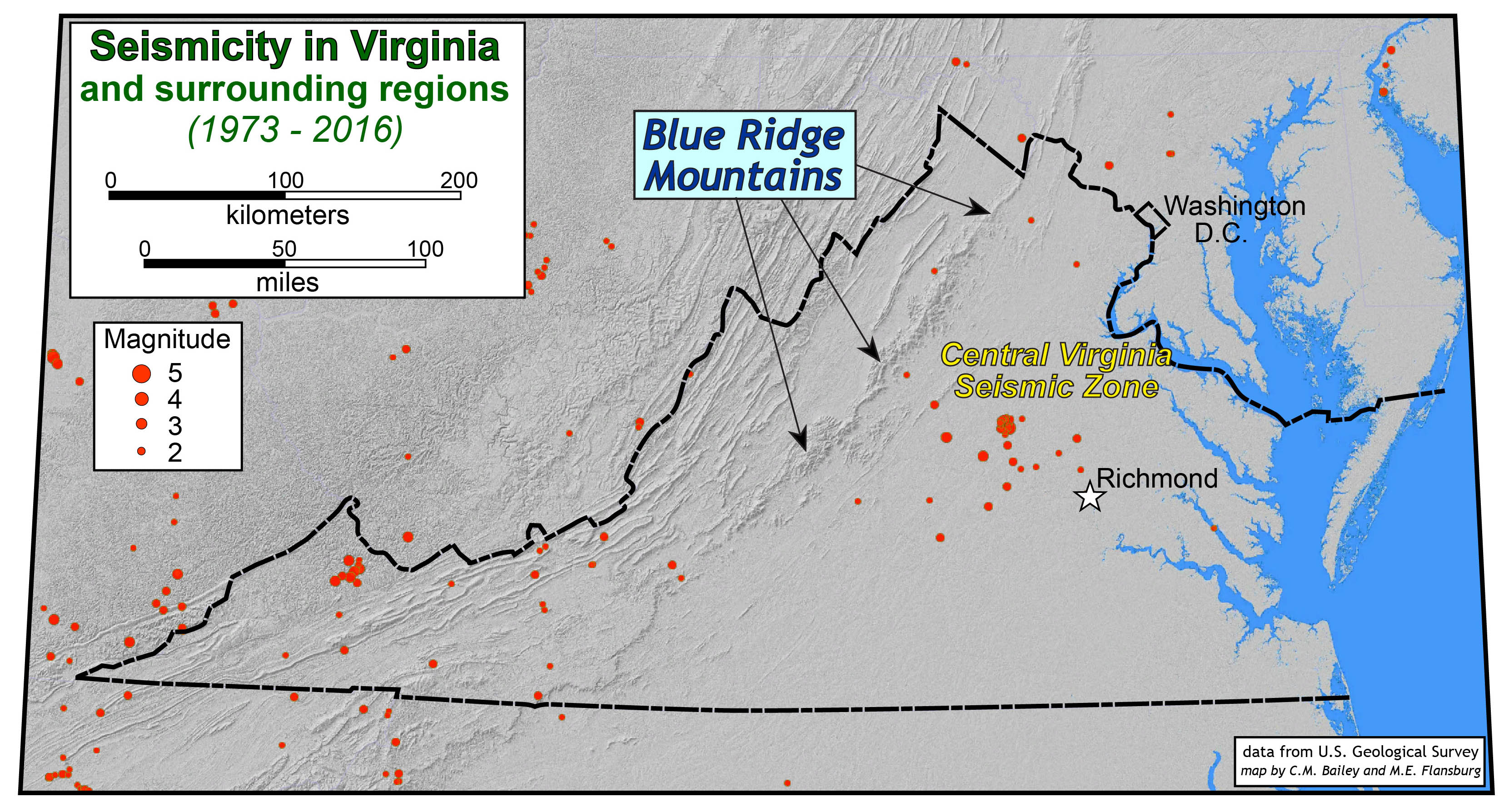
The origin of the Nottoway Falls knickpoint is not clear, nor has it been studied in any proper way. The Virginia Piedmont is lousy with granitic gneiss; it’s a durable rock, but there are vast tracts of granitic gneiss that do not underlie a knickpoint of any significance. The granitic gneiss exposed at the Falls lies at the the boundary (a fault zone) between two geologic terranes, the Carolina Terrane to the west and the Raleigh Terrane to the East. The Falls lies well south of the Central Virginia Seismic Zone, so its unlikely (but not out of the question) that recent uplift has produced this knickpoint. The Falls of the Nottoway is a feature worth further study.
One of my courses this Fall is the Structural Geology Seminar (GEOL 425), it’s a research class that will collaborate to answer a bevy of research questions, and one of our study locales is the Falls of the Nottoway. Our research efforts won’t be directed at just understanding the landform, we also want to understand the structure of the bedrock.
The photo below is a glimpse of the complex geologic structure exposed in the outcrop at the Falls of the Nottoway.
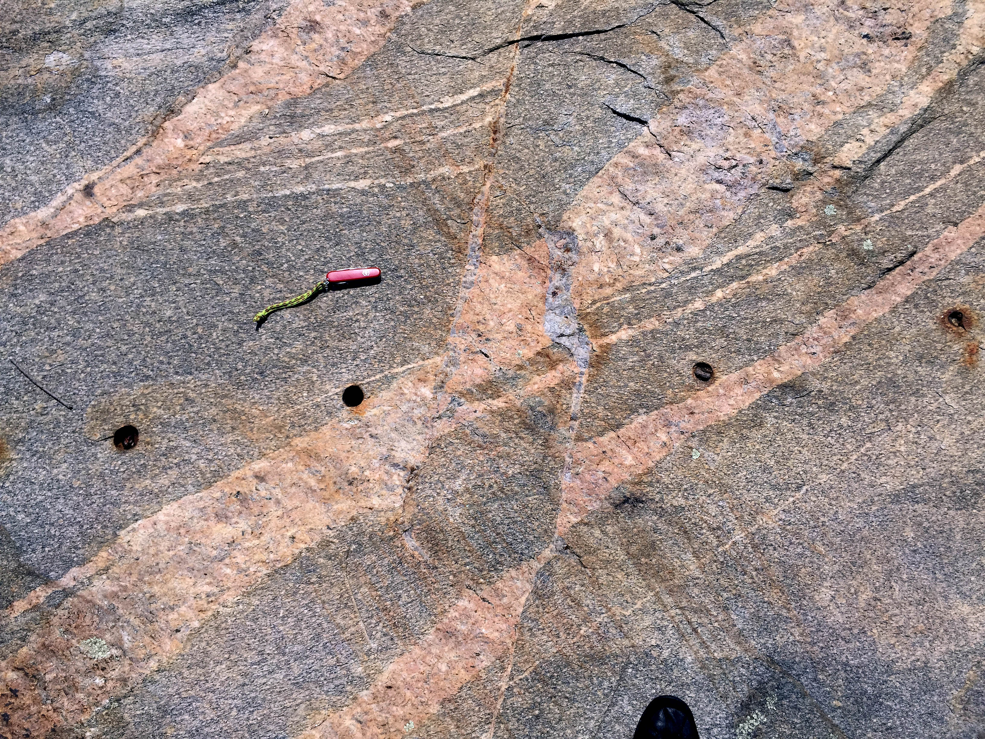
A small part of the outcrop exposed at the Falls of the Nottoway River. The pocket knife is ~10 cm in length.
Here is a quick reckoning of the scene: the oldest rock (exposed under the pocket knife) is a granitic gneiss that was intruded by thin dikes (narrow white layers above the pocket knife). Both of these rocks were deformed in a ductile fashion. The older rocks were then intruded by coarse-grained pegmatite dikes that are loaded with K-feldspar (the pinkish material) which were then cracked and faulted as dilational shear fractures filled with quartz (blue-gray). Some time later, much later- likely in the 19th century, the rock was quarried as evidenced by the circular drill holes in the rock.
The 2016 Structural Geology Seminar will tell the geological story of the Falls of the Nottoway River. Check back later this semester to learn more about the processes that were active when these rocks were fodder for the tectonic cannon as well as the results of our investigation into the origin of this distinctive Piedmont knickpoint.

Comments are currently closed. Comments are closed on all posts older than one year, and for those in our archive.
Wish I could join y’all on the structure seminar trip! Sounds like a great project.