
Game of Boxes
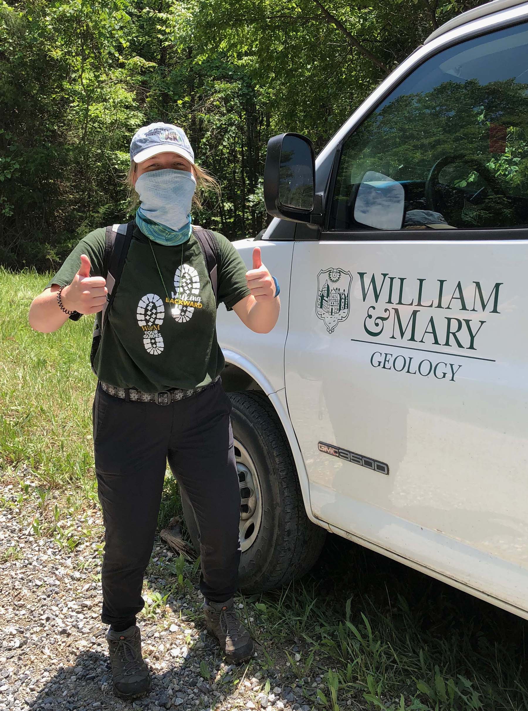
Emily Hinshaw (W&M Geology ’20) ready to commence the Game of Boxes.
Last week, with a team of undergraduate research students we commenced a Game of Boxes in the wilds of central Virginia. The Game of Boxes is a difficult game, as in a normal year summer field work is a ‘For the Bold’ kind of endeavor. In 2020, with our COVID-19 safety protocols, the challenge was even greater. Our game was not played out over seven fictitious kingdoms, rather its backdrop is a 7.5’ quadrangle.
What’s a 7.5’ quadrangle?
It’s a rectangular area that encompasses 7.5’ of latitude (north-south) and 7.5’ of longitude (west-east). In the United States, the 7.5’ quadrangle at a scale of 1:24,0001, is the most detailed and granular topographic map that’s available.
Over the past year and a half, we’ve been studying the geology in and around the Gladstone 7.5’ quadrangle in central Virginia. Three distinct terranes occur here, and we’ve worked to understand the structural geometry and geological history of this enigmatic area. Our research is funded by a grant from the U.S. Geological Survey and the deliverable is a detailed geological map of the Gladstone 7.5’ quadrangle with all the trimmings (explanation, cross sections, GIS files) – it’s due at the end of August.
The Gladstone Gladiators are now all recent William & Mary graduates with jobs and graduate school awaiting them. But the Gladiators wanted to come back to the field and finish what they’d started in 2019. Four of the original five Gladiators were able to make the trip (Sam Belding’s already begun his job in Pennsylvania). We were joined by three intrepid Geology seniors embarking on their thesis research this summer.
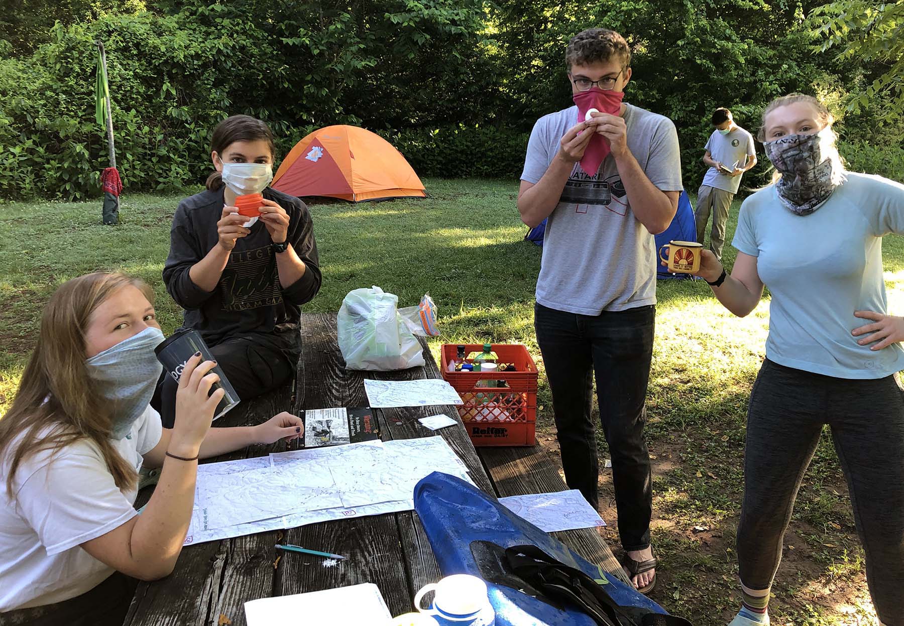
The Gladstone Gladiators research team attempts to enjoy their breakfast at base camp with the challenges of modern times. From left to right the research team includes: Emily Hinshaw (W&M Geology ’20), Evan Laughlin (W&M Geology ’20), Ryan Walter (W&M Geology ’20), and Amanda Sasina (W&M Geology ’20). Jerry Hu (W&M Geology ’21) is in the background.
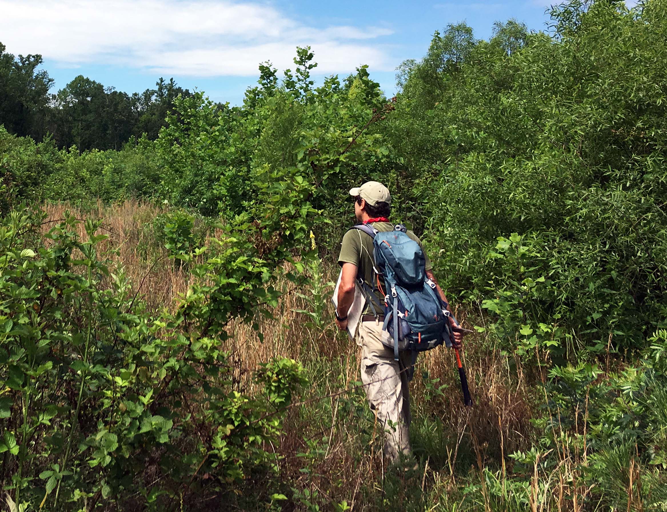
Heading into thorn jail on a traverse in the Gladstone 7.5′ quadrangle. Photo by Evan Laughlin
To produce an accurate and detailed geological map it’s crucial to examine the bedrock from one end of a quadrangle to the other. This requires boots on the ground, miles of scrambling over the terrain, and lots of people hours.
Although a quadrangle is defined by its geographic coordinates in the latitude and longitude system (angular measures on the spheroidal surface of the Earth from the Equator and the Prime Meridian, respectively), we use the Universal Transverse Mercator coordinate system for locating ourselves and our observations. The UTM system divides planet Earth into a set of 60 zones and a locations position is given in meters East (Easting) from a zone boundary and in meters North or South (Northing/Southing) of the equator. All of the Gladstone quadrangle is located in Zone 17, and, the summit of Buck Mountain, for example, is located at 695,455 m East, 4,161,860 m North.
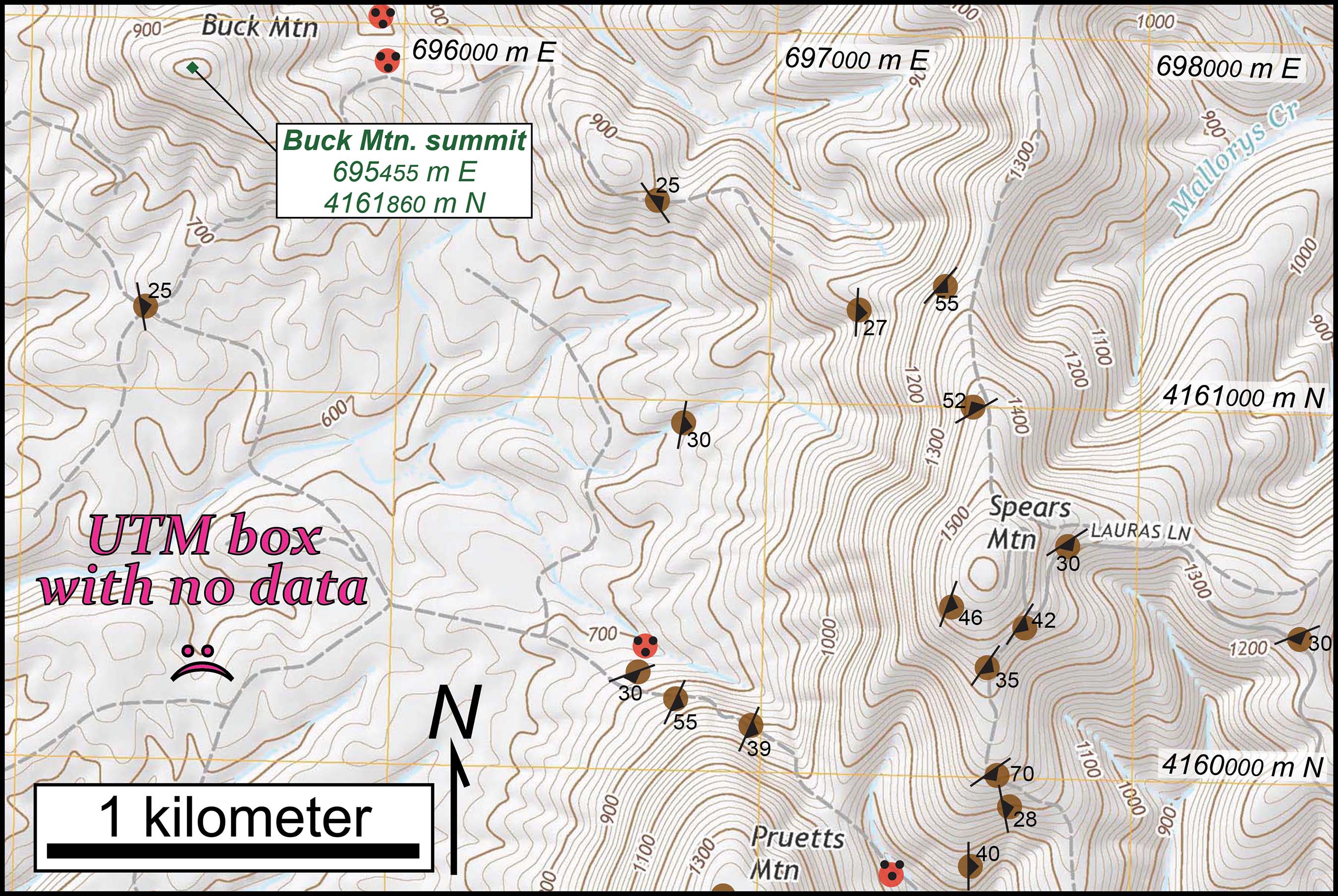
Part of the Gladstone 7.5′ quadrangle topographic map. Note the UTM grid boxes (thin yellow lines). Colored dots are bedrock outcrops (red- diabase and brown- muscovite schist) with structural data symbols.
On modern topographic maps the UTM grid is plotted with a 1 km spacing, we lovingly call these UTM grid boxes. The Gladstone 7.5’ quadrangle includes all or part of 180 UTM grid boxes. Ideally, we’ll have multiple geological data points in every UTM grid box providing detailed coverage across the study region.
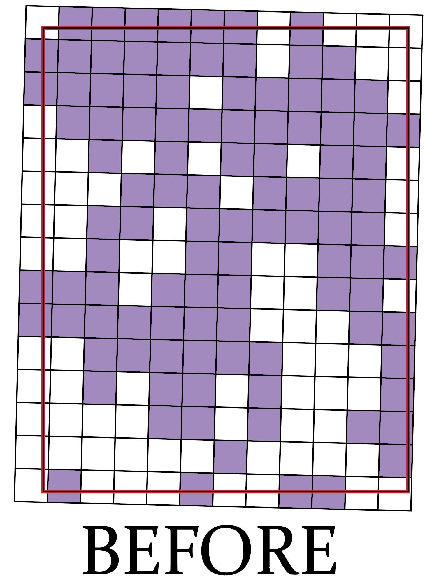
UTM grid boxes (purple) with geological data before our 2020 Gladiator SummerFest research trip. Thick rectangle is the outline of the Gladstone 7.5′ quadrangle.
During the Gladstone Gladiators 2019 field campaign we obtained data in 103 (out of 180 possible) UTM boxes. Not bad, but nowhere near what’s needed to publish a detailed geological map of the entire quadrangle.
So, at the height of mid-summer with the team assembled, we commenced a mid-summer Game of Boxes. Our objective was to obtain geological data in as many new UTM grid boxes as possible. Just how many new UTM grid boxes could we visit and examine bedrock during a 5-day flurry of fieldwork?
Not all of the UTM grid boxes are easy to access, being miles from the nearest road. Some UTM grid boxes are topographically challenged and bedrock outcrops are sparse.
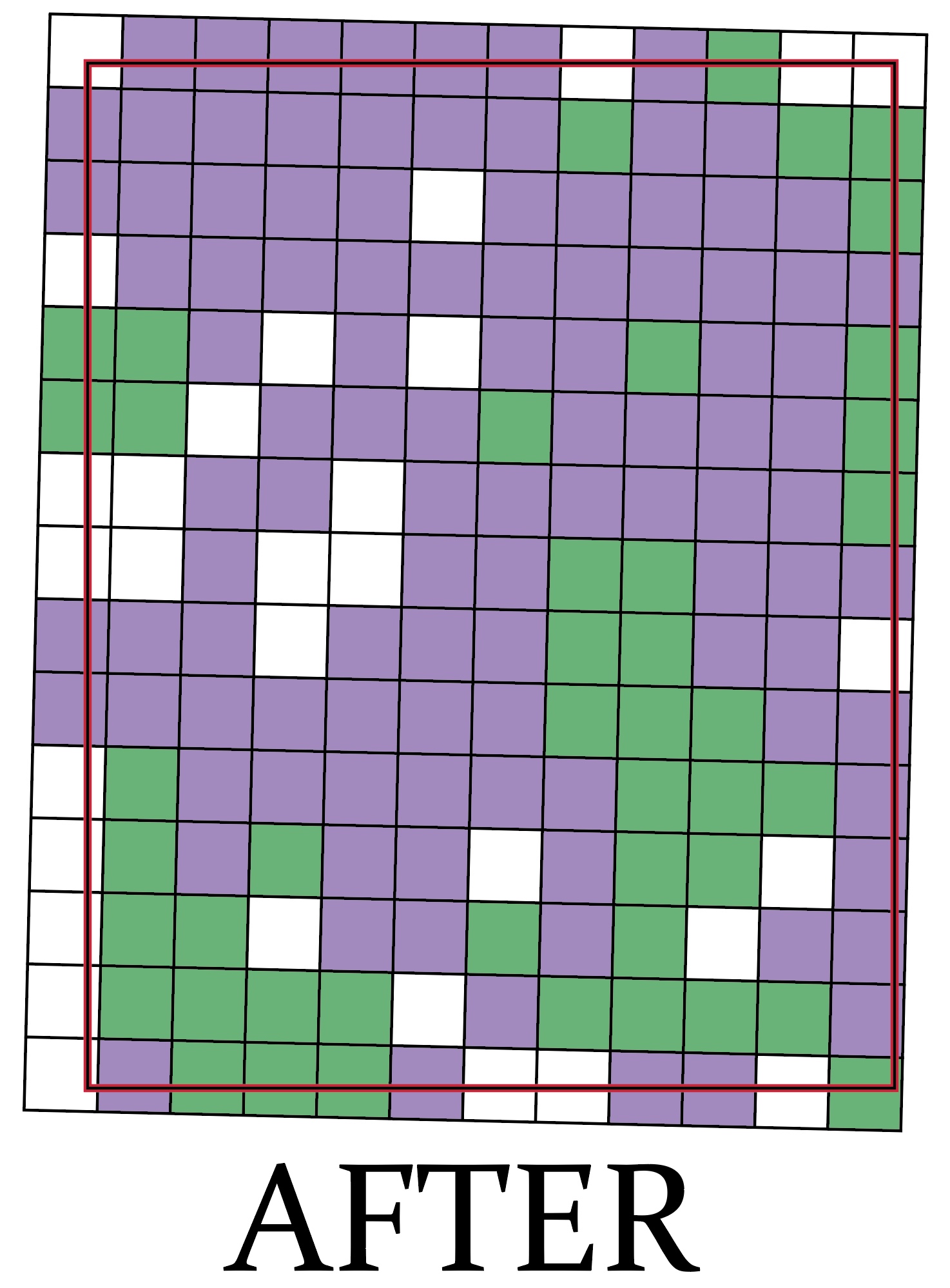
UTM grid boxes (green) with geological data after our 2020 Gladiator SummerFest research trip. Thick rectangle is the outline of the Gladstone 7.5′ quadrangle.
In spite of hot and humid conditions with the usual cast of unsavory field companions and conditions (ticks, chiggers, thorn jail2, etc.) our field work was a great success. We obtained geological data in 46 new UTM Grid boxes (we actually garnered data from 57 UTM Grid boxes, 11 of which already had observations). Our mid-summer box count now stands at 149/180, that’s 83% and many of the unvisited boxes are at the quadrangle’s edge.
Our overall geological map pattern changed little since we completed the Game of Boxes. That’s a good thing, as it means our previous mapping held up under further scrutiny. Invariably, geological mappers make predictions, based on previous observations and a dash of three-dimensional thinking, as to what rocks and what structures will occur where.
Over the next month, we’ll make a few more visits to Gladstone and seek out data from unvisited UTM grid boxes and other critical locations. I’ll post our finalized geological map in August.
1– at a fractional scale of 1:24,000, 1 cm on the map equals 240 meters on the ground or 1 inch on the map equals 2,000 feet on the ground.
2– thorn jail is a term the Gladstone Gladiators use to describe being stuck in a dense patch of thorny vegetation while on a traverse. Thorn jail is no fun.


Comments are currently closed. Comments are closed on all posts older than one year, and for those in our archive.
Great work by the team! I can’t wait to be proven wrong!