
Working in a Winter Wonderland: The Gravity of the Situation (Part 2)
Last summer I reported on our field research in the High Plateaus of Utah. Erika Wenrich’s senior thesis project involves a gravity survey aimed at estimating the amount of sediment beneath Fish Lake, a large alpine lake developed in a high-elevation graben. In June we measured gravity at a network of stations around Fish Lake, but to complete the gravity survey, and model the sediment’s thickness in the basin, we needed gravity data on the lake itself. It’s now February and Fish Lake is covered by ice—time to return and complete the survey on the lake’s frozen surface.
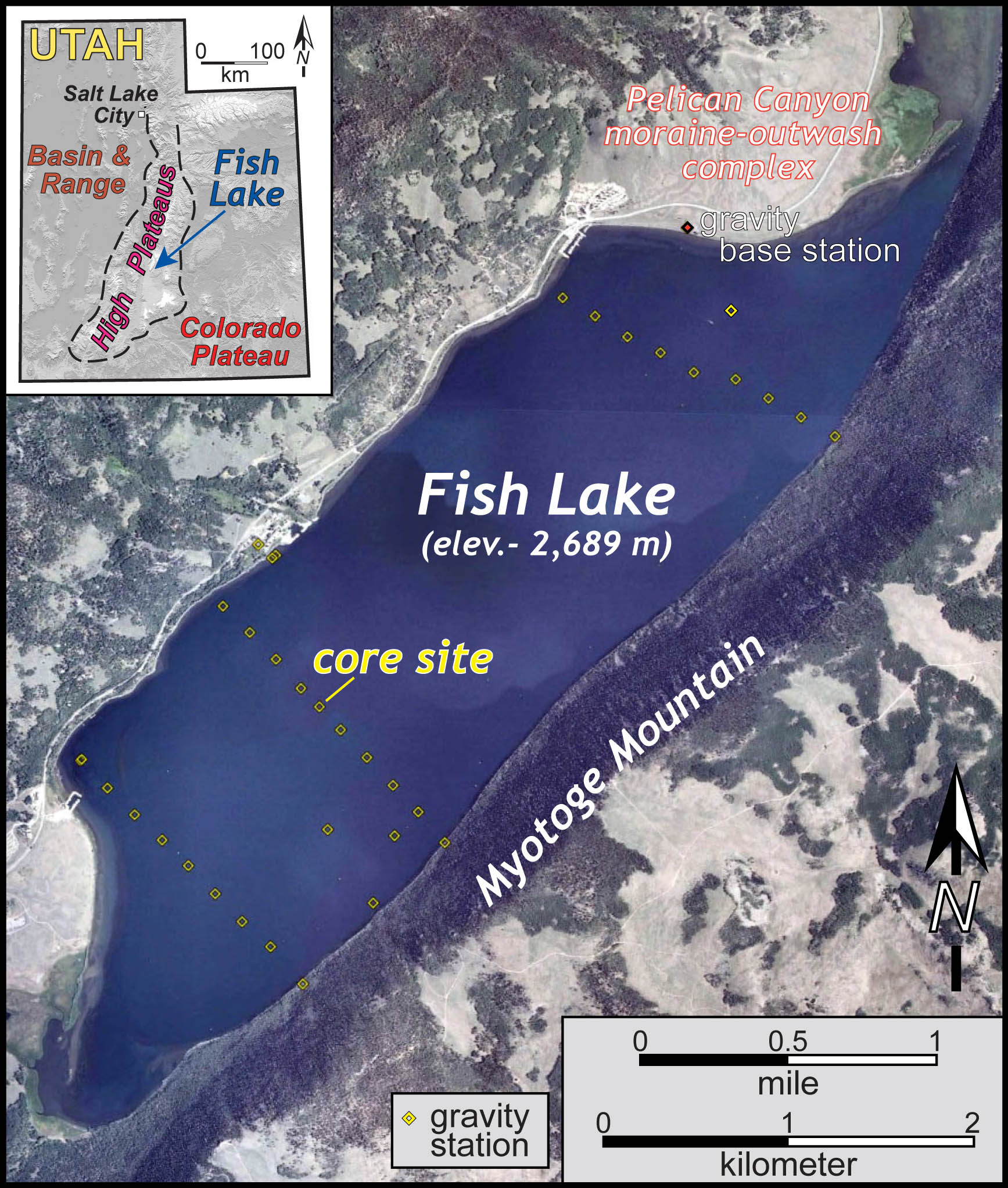
Overview map of Fish Lake, Utah with 2014 gravity stations and core site.
Our whirlwind outbound journey included an unexpected drive to Dulles airport to catch a long flight into Las Vegas followed by an even longer drive from Nevada to Fish Lake. We arrived at the lake weary from travel, but excited to get started. The lake was crusted over with ~30 cm of ice (12”) and a layer of snow from a recent storm. The temperatures were well below freezing and accompanied by a stiff breeze from the southwest—it was brisk.
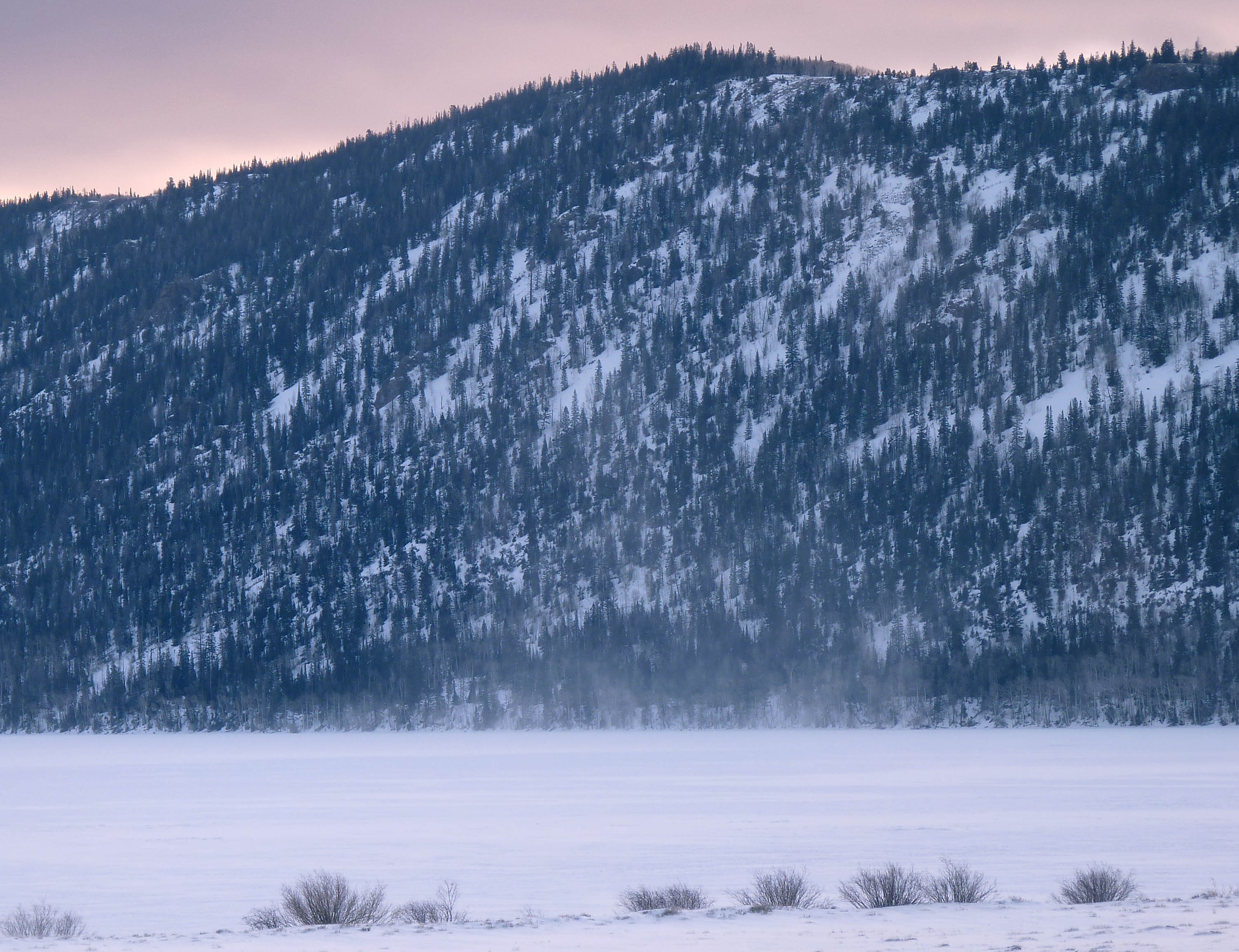
View to the east of Fish Lake’s frozen surface and Mytoge Mountain which rises steeply from the southeastern shore of the lake.
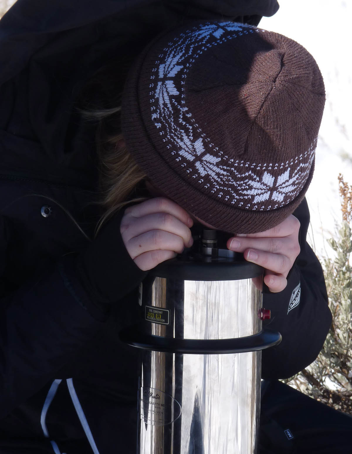
Erika Wenrich makes a gravity measurement.
As expected measuring gravity on the lake’s icy surface during the day proved to be nearly impossible. The gravimeter is a delicate instrument that needs to be carefully leveled and works via the stretching of a spring balance with a constant mass. During sunny daylight hours the lake receives copious solar insolation that heats the ice, and as the ice expands fractures develop (not big through-going cracks, but rather small cracks here and there). When cracks propagate, seismic energy courses through the ice causing the delicate spring in the gravimeter to oscillate such that obtaining a reliable and reproducible measurement is not possible.
At night the ice is far more stable and consequentially we became nocturnal creatures wandering about on the dark icy surface making our gravity measurements. The lake was profoundly quiet during the wee hours and the veil of stars put on quite a show overhead. Working the night shift took its toll; after two consecutive evenings into the early mornings spent out on the ice we were wiped out. However, we completed three new gravity traverses across the ice and Erika is in a good position going forward with her research.
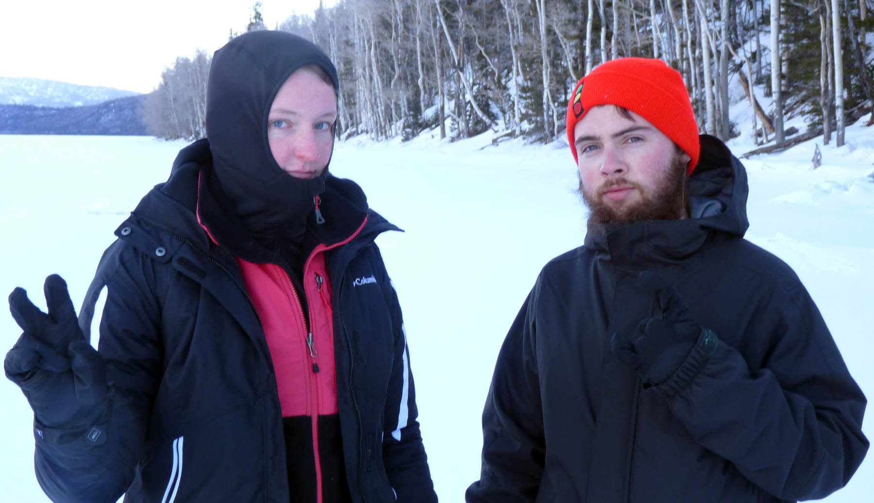
After a hard day’s night. W&M geologists Erika Wenrich and Peter Steele in the early morning light after their nighttime gravity survey.
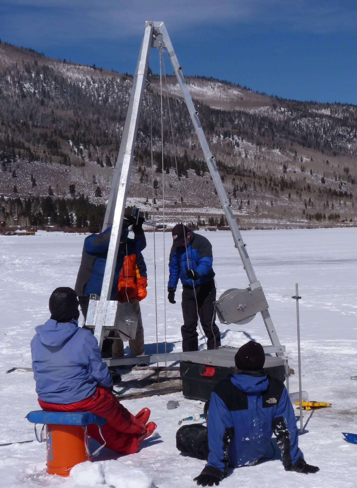
The coring team hard at work on Fish Lake’s icy surface.
Our trip was timed to coincide with a visit by a team of collaborating geoscientists who were obtaining the first sediment core from Fish Lake. Once again the ice was critical, as the team’s coring rig was set upon the firm surface—for four days they lowered and raised the coring apparatus through 30 meters (100’) of water and into the muddy sediment at the lake’s bottom. They were rewarded with about 11 meters (35’) of core, which was safely transported to Oregon State University’s core repository to await detailed study by the team.
William & Mary alum and all-around good guy, Dr. Scott Harris from the College of Charleston used a transient electromagnetic (TEM) geophysical system to learn about the subsurface. He had quite a setup with a long (400 m) wire transmitter placed around multiple receiver loops out on the ice. The system induces an electric field and then measures the decay of that field through time, providing what is essentially a column of the conductivity in the subsurface. The lake’s fresh-water has a very low conductivity, while the infilling mud in the lake basin and underlying bedrock have much higher conductivities. His initial tests yielded subsurface information to depths of over 300 m, hopefully imaging the contact between the lake sediments and bedrock.
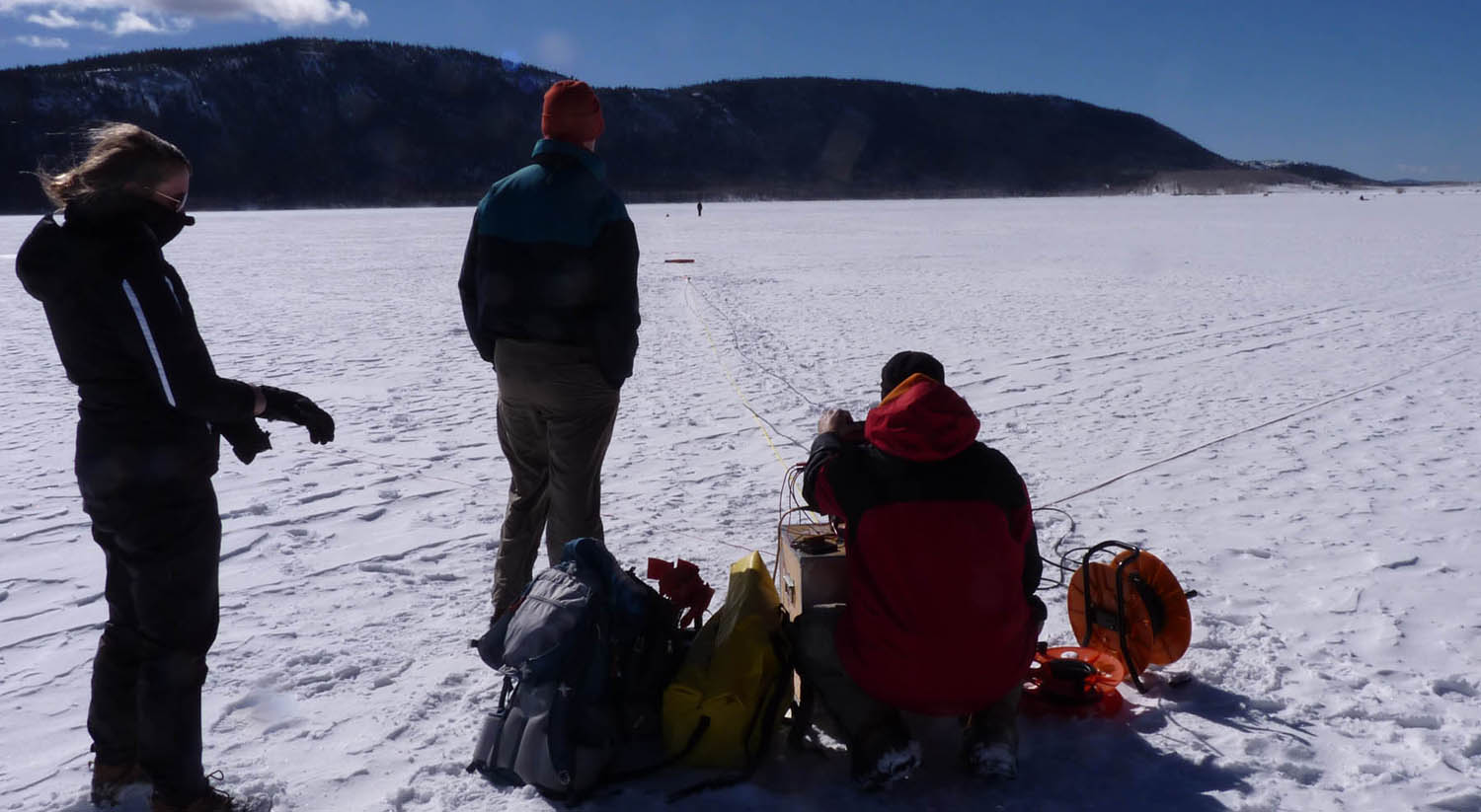
Dr. Scott Harris (W&M class of ’88), kneeling on the ice, runs the TEM geophysical system on a breezy day at Fish Lake.
Our gravity data indicate that the lake is underlain by upwards of 100 meters of sediment (>300’), so the coring operation sampled just the uppermost layers of the graben fill. In the future we hope to core though the entire sediment package to fully understand the geologic history of graben development, lake formation, and glaciation.
Erika is one of 33 William & Mary geology majors in the class of 2014 and they are all working on senior research (thesis) projects. These studies range from gaging rock erodibility along the banks of the Potomac River, to understanding the complexities of agricultural runoff in the Coastal Plain, and even searching for water ice on Mercury. As college seniors, W&M geology students are contributing new knowledge about how the Earth operates (and other worlds as well). It’s cool stuff and part of what makes majoring in geology at William & Mary distinctive.

Comments are currently closed. Comments are closed on all posts older than one year, and for those in our archive.
Yay. I <3 WM. Too bad warm fuzzies from alums like me don't make those field days any less frigid.
Man, those researchers look hardcore!