
Williamsburg’s Triple H’s
Welcome to William & Mary, it’s the middle of August and the weather in Williamsburg is…
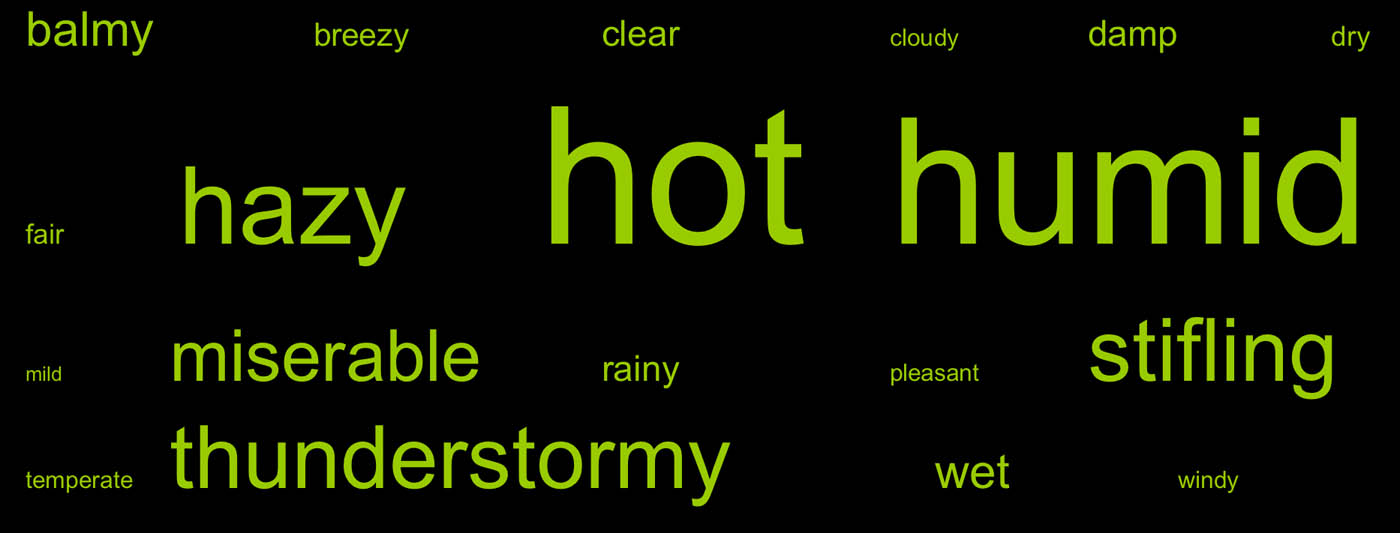
Word cloud of terms describing Williamsburg’s summer weather from a survey of Introductory Geology students.
Williamsburg’s Triple H’s- HAZY, HOT, and HUMID.
For me August is not Williamsburg’s finest month and I’m not the only one with that point of view. Faculty colleagues who, in August, moved to Williamsburg from New England, northern California, and Colorado have all thought “just what have I gotten myself into?” If you are new to William & Mary, fear not- Williamsburg’s weather gets better as autumn arrives. Next week the semester begins and I’ll be teaching Geology 312- Weather, Climate & Change, a second-level course pitched to a diverse audience. It is summer so there’s no surprise about the hot, but why is William & Mary wrapped in a humid blanket of air at this time of year and what about all that haze out there?
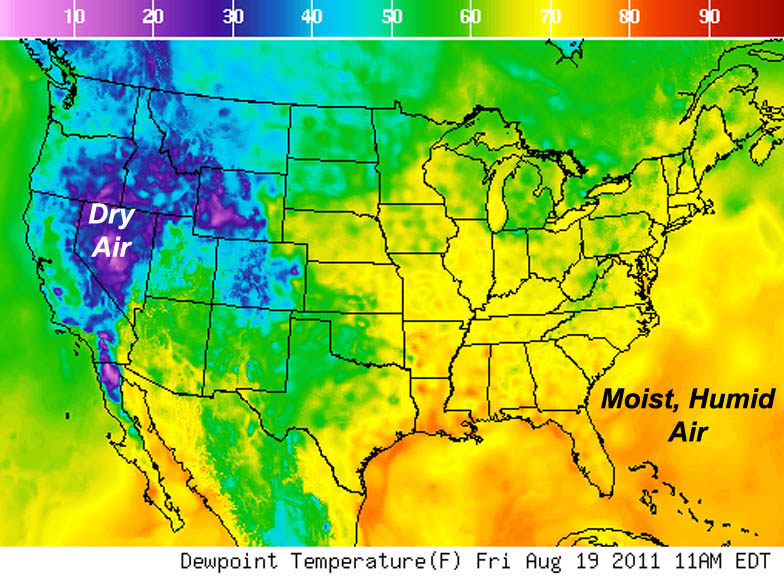
Map from the National Weather Service (http://www.weather.gov/forecasts/graphical/sectors/).
Before tackling that question it is important to consider just what is humidity and how best to define humidity? The Earth’s atmosphere is a mixture of various gases; H2O in the vapor phase forms a small, but important, fraction of the atmosphere. Humidity, in a broad sense, is the amount of water vapor in the atmosphere. The trouble is that humidity can be defined in a number of ways- including relative, specific, and absolute humidity, as well as by mixing ratios and with saturation vapor pressures. The amount of water vapor that air can contain changes with temperature; warm air holds more water vapor than cold air. Relative humidity, a commonly used meteorological metric, is
(water vapor content of the air/ water vapor capacity at that temperature) x 100
When air is saturated with water vapor the relative humidity is 100%. Typically, relative humidity changes over the course of a day- as the temperature rises, the air’s capacity to hold water vapor increases and consequentially the relative humidity drops. Another measure of humidity is dewpoint, the temperature at which the air is saturated. Moist, humid air has dewpoint temperatures of greater than 15˚ C (~60˚ F).
The plot below illustrates data collected at W&M’s Keck lab from 2004 through 2010. Notice that the average relative humidity tops 80% in August, September, and October and stays above 77% for half the year (from June thru November). But the dewpoint temperature reaches its maximum, over 20˚ C (67˚ F), in July and August and that is the key. The air harboring the most moisture envelopes Williamsburg in mid to late summer. Although the relative humidity in October and November remains high, the dewpoint temperature is much lower during the summer and these autumn months are among the most pleasant in Williamsburg.
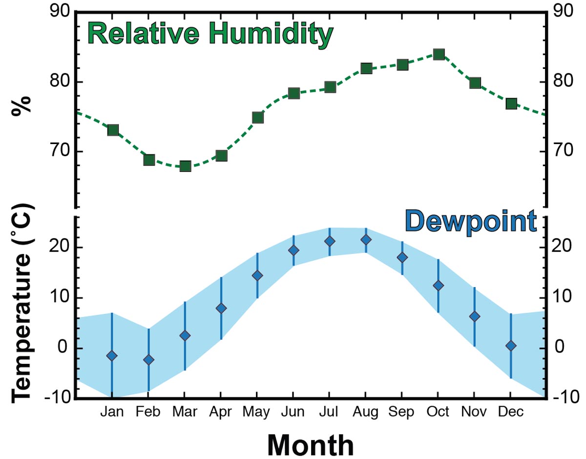
Data from W&M Keck Lab (2004-2010). Blue shaded area and bars are standard deviation of data.
But why such moist air during the summer? As Bob Dylan croons- “the answer, my friend, is blowin’ in the wind”. Consider the wind roses compiled from a weather station at Yorktown (15 km east of Williamsburg): during the summer months the wind blows from a southerly direction (southeast, south, and southwest) nearly 50% of the time. During the winter months the wind comes from the south just over 30% of the time and the dominant wind direction is from the northwest.
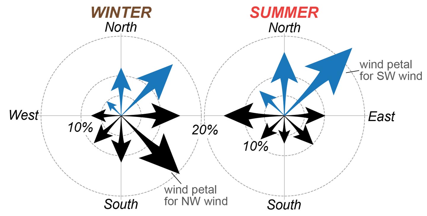
Seasonal wind rose for Yorktown, Virginia. Arrows point in direction the wind blows towards (i.e. a SW wind blows towards the NE). Southerly winds illustrated in blue.
That southerly wind brings with it moist, marine air from the Gulf of Mexico and tropical Atlantic Ocean- stoking up humidity in the southeastern United States. Why the seasonal shift in wind direction? Questions like that are a significant part of the Geology 312 course. Here is the quick answer- during the northern hemisphere summer a stable high pressure (anticyclone) tends to develop over the Atlantic (known as the Bermuda High or Azores High). The clockwise flow of air around this high-pressure system conveys warm and moist air to the southeastern United States. Weather fronts and tropical storm development complicate the pattern, but the regional climate is dictated by this stable summer air mass in the Atlantic. During the winter months the high is weakened and excursions of a southerly jet stream can bring cooler and drier continental air masses to southeastern Virginia.
In addition to moist air, the southerly wind is currently bringing lots of haze with an acrid smoky smell and even ash from a wildfire that’s burning in the Dismal Swamp. What a welcome to Williamsburg! Carbon is being liberated from both modern and ancient vegetation (in the form of peat buried in the swamp)- carbon cycling plays a huge role in climate. Just how much carbon is being liberated, where will it go and what are the consequences? More questions that the Weather, Climate, & Change class will tackle starting next week. The semester begins on Wednesday, I can’t wait.
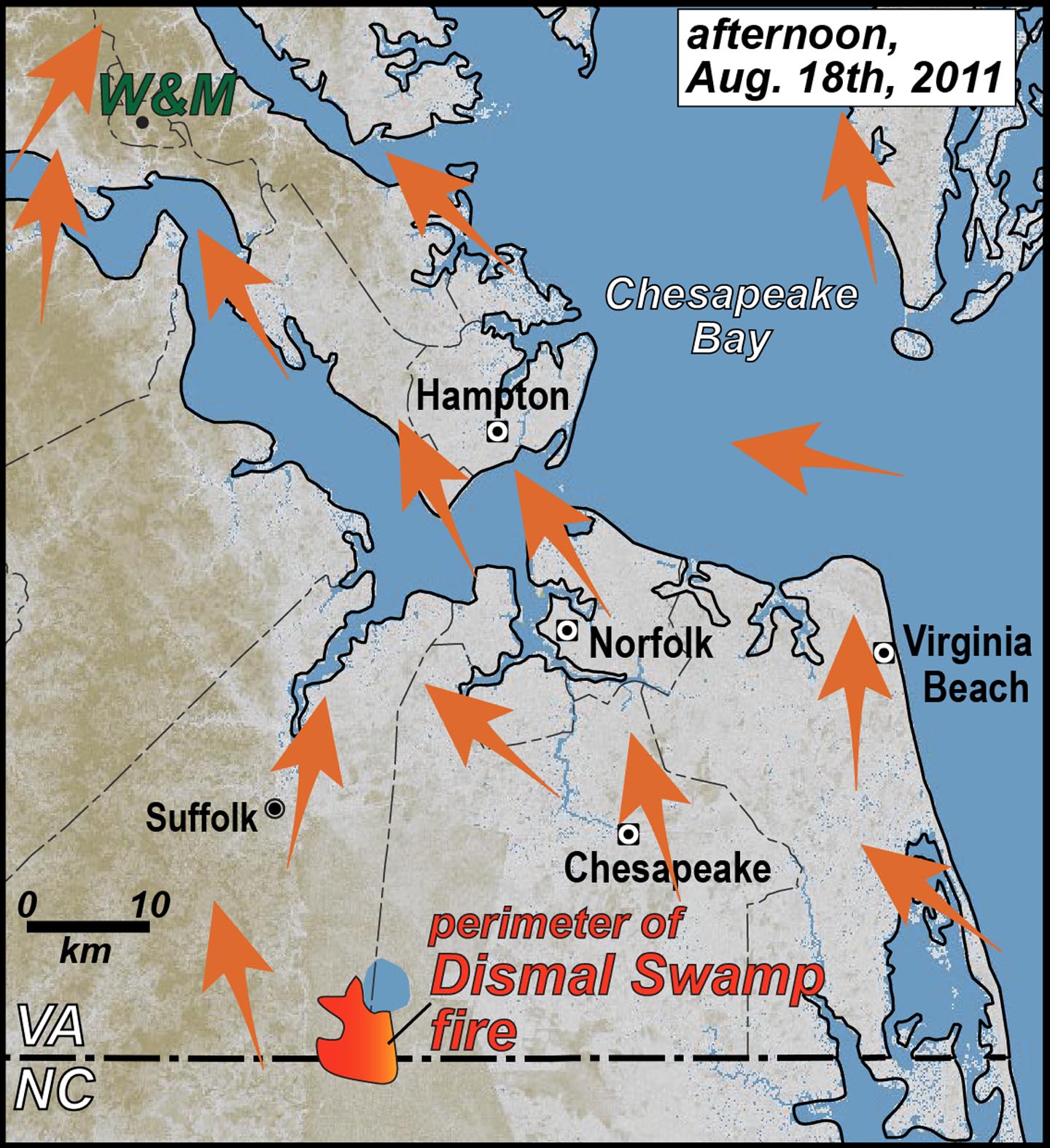
Orange arrows illustrate wind direction in southeastern Virginia during the afternoon, August 18th, 2011. Wind data from National Weather Service.
Comments are currently closed. Comments are closed on all posts older than one year, and for those in our archive.
Chuck, I love posts like this! Even people that “know” things like this benefit from your clear explanations of life-relevant (not just geology-relevant) phenomena. This is how you reeled me in to the geology major!
Chuck, is the dew point the only reason the lows in the Williamsburg during the summer are always so high…if that makes any sense!?
Michael,
The high dew point is a big reason why the low temperatures are high during Williamsburg’s summer. Dry air cools more quickly than moisture-laden air.