
Williamsburg is Not Flat
Spring has arrived and the William& Mary landscape is especially captivating. When asked to describe William & Mary’s landscape, many students, faculty and even administrators use the words flat and swampy. To be sure, parts of campus are flat and some of the bottomland is swampy, but this landscape description is incomplete.
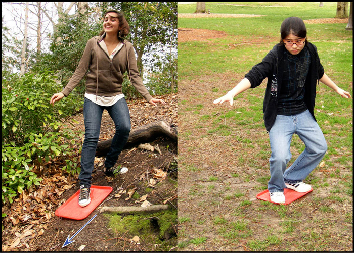
Grace (left) is grooving: ready to take that final step and start landsurfing down a steep pitch on campus (blue arrow points down slope). Bo (right) is bumming: no land surfing for her, as the slope she chose is not steep enough.
A measure of a landscape’s ‘flatness’ or ‘steepness’ is slope, a quantity that can be expressed in either degrees or percent (%). The % slope is simply the ratio of the vertical change to the horizontal change multiplied by 100 ([dV/dH] x 100). Slopes of <2%, are quite flat; whereas slopes of 30% are steep (try walking or cycling up a 30% slope and see what you think). To better appreciate the concept of landscape slope, Grace Dawson (’11) and Bo Mekavibul (’10) embarked on a campus landsurfing expedition. Landsurfing is a simple pastime; place a cafeteria tray on the Earth’s surface and step on, if the slope is steep enough the surfing gets fun and down you go.
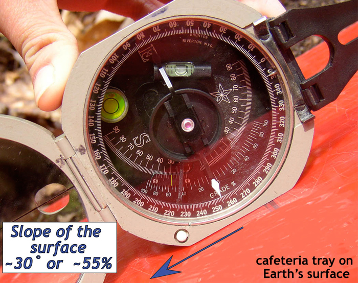
Red cafeteria tray placed parallel to the Earth’s surface, arrow points down the slope. View of clinometer (thin yellow line) on a Brunton compass registering a ~30-degree (~55%) slope.
Using digital topographic data and a Geographic Information System (GIS), Professor Stuart Hamilton provided the data and we generated a slope map of campus and the surrounding area. The map below illustrates the slope of the terrain in Williamsburg; it is color-coded such that flattish areas are a neutral beige-green color, whereas the steep terrain is bright orange to magenta. Campus extends west from the triple junction of Richmond Road, Jamestown Road, and the Duke of Gloucester Street.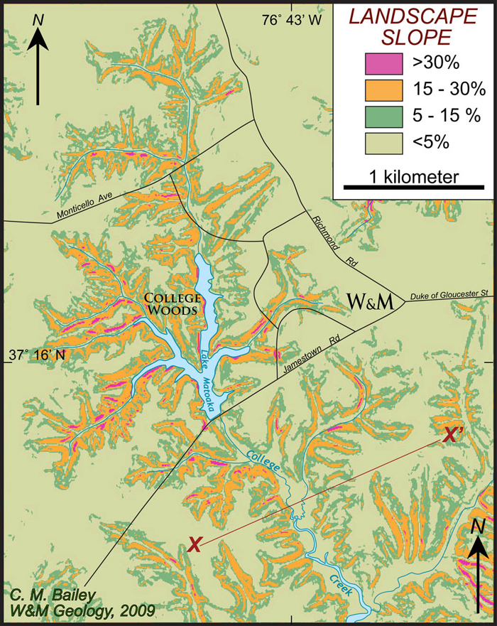
Flat areas occur as both uplands and bottomlands with relatively steep slopes on the intervening terrain. Steep slopes occur along valley walls (i.e. in the College Woods adjacent to small streams draining into Lake Matoaka). The steepest natural slope on W&M’s campus exceeds 70%. That is definitely not flat. A cross sectional view (X-X’) nicely illustrates the flattish bottomlands and uplands, separated by steeper valley walls.
Why are some parts of the landscape flat? Why are other locations steep? What processes control the slope of a landscape? Questions, questions, and more questions. For what it’s worth professors are commonly better at asking questions than dishing up answers.
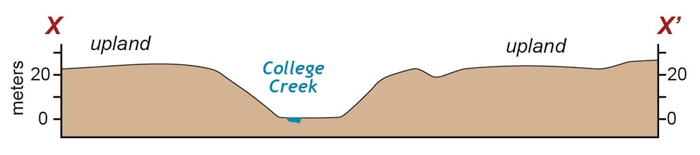
Cross sectional view of the Williamsburg landscape. The upland and bottomland are flat whereas the intervening slope is steep. The topographic section is vertically exaggerated by a factor of 5.
Eastern Virginia is underlain by a sequence of sediments deposited in and along the margin of the Atlantic Ocean over the past few million years. During low stands of sea level, the flattish sea bottom becomes an emergent land surface. In essence, today’s flat uplands are the vestige of an ancient sea floor. Above sea level, the rain that falls on the landscape runs off into stream channels that drain to the James and York River estuaries. Over time, water flowing in these channels erodes sediment and progressively dissects the upland. As the streams approach sea level their slope decreases and sediment eroded from the uplands is deposited creating a broad floodplain with marshes at the lowest elevations. The steep slopes on valley walls are very active parts of the landscape; here the tug of gravity causes soil to creep downwards over time. The physical properties of the soil and underlying sediment set the upper limit to a slope’s steepness; if a slope exceeds the cohesive strength of the underlying material it will slump or slide downwards thereby lowering the overall slope (just as a pile of dry sand can only become so steep before the grains tumble, expanding the pile outward and consequently lowering the slope).
For those who crave a pancake flat landscape try the High Plains near Midland, Texas or head further west to the expansive Central Valley of California. Williamsburg’s landscape is subtle, but by no means flat- a lovely testament to the dynamic interactions of stream and slope processes. Next time you stroll across campus have a look about and see for yourself.


No comments.
Comments are currently closed. Comments are closed on all posts older than one year, and for those in our archive.