
Travels and Travails
I am bashing on the keyboard, eastbound on a flight from Portland, Oregon to Chicago, Illinois with every hope of arriving in Williamsburg before midnight. Portland hosted the Geological Society of America’s annual meeting and my travels both to and from the Pacific Northwest have been smooth. The same cannot be said for a passel of posters that have occupied a significant role in both my imaginary and, lately, my reality.
Next March the Geological Society of America will convene for a joint meeting of the northeastern and southeastern sections in Baltimore, Maryland. This meeting will attract geologists from all over eastern North America to Charm City. I am the co-chair of that meeting and, as such, it is my responsibility to drum up interest for this meeting. To duly advertise the Baltimore meeting I crafted a set of digital images of eastern North America. We even have our own slogan for the meeting- “Linking North and South, Exploring the Connections between Continent and Sea“- catchy, eh?
The imagery was created at William & Mary, my partner in crime Professor Stuart Hamilton married digital topographic data from eastern North America with offshore bathymetric data from the Atlantic Ocean and then I manipulated, colored, shaded, and rotated the data into the image below.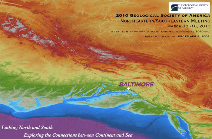
More on what the poster actually illustrates later, but we decided to print 500 copies of a 2×3 foot poster and distribute those to geologists attending the annual meeting. The first wrinkle in the plan occurred a week before the meeting when the printing firm in Williamsburg told us that they would need 10 business days to get the posters printed. I was in Boston when this problem arose and my assistant in Williamsburg was perplexed, but she had a plan. She was off to Las Vegas with her husband for holiday and took the digital file with her. In Vegas she found a printer who could get the posters printed and shipped to Portland, but they would not print a mere 500 posters- 1,000 was their minimum. So we had 1,000 posters printed in Las Vegas, amazingly 1,000 posters in Vegas cost the same as 500 in Williamsburg (some say Vegas is a magical place, perhaps they are right!).
I arrived at my hotel in Portland and enquired about the posters. With a knowing look the porter said “Oh, those posters. Do you want all four boxes delivered to your room? They are kinda heavy.” Heavy indeed- each box with 250 posters weighed in at 67 pounds. My hotel was nearly 2 miles from the convention center; I made a curious commuter toting my poster boxes down the street and onto the light rail. At the opening reception we laid out the posters right next to the bar- a foolproof plan to get the posters disseminated.
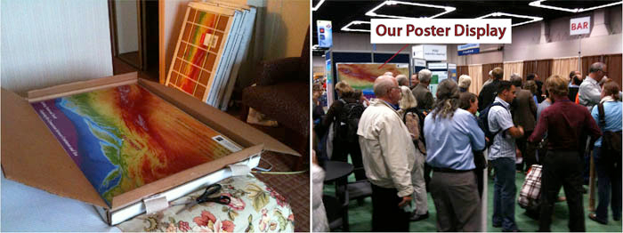
Left- Four boxes of posters (one in the foreground, three in the background) in Portland hotel room. Right- At the Portland Convention Center, note convenient location next to the bar.
We gave away 500 posters at the meeting, which left 500 posters remaining in the boxes. Early this morning I made two trips from my hotel to a shipping store five blocks away- indeed I was sending the remaining posters to myself in Williamsburg for further distribution. The shipping clerks were an eager duo, unfortunately they were not the brightest boys in Portland; although the posters were packaged tightly (and occupying the very same boxes in which they’d already been shipped!) the clerks were perplexed as to how to get this transaction processed. We debated and debated, time was running out- I had a plane to catch. Now I am cruising eastward at 33,000 feet, who knows if or when I’ll see the posters again.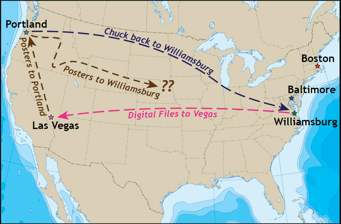
The poster is an image of the mid-Atlantic region in eastern North America with the topography and bathymetry colored to represent various elevations and depths, shading is added to enhance features. The viewpoint is from high above the Atlantic Ocean and the view is to the northwest providing an unusual perspective on the eastern seaboard. Major features, readily evident on the image, include the Continental Shelf, submarine canyons, the Fall Zone, and the Appalachian Mountains and their various provinces.
A poster (.pdf file) with the salient geographic, topographic, and bathymetric figures can be can be downloaded at http://web.wm.edu/geology/blog/EastCoastMap.pdf
A .kmz file that can be opened and overlaid in Google Earth then rotated, tilted, and panned can be downloaded at http://web.wm.edu/geology/blog/EastCoastMap.kmz
Download these files, fly over the mid-Atlantic region using Google Earth, and share these links with anybody interested in the region.
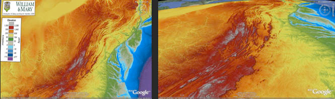
Screen shots of the Google Earth .kmz file of the mid-Atlantic region.
P.S- Two boxes of posters were dutifully delivered to the Geology Department at W&M on Monday, October 26th, now I can rest easy.


No comments.
Comments are currently closed. Comments are closed on all posts older than one year, and for those in our archive.